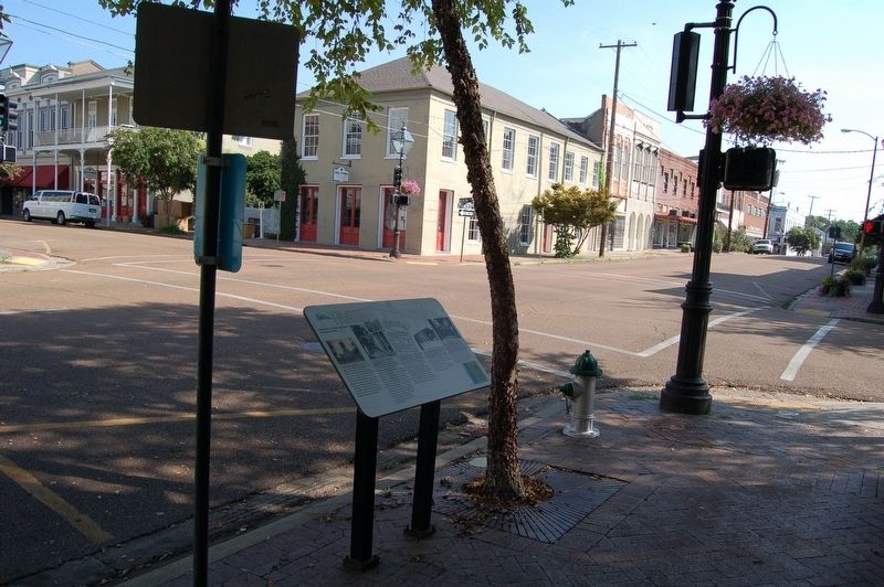
Intersection of Main and South Commerce streets
Natchez Trails
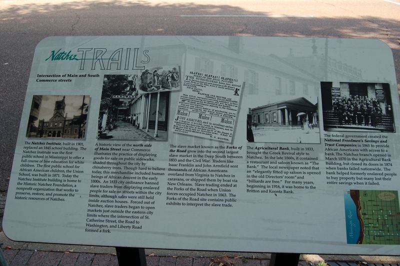
The Natchez Institute, built in 1901, replaced an 1845 school building. The Natchez Institute was the first public school in Mississippi to offer a full course of free education for white children. The first public school for African American children, the Union School, was built in 1871. Today the Natchez Institute building is home to the Historic Natchez Foundation, a nonprofit organization that works to preserve, restore, and promote the historic resources of Natchez.
A historic view of the north side the of Main Street near Commerce illustrates the practice of displaying goods for sale on public sidewalk shaded throughout the city by chinaberry trees. Though hard to believe today, this merchandise included human beings of African descent in the early 1800s. An 1833 city ordinance banned slave traders from displaying enslaved people for sale on streets within the city limits, although sales were still held inside auction houses. Forced out of Natchez, slave traders began to open markets just outside the eastern city limits where the intersection of St Catherine Street, the Road to Washington, and Liberty Road formed a fork.
The slave market known as the Forks of the Road grew into the second largest slave market in the Deep South between 1833 and the Civil
War. Traders like Isaac Franklin and John Armfield sent thousands of African Americans overland from Virginia to Natchez in caravans, or shipped them by boat via New Orleans. Slave trading ended at the Forks of the Road when Union forces occupied Natchez in 1863. The Forks of the Road site contains public exhibits to interpret the slave trade.The Agricultural Bank, built in 1833, brought the Greek Revival style to Natchez. In the late 1860s, it contained a restaurant and saloon known as "The Bank." The local newspaper noted that an "elegantly fitted up saloon is opened in the old Directors' room" and "billiards are free." For many years, beginning in 1916, it was home to the Britton and Koontz Bank.
The federal government created the National Freedmen's Savings and Trust Companies in 1865 to provide African Americans with access to a bank. The Natchez branch opened in March 1870 in the Agricultural Bank Building, but closed its doors in 1874 when banks failed nationwide. The bank helped formerly enslaved people to buy property but many lost their entire savings when it failed.
Erected by City of Natchez.
Topics and series. This historical marker is listed in these topic lists: Roads & Vehicles • Settlements & Settlers
Location. 31° 33.568′ N, 91° 24.145′ W. Marker is in Natchez, Mississippi, in Adams County. Marker is at the intersection of South Commerce Street and Main Street, on the left when traveling south on South Commerce Street. Touch for map. Marker is in this post office area: Natchez MS 39120, United States of America. Touch for directions.
Other nearby markers. At least 8 other markers are within walking distance of this marker. Bud Scott (about 300 feet away, measured in a direct line); Intersection of Main and South Union Streets (about 300 feet away); United States Courthouse (about 400 feet away); In Gratitude (about 400 feet away); St. Mary's Cathedral (about 400 feet away); Intersection of Main and North Pearl streets (about 400 feet away); Bishops' Prayer Garden (about 400 feet away); Site of Cokesbury Chapel (about 400 feet away). Touch for a list and map of all markers in Natchez.
More about this marker. South Commerce street is one-way south bound at this location.
Credits. This page was last revised on December 7, 2018. It was originally submitted on December 7, 2018, by Cajun Scrambler of Assumption, Louisiana. This page has been viewed 269 times since then and 32 times this year. Photos: 1, 2. submitted on December 7, 2018.

