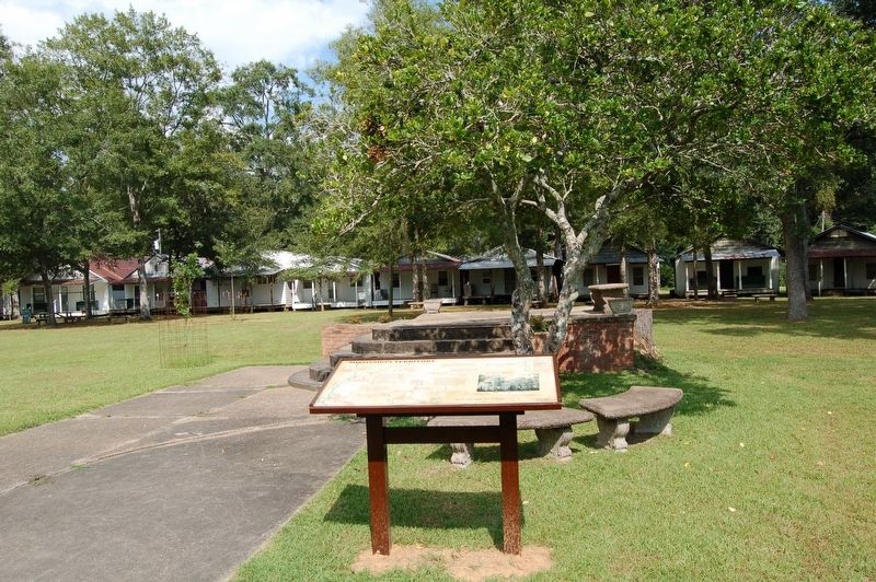
Mississippi Territory
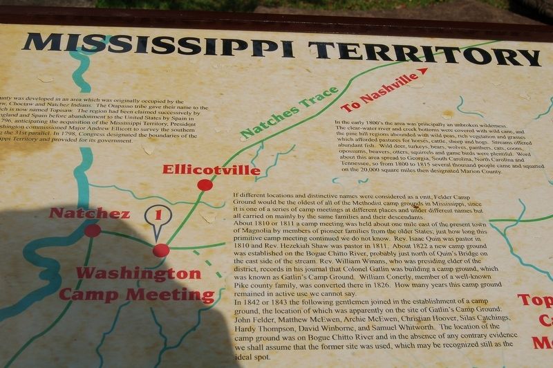
Pike County was developed in an area which was originally occupied by the Chickasaw, Choctaw and Natchez Indians. The Otapasso tribe gave their name to the creek which is now named Topisaw. The region had been claimed successively by France, England and Spain before abandonment to the United States by Spain in 1798. In 1796, anticipating the acquisition of the Mississippi Territory, President George Washington commissioned Major Andrew Ellicott to survey the southern border along the 31st parallel. In 1798, Congress designated the boundaries of the new Mississippi Territory and provided for its government.
In the early 1800's the area was principally an unbroken wilderness. The clear-water river and creek bottoms were covered with wild cane, and the pine hill regions abounded with wild peas, rich vegetation and grasses which afforded pastures for horses, cattle, sheep and hogs. Streams offered abundant fish. Wild deer, turkeys, bears, wolves, panthers, cats, coons, opossums, beavers, otters, squirrels and game birds were plentiful. Word about this area spread to Georgia, South Carolina, North Carolina and Tennessee, so from 1800 to 1815 several thousand people came and squatted on the 20,000 square miles then designated Marlon County.
If different locations and distinctive names were considered as a unit, Felder Camp Ground
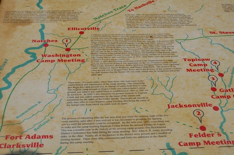
would be the oldest of all of the Methodist camp grounds in Mississippi, since it is one of a series of camp meetings at different places and under different names but all carried on mainly by the same families and their descendants.About 1810 or 1811 a camp meeting was held about one mile east of the present town of Magnolia by members of pioneer families from the older States; just how long this primitive camp meeting continued we do not know. Rev. Isaac Quin was pastor in 1810 and Rev. Hezekiah Shaw was pastor in 1811. About 1822 a new camp ground was established on the Bogue Chitto River, probably just north of Quin's Bridge on the east side of the stream. Rev. William Winans, who was presiding elder of the district, records in his journal that Colonel Gatlin was building a camp ground, which was known as Gatlin's Camp Ground. William Conerly, member of a well-known Pike county family, was converted there in 1826. How many years this camp ground remained in active use we cannot say.
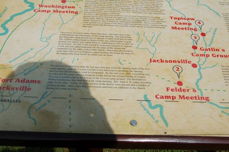
In 1842 or 1843 the following gentlemen joined in the establishment of a camp ground, the location of which was apparently on the site of Gatlin's Camp Ground: John Felder, Matthew McEwen, Archie McEwen, Christian Hoover, Silas Catchings, Hardy Thompson, David Winbome, and Samuel Whitworth. The location of the camp ground was on Bogue Chitto River and in the absence of any contrary evidence we shall assume that the former site was used, which may be recognized still as the ideal spot.
There were, of course, many others than these, who had a part in the establishment and continuance of the camp meeting. One interesting fact about this camp ground was its change of name from time to time. The original camp ground on Bogue Chitto was called Gatlin's camp ground; just what it was called when re-established in 1842 or 1843 we do not know. In 1845 it was moved to its present location on Topisaw Creek and was called sometimes by the name of the stream and sometimes by the name of the Felder family. Practically all records in early days refer to it as Otapasso camp meeting, this being the name of the Indian tribe from which the creek took its name.
The process of rebuilding after the war was slow and when the opening night of the first camp meeting came after it was revived, it was necessary to postpone the opening service until the tabernacle could be completed. By the next year, 1882, everything was in order and the camp meeting began on Friday before the second Sunday in August. This was a notable year in the history of the revived camp ground. The Brookhaven District Conference was held during the camp meeting. Rev. John A. B. Jones, presiding elder, in the chair. Nearly all of the pastors in the district were present and a number of visiting laymen. There were fifty
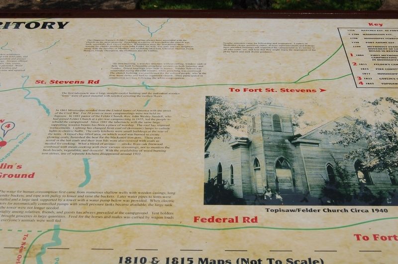
conversions and forty-six additions to the church during this camp meeting.The Otapasso-Topisaw-Felder Campgroud has always been associated with the church on the same property. Preaching in a grove of trees before the church was built, reportedly Rev. Green and Rev. Whittington were the first pastors there. Among the charter members were John Felder, his wife, five sons and two daughters along with the families of Matthew and Archibald McEwen, Christian Hoover, Frank Bridges, Hardy Thompson, the Huffmans and the Gatlins.
The first building, a wooden structure without ceiling, window sash or heat, was built for monthly preaching services on both Saturday and Sunday. Prayer meetings were held in homes. Sunday School was suspended during the cold months, while preaching was continued. The church building was partitioned for the colored people, who at the time were slaves and had no organized church. They participated in communion services following the white congregation.
The first tabernacle was a long, straight-roofed building and the individual wooden "tents" were of good material with sawdust covering the earthen floors.
In 1861 Mississippi seceded from the United States of America with the onset of the Civil War. For 20 years or more campmeetings were not held on Topisaw. In 1881 pastor of the Felder Church, Rev. John Wesley Sandell, who had joined Felder
Church at a pre-war campmeeting in 1855, led the people to rebuild the campground. Since 1881 the tabernacle with the same large supporting wooden beams has been a place of worship. The roof has required replacements. Lighting has changed from coal oil (kerosene) lamps to carbide lights to electric bulbs. The early kitchens were small buildings at the rear of the tents. A raised clay-filled area, on which wood was burned to create glowing coals, furnished the heat for the blackened iron pots. These pots rested in the hot coals and their iron lids were also covered with coals as needed for cooking. What a blend of aromas --- smoke from oak firewood combined with meats cooking with their various seasonings, not to mention the fresh breads, vegetables, and desserts! With the availability of wood burning iron stoves, use of separate kitchens disappeared around 1922.The water for human consumption first came from numerous shallow wells with wooden casings, long slender buckets, and rope with pulley to lower and raise the buckets. Later water pipes to tents were installed and a large tank supported by a tower with a water pump below was provided. When electric motors for automatically controlled pumps with small pressure tanks became available, the large tank and the tower were not longer needed. Hospitality among relatives, friends, and guests has always prevailed at the campground.
Tent holders of old brought groceries in large quantities. Feed for the horses and mules was carried by wagon loads so that everyone's animals were well fed.Nearby ministers came for fellowship and inspiration. Leaders of Methodist clergy, presiding elders, district superintendents and bishops have attended meetings and supported the campground in its service to all who come, see and hear that they might enjoy the inspiration of the Holy Spirit and seek divine guidance.
Topics. This historical marker is listed in this topic list: Churches & Religion. A significant historical year for this entry is 1810.
Location. 31° 19.109′ N, 90° 19.142′ W. Marker is in Summit, Mississippi, in Pike County. Marker is on Campground Road south of Highway 591, on the left when traveling south. Touch for map. Marker is in this post office area: Summit MS 39666, United States of America. Touch for directions.
Other nearby markers. At least 8 other markers are within 8 miles of this marker, measured as the crow flies. Felder Campground (within shouting distance of this marker); Col. Preston Brent (approx. 2˝ miles away); Bogue Chitto Church (approx. 3.4 miles away); Site of Ruth School (approx. 4.2 miles away); J.A. Jones Consolidated School (approx. 4.8 miles away); Home Site 1812-1855 (approx. 7.6 miles away); War of 1812, Pike County (approx. 7.9 miles away); Old Pike County Chancery Clerk's Office (approx. 7.9 miles away). Touch for a list and map of all markers in Summit.
Credits. This page was last revised on July 6, 2022. It was originally submitted on December 7, 2018, by Cajun Scrambler of Assumption, Louisiana. This page has been viewed 611 times since then and 55 times this year. Photos: 1, 2, 3, 4, 5. submitted on December 7, 2018.
Editor’s want-list for this marker. Clear readable photo of marker. • Can you help?
