Near Troy in Lincoln County, Montana — The American West (Mountains)
Kootenai Falls People and History
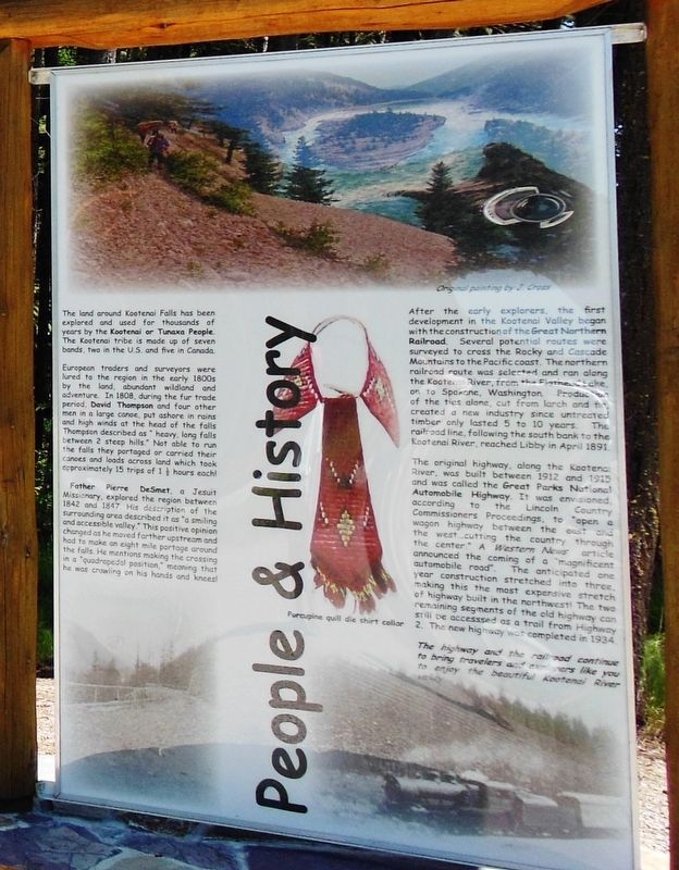
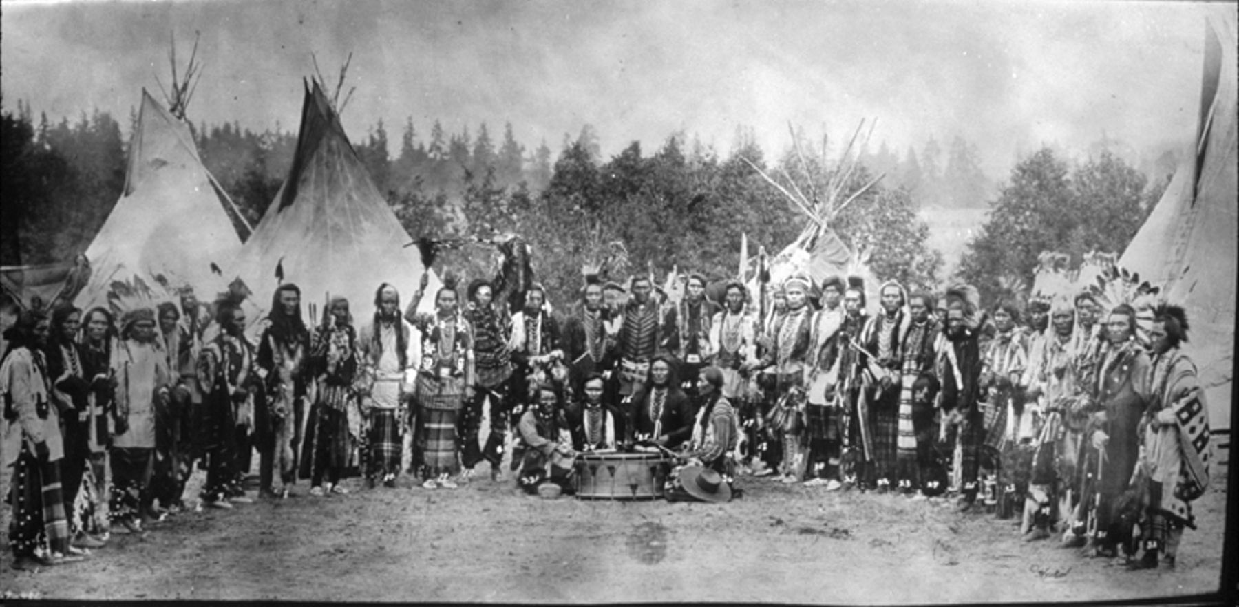
The land around Kootenai Falls has been explored and used for thousands of years by the Kootenai or Tunaxa People. The Kootenai tribe made up of seven bands, two in U.S. and five in Canada.
European traders and surveyors were lured to the region in the early 1800s by the land, abundant wildland and adventure. In 1808, during the fur trade period, David Thompson and four other men in a large canoe, put ashore in rains and high winds at the head of the falls Thompson described as “heavy, long falls between 2 steep hills.” Not able to run the falls they portaged or carried their canoes and loads across land which took approximately 15 trips of 1.5 hours each!
Father Pierre DeSmet, a Jesuit Missionary, explored the region between 1842 and 1847. His description of the surrounding area described it as “a smiling and accessible valley.” This positive opinion changed as he moved farther upstream and had to make an eight mile portage around the falls. He mentions making the crossing in a “quadrupedal position,” meaning that he was crawling on his hands and knees!
After the early explorers, the first development in the Kootenai Valley began with the construction of the Great Northern Railroad. Several potential routes were surveyed to cross the Rocky and Cascade Mountains to the Pacific coast. The northern railroad route was selected and ran along the Kootenai River, from Flathead Lake, on to Spokane, Washington. Production of the ties alone, cut from larch and fir, created a new industry since untreated timber only lasted 5 to 10 years. The railroad line, following the south bank to the Kootenai River, reached Libby in April 1891.
The original highway, along the Kootenai River, was built between 1912 and 1915 and was called the Great Parks National Automobile Highway. It was envisioned, according to the Lincoln County Commissioners Proceedings, to “open a wagon highway between the east and the west, cutting the country through the center.” A Western News article announced the coming of a “magnificent automobile road.” The anticipated one year construction stretched into three, making this the most expensive stretch of highway built in the northwest! The two remaining segments of the old highway can still be accessed as a trail from Highway 2. The new highway was completed in 1934.
The highway and the railroad continue to bring travelers and explorers like you to enjoy the beautiful Kootenai River Valley.
Topics. This historical marker is listed in these topic lists: Exploration • Native Americans • Railroads & Streetcars • Roads & Vehicles.
Location.
48° 27.169′ N, 115° 46.127′ W. Marker is near Troy, Montana, in Lincoln County. Marker is on U.S. 2, 4 miles east of State Highway 56, on the left when traveling east. Marker is located at the Kootenai Falls Trailhead, at the east end of a pull-out and parking lot on the north side of the highway. Touch for map. Marker is in this post office area: Troy MT 59935, United States of America. Touch for directions.
Other nearby markers. At least 2 other markers are within walking distance of this marker. Kootenai River Waterfowl Home and Highway (within shouting distance of this marker); Kootenai River (within shouting distance of this marker).
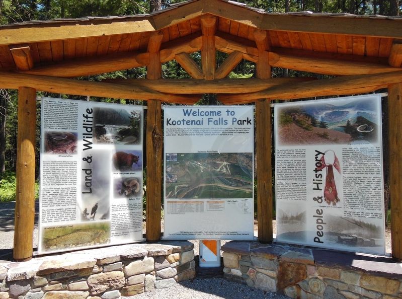
More about this marker. This marker is a large composite plaque mounted within a large, heavy-timber kiosk. This is the right-most of three panels in the kiosk; the other two panels do not contain historical information.
Also see . . .
1. Kutenai. Wikipedia entry:
Kootenai (K̓upawi˘q̓nuk or Ksanka) are members of the Confederated Salish and Kootenai Tribes, along with Bitterroot Salish and Pend d'Oreilles bands.[16] An Upper Kutenai group, they live mostly on the Flathead Reservation in western Montana. A total population of about 6,800 live on the reservation, while 3,700 live outside the reservation nearby. (Submitted on February 17, 2021, by Larry Gertner of New York, New York.)
2. David Thompson. Wikipedia entry:
David Thompson (1770-1857) was a British-Canadian fur trader, surveyor, and map-maker, known to some native peoples as Koo-Koo-Sint or "the Stargazer." Over Thompson's career, he traveled some 56,000 miles across North America, mapping 1.9 million square miles along the way. For this historic feat, Thompson has been described as the "greatest land geographer who ever lived." (Submitted on December 10, 2018, by Cosmos Mariner of Cape Canaveral, Florida.)
3. On the Trail of Father Pierre De Smet. In late March of 1840, Father De Smet left St. Louis with an American Fur Company brigade. He traveled with them over much of his route as he responded to the appeal from the Salish tribe for a mission. This priest would spend the remainder of his life traveling not only in the West, where he established missions and participated in important treaty negotiations with the tribes, but also around the world. (Submitted on December 10, 2018, by Cosmos Mariner of Cape Canaveral, Florida.)
4. Great Northern Railway (US). Wikipedia entry:
The Great Northern Railway was an American Class I railroad. Running from Saint Paul, Minnesota, to Seattle, Washington, it was the creation of 19th-century railroad entrepreneur James J. Hill and was developed from the Saint Paul & Pacific Railroad. The Great Northern's route was the northernmost transcontinental railroad route in the U.S. (Submitted on December 10, 2018, by Cosmos Mariner of Cape Canaveral, Florida.)
5. National Park to Park Highway. Wikipedia entry:
The National Park to Park Highway was an auto trail in the United States in the 1910s and 1920s, plotted by A. L. Westgard. It followed a large loop through the West, connecting twelve National Parks. In 1914, Secretary of the Interior Lane entered into an agreement with the Office of Public Roads to develop road access to Glacier, Sequoia and Yosemite National Parks. By 1920, eleven states were involved in the Park-to-Park Highway program. The proposed route would cover 6,000 miles of roads and numerous feeders to and from the various National Parks. (Submitted on December 10, 2018, by Cosmos Mariner of Cape Canaveral, Florida.)
Credits. This page was last revised on February 18, 2021. It was originally submitted on December 10, 2018, by Cosmos Mariner of Cape Canaveral, Florida. This page has been viewed 305 times since then and 30 times this year. Photos: 1, 2. submitted on December 10, 2018, by Cosmos Mariner of Cape Canaveral, Florida. 3. submitted on February 17, 2021, by Larry Gertner of New York, New York. • Bill Pfingsten was the editor who published this page.


