Havre de Grace in Harford County, Maryland — The American Northeast (Mid-Atlantic)
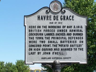
Havre de Grace
War of 1812
Erected by Maryland Historical Society.
Topics. This historical marker is listed in this topic list: War of 1812. A significant historical date for this entry is May 3, 1813.
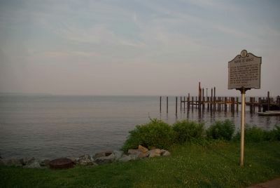
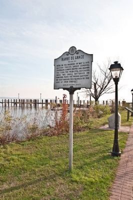
Location. 39° 32.447′ N, 76° 5.112′ W. Marker is in Havre de Grace, Maryland, in Harford County. Marker is at the intersection of Concord Street and Lafayette Street on Concord Street. Touch for map. Marker is in this post office area: Havre de Grace MD 21078, United States of America. Touch for directions.
Other nearby markers. At least 8 other markers are within walking distance of this marker. The Concord Point Light Keeper’s House and Property, 1827-1920 (here, next to this marker); Keeper of the Light (here, next to this marker); Concord Point Light Station (within shouting distance of this marker); Hero's Reward (within shouting distance of this marker); Adding On (within shouting distance of this marker); Post U.S. Lighthouse Service Use (within shouting distance of this marker); The Keepers (within shouting distance of this marker); Keeper's House (within shouting distance of this marker). Touch for a list and map of all markers in Havre de Grace.
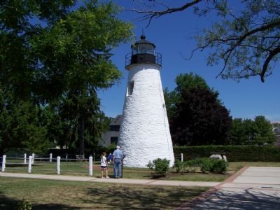
More about this marker. It is located on the grounds of the lighthouse.
Regarding Havre de Grace. “After the other defenders ran away, O’Neill single-handedly manned the artillery battery near where the lighthouse now stands. According to his great-granddaughter, it was called the ‘Potato Battery’ because of the size of the iron shot fired by the two six-pound and one nine-pound guns.” —from the book 1812: Rediscovering Chesapeake Bay’s Forgotten War by David Headly.
Also see . . . 1812: Rediscovering Chesapeake Bay’s Forgotten War. 2005 book by David Headley on Amazon.com. (Submitted on June 26, 2007.)
Credits. This page was last revised on December 13, 2020. It was originally submitted on June 24, 2007, by Bill Pfingsten of Bel Air, Maryland. This page has been viewed 2,591 times since then and 45 times this year. Last updated on December 9, 2020, by Carl Gordon Moore Jr. of North East, Maryland. Photos: 1. submitted on June 24, 2007, by Bill Pfingsten of Bel Air, Maryland. 2. submitted on June 6, 2008, by Christopher Busta-Peck of Shaker Heights, Ohio. 3. submitted on June 24, 2007, by Bill Pfingsten of Bel Air, Maryland. 4. submitted on December 15, 2009, by Ronald Claiborne of College Station, Texas. • J. Makali Bruton was the editor who published this page.


