Financial District in Manhattan in New York County, New York — The American Northeast (Mid-Atlantic)
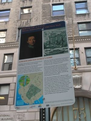
Adriaen van der Donck’s Home
Birth of a City: Nieuw Amsterdam & Old New York
ADRIAEN VAN DER DONCK’S HOME
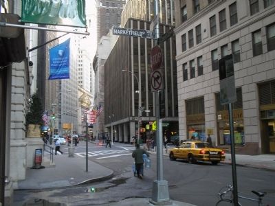
Location: Marketfield Street at Broad Street
Dutch Name: Het Marckvelt Steegie
In a house that stood a few feet from here lived lawyer Adriaen van der Donck (c. 1620 - c. 1655), author of the Remonstrance of New Netherland (1649). He wanted to persuade officials in the Dutch Republic to take over the Nieuw Nederland colony from the Dutch West India Company. Like other settlers, he also wanted Nieuw Amsterdam to have its own city government.
Many townspeople were frustrated with the Company. They were furious about a disastrous Indian war they blamed on Company blundering. In the Netherlands, people were used to having city governments to protect their rights, something they lacked on Manhattan.
Van der Donck failed in his efforts to get the Dutch government to assume control of the colony. But Director-General Stuyvesant and his council agreed to establish a municipality. In 1653, two burgomasters and five magistrates started running “this new and growing city of Nieuw Amsterdam” from the Stadt Huys (City Hall) on Pearl Street. By adapting Dutch institutions to life in the New World, colonists planted the roots of New York City’s government.
Erected 2009 by City Lore & NY 400.
Topics. This historical marker is listed in this topic list: Colonial Era. A significant historical year for this entry is 1620.
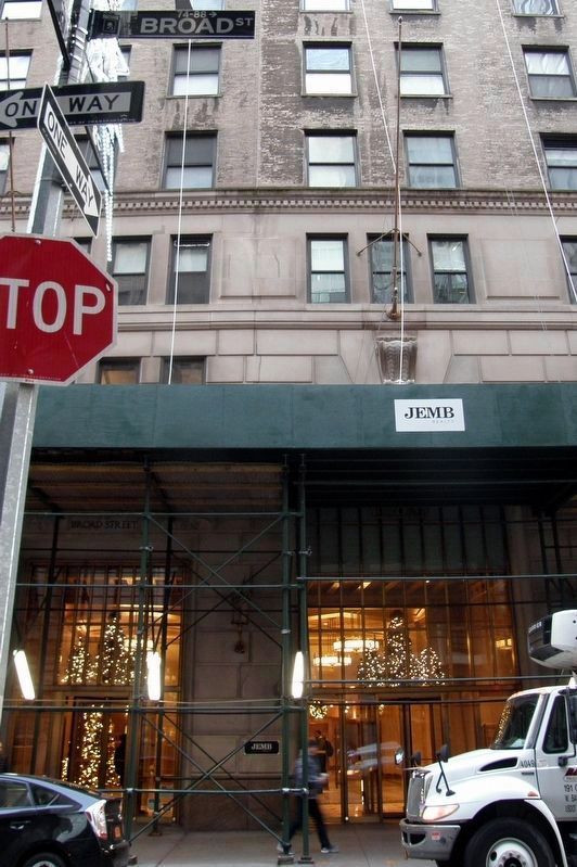
Location. Marker has been reported permanently removed. It was located near 40° 42.281′ N, 74° 0.694′ W. Marker was in Manhattan, New York, in New York County. It was in the Financial District. Marker was at the intersection of Broad Street and Marketfield Street, on the left when traveling north on Broad Street. Touch for map. Marker was in this post office area: New York NY 10004, United States of America.
We have been informed that this sign or monument is no longer there and will not be replaced. This page is an archival view of what was.
Other nearby markers. At least 8 other markers are within walking distance of this location. 75 Broad Street (a few steps from this marker); The First Huguenot Church in New York City (within shouting distance of this marker); Marinus Willett (within shouting distance of this marker); 13 South William Street (about 300 feet away, measured in a direct line); Stone Street Historic District (about 300 feet away); Dutch Hoog Straat (about 300 feet away); 57 Stone Street (about 400 feet away); Fraunces Tavern Block Historic District (about 400 feet away). Touch for a list and map of all markers in Manhattan.
More about this marker. The top of the marker contains a painting that is “Long thought to portray Adriaen van der Donck, [but] may in fact depict an unknown Frenchman.” Next to this is a picture of “The Dutch West India Company headquarters in Amsterdam.” The lower left of the marker contains a map showing the route of the Nieuw Amsterdam Trail in lower Manhattan.
NOTE: As of December 2018, all the markers in this series had been removed.
Related markers. Click here for a list of markers that are related to this marker. Learn about New York City’s colonial Dutch heritage by taking a virtual tour of the Nieuw Amsterdam Trail though lower Manhattan.
Also see . . . City Lore website. City Lore's mission is to foster New York's - and America's - living cultural heritage. (Submitted on November 5, 2009, by Bill Coughlin of Woodland Park, New Jersey.)
Credits. This page was last revised on January 31, 2023. It was originally submitted on November 5, 2009, by Bill Coughlin of Woodland Park, New Jersey. This page has been viewed 1,504 times since then and 44 times this year. Last updated on December 11, 2018, by Larry Gertner of New York, New York. Photos: 1, 2, 3. submitted on November 5, 2009, by Bill Coughlin of Woodland Park, New Jersey. 4. submitted on December 11, 2018, by Larry Gertner of New York, New York. • Andrew Ruppenstein was the editor who published this page.


