Irapuato, Guanajuato, Mexico — The Central Highlands (North America)
Saint Joseph Church
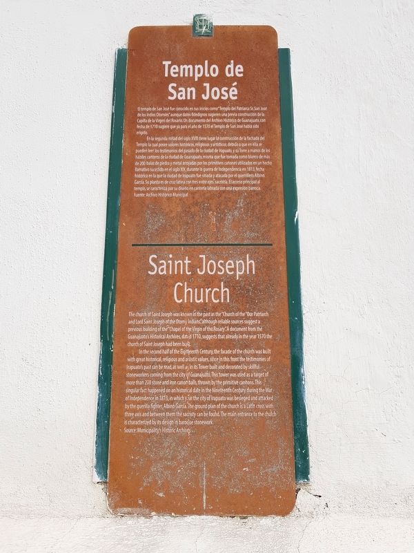
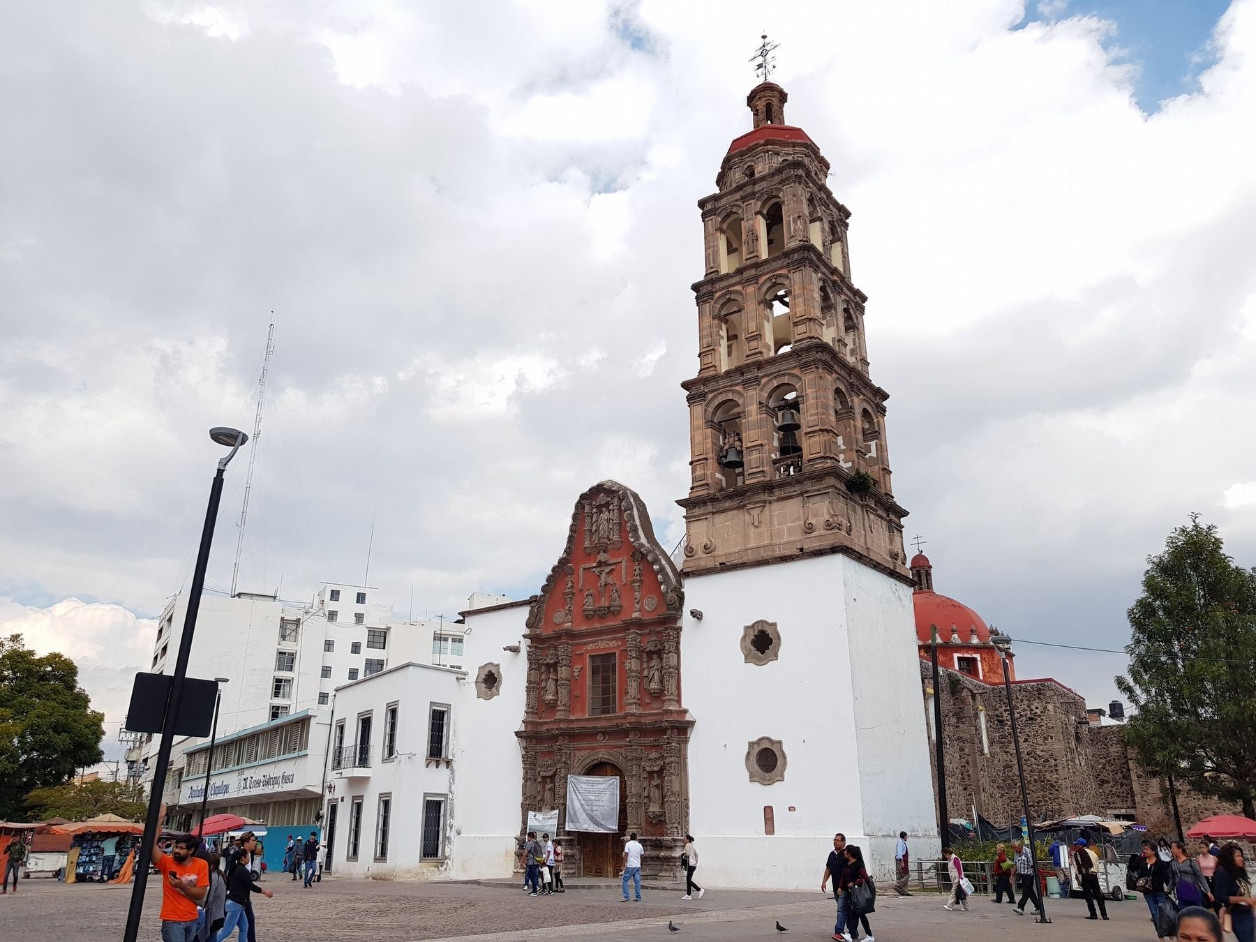
El templo de San José fue conocido en sus inicios como “Templo del Patriarca Sr. San José de los Indios Otomíes” aunque datos fidedignos sugieren una previa construcción de la Capilla de la Virgen del Rosario. Un documento del Archivo Histórico de Guanajuato, con fecha de 1710 sugiere que ya para el año de 1570 el Templo de San José había sido erigido.
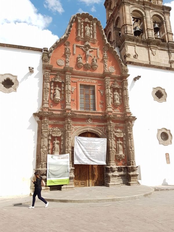
En la segunda mitad del siglo XVIII tiene lugar la construcción de la fachada del Templo la cual posee valores históricos, religiosos y artísticos, debido a que en ella se pueden leer los testimonios del pasado de la ciudad de Irapuato, y su Torre a manos de los hábiles canteros de la ciudad de Guanajuato, misma que fue tomada como blanco de más de 200 balas de piedra y metal arrojadas por los primitivos cañones utilizados en un hecho llamativo sucedido en el siglo XIX, durante la guerra de Independencia en 1813, fecha histórica en la que la ciudad de Irapuato fue sitiada y atacada por el guerillero Albino García. Su planta es de cruz latina con tres entre ejes, sacristía. El acceso principal al templo, se caracteriza por su diseño en cantería labrada con una expresion barroca.
Fuente: Archivo Histórico Municipal.
Saint Joseph Church
The church of Saint Joseph was known in the past as the “Church of the Our Patriarch and Lord Saint Joseph of the Otomy Indians”, although reliable sources suggest a previous building of the “Chapel of the Virgin of the Rosary.” A document from the Guanajuato's Historical Archives, dated 1710, suggests that already in the year 1570 the church of Saint Joseph had been built.
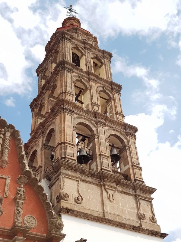
In the second half of the Eighteenth Century, the facade of the church was built with great historical, religious and artistic values, since in this front the testimonies of Irapuato’s past can be read, as well as in its Tower built and decorated by skillful stoneworkers coming from the city of Guanajuato. This tower was used as a target of more than 200 stone and iron canon balls, thrown by the primitive cannons.This singular fact happened on an historical date in the Nineteenth Century during the War of Independence in 1813, in which year the city of Irapuato was besieged and attacked by the guerrilla fighter, Albino Garcia. The ground plan of the church is a Latin cross with three axis and between them the sacristy can be found. The main entrance to the church is characterized by its design in baroque stonework.
Source: Municipality's Historic Archives
Topics. This historical marker is listed in these topic lists: Churches & Religion • Colonial Era • Man-Made Features • Wars, Non-US. A significant historical year for this entry is 1710.
Location. 20° 40.488′ N, 101° 20.769′ W. Marker is in Irapuato, Guanajuato. Marker is on Plazuela Abasolo just west of Calle Colón, on the right when traveling north. Touch for map. Marker is in this post office area: Irapuato GTO 36513, Mexico. Touch for directions.
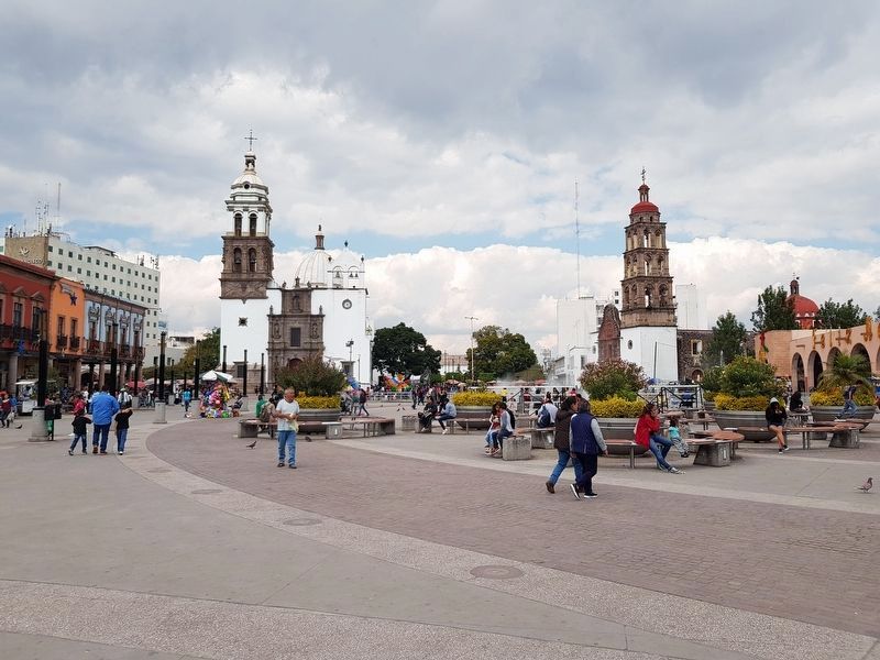
Other nearby markers. At least 8 other markers are within 18 kilometers of this marker, measured as the crow flies. Irapuato Cathedral (within shouting distance of this marker); Major Plaza (about 120 meters away, measured in a direct line); Temple of the Third Order (about 240 meters away); Temple of the Convent (about 240 meters away); Temple of the Convent / Temple of the Third Order (approx. 0.2 kilometers away); Temple of Solitude (approx. 0.3 kilometers away); Founding of Irapuato (approx. 0.3 kilometers away); Darío Díaz (approx. 16.7 kilometers away). Touch for a list and map of all markers in Irapuato.
Regarding Saint Joseph Church. The guerrilla fighter Albino García, the Independence fighter mentioned in the marker text, was executed in Celaya in June 1812, so it is possible that the text is in error when it mentions 1813 as the siege of Irapuato during that conflict.
Credits. This page was last revised on December 12, 2018. It was originally submitted on December 12, 2018, by J. Makali Bruton of Accra, Ghana. This page has been viewed 95 times since then and 7 times this year. Photos: 1, 2, 3, 4, 5. submitted on December 12, 2018, by J. Makali Bruton of Accra, Ghana.
