Marker Logo HMdb.org THE HISTORICAL
MARKER DATABASE
“Bite-Size Bits of Local, National, and Global History”
Jamaica in Queens in Queens County, New York — The American Northeast (Mid-Atlantic)
 

The Old Stone Church


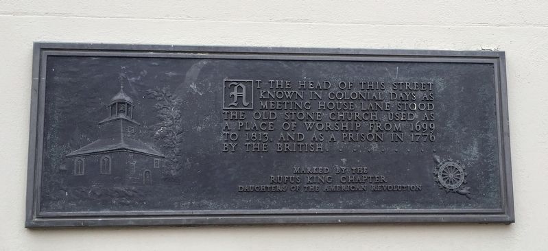
The Old Stone Church Marker image. Click for full size.
Photographed By Andrew Ruppenstein, February 21, 2017
1. The Old Stone Church Marker
Inscription. At the head of this street known in colonial days as Meeting House Lane stood the Old Stone Church, used as a place of worship from 1699 to 1813, and as a prison in 1776 by the British.


Erected by Daughters of the American Revolution Rufus King Chapter.
 
Topics and series. This historical marker is listed in these topic lists: Churches & ReligionColonial EraWar, US Revolutionary. In addition, it is included in the Daughters of the American Revolution series list. A significant historical year for this entry is 1699.
 
Location. 40° 42.241′ N, 73° 47.875′ W. Marker is in Queens, New York, in Queens County. It is in Jamaica. Marker is at the intersection of Union Hall Street and Jamaica Avenue, on the right when traveling north on Union Hall Street. Touch for map. Marker is in this post office area: Jamaica NY 11432, United States of America. Touch for directions.
 
Other nearby markers. At least 8 other markers are within walking distance of this marker. Jamaica Center Sidewalk Clock (a few steps from this marker); La Casina Building (about 400 feet away, measured in a direct line); St. Monica's Catholic Church (about 700 feet away); Prospect Cemetery (about 800 feet away); Grace Church (approx. 0.2 miles away); a different marker also named Prospect Cemetery

Paid Advertisement
Click on the ad for more information.
Please report objectionable advertising to the Editor.
Click or scan to see
this page online
(approx. 0.2 miles away); Grace Episcopal Church and Graveyard (approx. 0.2 miles away); Valencia Theater (approx. 0.2 miles away). Touch for a list and map of all markers in Queens.
 
Also see . . .  Sidewalk clock on Jamaica Avenue (Wikipedia). "The village of Jamaica, settled by a band of English people, was granted a charter for “Rustdorp” by Governor Stuyvesant in 1656. Six years later, about 25 families of these settlers joined together to make this church. At a town meeting the same year it was voted to build a parsonage, 26 ft. long and 17 ft. wide, a large house for the time and place, the whole town being assessed for the cost. This parsonage served as the house for a few years until the town church was built in the last decade of the 17th century. The new meeting house was variously called : “The Town Church,” “The Stone Church” and “The Church.” It stood on the main street of the village not far from the present corner of Fulton Street and New York Avenue (Guy Brewer) at the head of Meeting House Lane (Union Hall St.)...It was used by all congregations for worship, as a town hall and as a court house for many years. For most
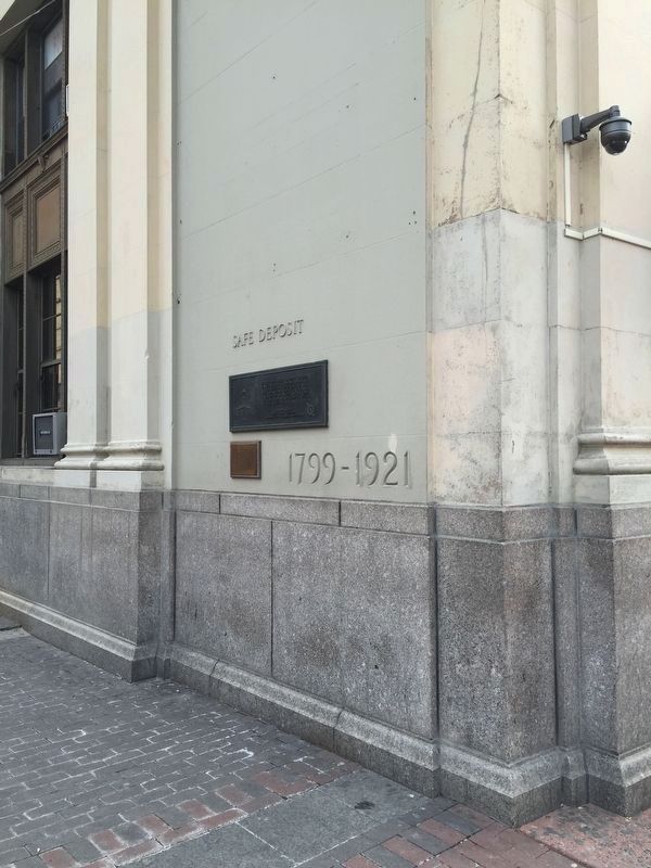
The Old Stone Church and Jamaica Center Sidewal Clock Markers image. Click for full size.
Photographed By Andrew Ruppenstein, February 21, 2017
2. The Old Stone Church and Jamaica Center Sidewal Clock Markers
Oddly, the "1799-1921" date corresponds to nothing on either marker, and there is no further explanation of those dates nearby.
of the 18th century the “Old Trail” along Jamaica avenue would make this area a trading post for farmers and their produce, with horse-drawn carts found up and down “Kings Highway”....When Lord Cornbury became governor, he placed the church and the parsonage at the disposal of the congregation of the Church of England on the grounds that the building had been paid for by public taxation. The Episcopalians then refused the other congregations the use of it. Whereupon, the Presbyterians brought suit and recovered both the parsonage and the church, which they continued to use until the new building was built in 1813. In the foundations of this building on 163rd st are some of the stones of the old church." (Submitted on December 14, 2018.) 
 
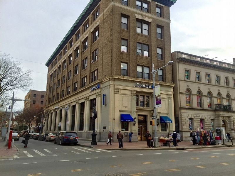
The Old Stone Church Marker - wide view image. Click for full size.
Photographed By Andrew Ruppenstein, February 21, 2017
3. The Old Stone Church Marker - wide view
Visible here on the corner of the building.
 
 
Credits. This page was last revised on January 31, 2023. It was originally submitted on December 14, 2018, by Andrew Ruppenstein of Lamorinda, California. This page has been viewed 267 times since then and 43 times this year. Photos:   1, 2, 3. submitted on December 14, 2018, by Andrew Ruppenstein of Lamorinda, California.
Share this page.  
Share on Tumblr
m=127377

CeraNet Cloud Computing sponsors the Historical Marker Database.
This website earns income from purchases you make after using our links to Amazon.com. We appreciate your support.
Paid Advertisement
Apr. 24, 2024