San Marino in Los Angeles County, California — The American West (Pacific Coastal)
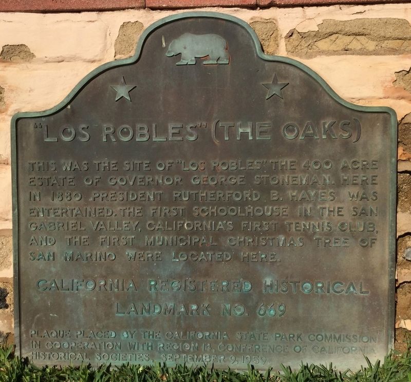
Los Robles
The Oaks
Erected 1959 by California State Parks; and Conference of California Historical Societies. (Marker Number 669.)
Topics and series. This historical marker is listed in these topic lists: Education • Government & Politics • Settlements & Settlers • Sports. In addition, it is included in the California Historical Landmarks, and the Former U.S. Presidents: #19 Rutherford B. Hayes series lists.
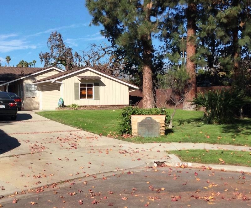
Location. 34° 6.878′ N, 118° 8.189′ W. Marker is in San Marino, California, in Los Angeles County. Marker is on Montrobles Place east of Los Robles Avenue, on the left when traveling east. Touch for map. Marker is at or near this postal address: 1912 Montrobles Place, San Marino CA 91108, United States of America. Touch for directions.
Other nearby markers. At least 8 other markers are within walking distance of this marker. The Picture Bridge (approx. 0.4 miles away); The Old Mill (approx. 0.6 miles away); Adobe Flores (approx. 0.7 miles away); Blacker House (approx. 0.9 miles away); Oaklawn Bridge & Waiting Station (approx. 0.9 miles away); Cordelia A. Culbertson House (approx. 0.9 miles away); Vietnam War Memorial (approx. 0.9 miles away); Thornton Gardens (approx. one mile away). Touch for a list and map of all markers in San Marino.

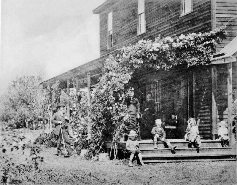
Photograph courtesy of the California Historical Society Collection at the USC Libraries, circa 1879
3. Portrait of General Stoneman and family at the Los Robles Ranch, San Gabriel, ca.1878-1880
General Stoneman, a celebrated Cavalry leader during the Civil War, stands dressed in a suit to the left of the house's porch at right on which his wife, a second woman further up on the porch, and five children are situated. He rests his left hand in his lapel and the other on the top of a hoe's handle. Roses have grown over the porch's eaves, up to the second story of the clapboarded house. Picture File Card reads: "He was asking $125,000 for his ranch at the time the photo was taken".
Credits. This page was last revised on January 30, 2023. It was originally submitted on December 20, 2018, by Craig Baker of Sylmar, California. This page has been viewed 303 times since then and 20 times this year. Photos: 1, 2. submitted on December 20, 2018, by Craig Baker of Sylmar, California. 3. submitted on December 22, 2018. • Andrew Ruppenstein was the editor who published this page.

