Historic District in St. Augustine in St. Johns County, Florida — The American South (South Atlantic)
Multi-Use Moat / ¿Un foso sin agua?
Castillo de San Marcos National Monument
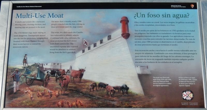
The 1702 British siege made staying in town dangerous. Townspeople moved into the fort for protection, bringing their livestock with them. Farmers brought their recent harvest to extend the storeroom rations.
For more than a month, nearly 1500 people crowded into the fort, relying on these provisions until the siege ended.
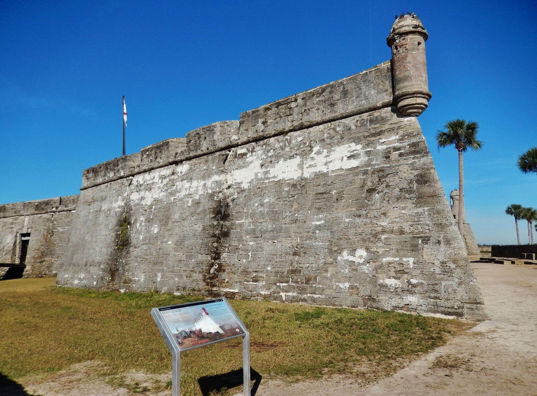
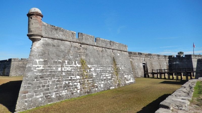
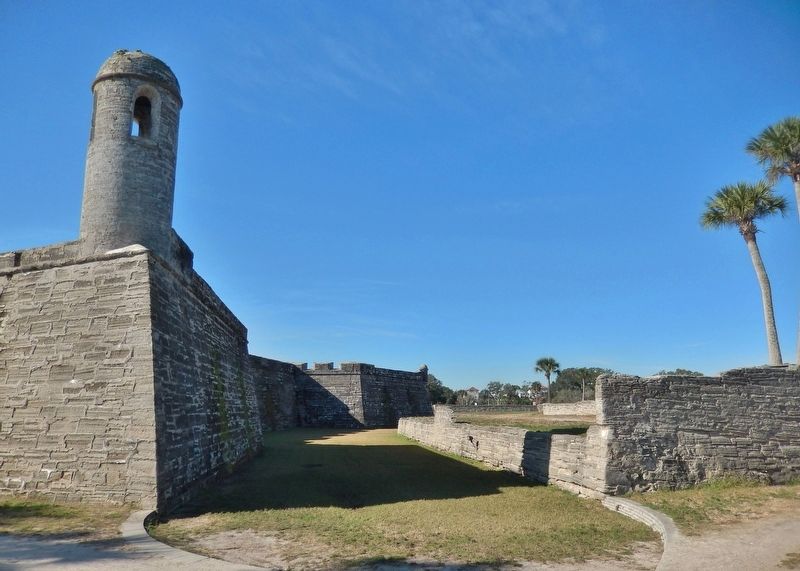
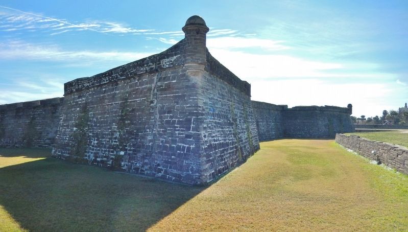
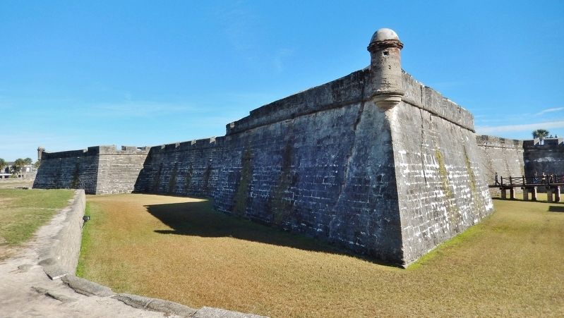
This wide, dry ditch made the Castillo less vulnerable to infantry attacks. Combined with other defenses, the moat protected the fort's lower walls from cannon fire. The uncovered expanse also exposed would-be attackers to soldiers firing from the fort's gun deck.
The moat was filled with water from 1938 until 1996, when the National Park Service drained it to reflect its original appearance.
Tras el asedio por parte de los británicos en 1702 quedarse en la ciudad era peligroso. Sus habitantes se trasladaron a la fortaleza para estar protegidos trayendo con ellos su ganado. Los agricultores trajeron sus recientes cosechas para extender las raciones almacenadas. Por más de un mes, unas 1500 personas se abarrotaron en el castillo, dependiendo de estas provisiones hasta que terminara el asedio.
Esta excavación ancha y seca hacía el castillo menos vulnerable ante los ataques de infantería. Combinado con otras defensas, el foso protegía la parte inferior de las murallas del fuego de los cañones enemigos. La extensión de tierra sin resguardo también exponía cualquier posible atacante a los fusilazos de los soldados en el terraplén.
El foso se llenó con agua de 1938 hasta 1996, cuando el National Park Service lo drenó para reflejar su aspecto original.
Erected 2018 by National Park Service, U.S. Department of the Interior.
Topics. This historical marker is listed in these topic lists: Colonial Era • Forts and Castles • Notable Events • Settlements & Settlers. A significant historical year for this entry is 1702.
Location. 29° 53.84′ N, 81° 18.659′ W. Marker is in St. Augustine, Florida, in St. Johns County. It is in the Historic District. Marker can be reached from
the intersection of South Castillo Drive (State Road A1A) (Business U.S. 1) and Cuna Street, on the right when traveling north. Marker is located on the Castillo de San Marcos National Monument grounds, near the southeast corner of the San Agustin Bastion. Touch for map. Marker is at or near this postal address: 1 South Castillo Drive, Saint Augustine FL 32084, United States of America. Touch for directions.
Other nearby markers. At least 8 other markers are within walking distance of this marker. Weapons of War / Artillería (a few steps from this marker); Fort Marion (a few steps from this marker); Sentry Box (a few steps from this marker); Spanish Stronghold / Ciudadela española (within shouting distance of this marker); Crumbling Coquina / Piedra frágil (within shouting distance of this marker); Guarding the Back Door / Vigilando dos entradas (within shouting distance of this marker); Covered Way (within shouting distance of this marker); Fortress Facelift / Nuevo dueño, obras nuevas (within shouting distance of this marker). Touch for a list and map of all markers in St. Augustine.
More about this marker. Marker is a large rectangular composite plaque, mounted horizontally on waist-high metal posts.
Related markers. Click here for a list of markers that are related to this marker. Castillo de San Marcos National Monument
Also see . . .
1. Castillo de San Marcos National Monument. A
monument not only of stone and mortar but of human determination and endurance, the Castillo de San Marcos symbolizes the clash between cultures which ultimately resulted in our nation. Still resonant with the struggles of an earlier time, these original walls provide tangible evidence of America’s remarkable history. (Submitted on December 14, 2018, by Cosmos Mariner of Cape Canaveral, Florida.)
2. The Siege of St. Augustine (1702). As early as October 27th, intelligence of an impending English attack was coming in from the frontier through Spain’s native allies. Joseph de Zúñiga y Zérda, the governor of Spanish Florida, quickly began to arrange his men and materials. He called for the recent harvest to be brought from the farms to the town to be stored. All livestock was to be driven into and corralled in the dry moat of the Castillo de San Marcos. These supplies, along with the two months worth of rations already in the storerooms at the Castillo, would allow the garrison to hold on until help arrived from the nearest Spanish post: Havana, Cuba. (Submitted on December 14, 2018, by Cosmos Mariner of Cape Canaveral, Florida.)
Credits. This page was last revised on January 2, 2019. It was originally submitted on December 14, 2018, by Cosmos Mariner of Cape Canaveral, Florida. This page has been viewed 231 times since then and 16 times this year. Last updated on December 23, 2018, by Cosmos Mariner of Cape Canaveral, Florida. Photos: 1, 2, 3, 4, 5, 6. submitted on December 14, 2018, by Cosmos Mariner of Cape Canaveral, Florida. • Andrew Ruppenstein was the editor who published this page.
