Témoins de l'automatisation de la station de phare
Vestiges of lighthouse station automation
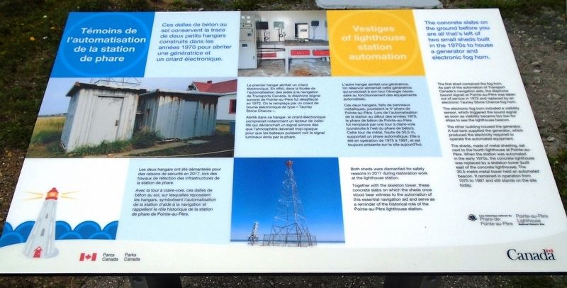
Ces dalles de béton au sol conservent la trace de deux petits hangars construits dans les années 1970 pour abriter une génératrice et un criard électronique.
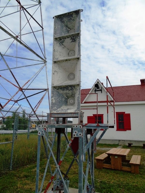
Le premier hangar abritait un criard électronique. En effet, dans la foulée de l'automatisation des aides à la navigation de Transports Canada, le diaphone (signal sonore) de Pointe-au-Père fut désaffecté en 1972. On le remplaça par un criard de brume électronique de type « Tauney Stone Chance ».
Abrité dans ce hangar, le criard électronique comprenait notamment un lecteur de visibilité que déclenchait un signal sonore dès que l'atmosphère devenait trop opaque pour que les bateaux puissent voir le signal lumineux émis par le phare.
L'autre hangar abritait une génératrice. Un réservoir alimentait cette génératrice qui produisait à son tour l'énergie nécessaire au fonctionnement des équipements automatisés.
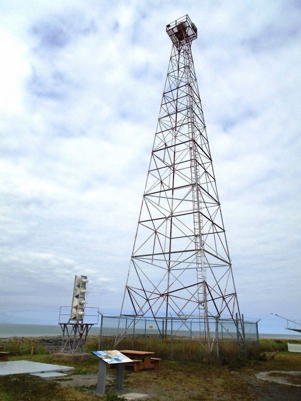
Ces deux hangars, faits de panneaux métalliques, jouxtaient le 4e phare de Pointe-au-Père. Lors de l'automatisation de la station au début des années 1970, le phare de béton de Pointe-au-Père fut remplacé par une tour à claire-voie (construite
à l'est du phare de béton). Cette tour de métal, haute de 30,5 m, supportait un phare automatique. Elle a été en opération de 1975 à 1997, et est toujours présente sur le site aujourd'hui.Les deux hangars ont été démantelés pour des raisons de sécurité en 2017, lors des travaux de réfection des infrastructures de la station de phare.
Avec la tour à claire-voie, ces dalles de béton au sol, sur lesquelles reposaient les hangars, symbolisent l'automatisation de la station d'aide à la navigation et rappellent le rôle historique de la station de phare de Pointe-au-Père.
The first shed contained the fog horn. As part of the automation of Transport Canada's navigation aids, the diaphone (sound signal) at Pointe-au-Père was taken out of service in 1972 and replaced by an electronic Tauney Stone Chance fog horn.
The electronic fog horn included a visibility sensor, which triggered the sound signal as soon as visibility became too low for ships to see the lighthouse beacon.
The other building housed the generator. A fuel tank supplied the
The sheds, made of metal sheeting, sat next to the fourth lighthouse at Pointe-au-Père. When the station was automated in the early 1970s, the concrete lighthouse was replaced with a skeleton tower (built east of the concrete lighthouse). The 30.5-metre metal tower held an automated beacon. It remained in operation from 1975 to 1997 and still stands on the site today.
Both sheds were dismantled for safety reasons in 2017 during restoration work at the lighthouse station.
Together with the skeleton tower, these concrete slabs on which the sheds once stood bear witness to the automation of this essential navigation aid and serve as a reminder of the historical role of the Pointe-au-Père lighthouse station.
Erected 2018 by Parks/Parcs Canada.
Topics and series. This historical marker is listed in these topic lists: Communications • Parks & Recreational Areas • Waterways & Vessels. In addition, it is included in the Lighthouses series list. A significant historical year for this entry is 1970.
Location. 48° 31.071′ N, 68° 28.086′ W. Marker is in Rimouski, Québec, in Rimouski-Neigette. Marker is on rue du Phare, on the left when traveling east. Marker is on the Pointe-au-Père Lighthouse
Other nearby markers. At least 8 other markers are within walking distance of this marker. Les signaux sonores / The sound signals (a few steps from this marker); Les premices / In the beginning (a few steps from this marker); Le hangar de la corne de brume / Fog Alarm Shed (a few steps from this marker); Bienvenue / Welcome (a few steps from this marker); Les premiers phares / The first lighthouses (within shouting distance of this marker); Modernisation / Modernizing (within shouting distance of this marker); Innovation (within shouting distance of this marker); L'épave du/The Wreck of RMS Empress of Ireland (within shouting distance of this marker). Touch for a list and map of all markers in Rimouski.
Also see . . .
1. Lieu historique national du Canada du Phare-de-Pointe-au-Père. (Submitted on December 26, 2018, by William Fischer, Jr. of Scranton, Pennsylvania.)
2. Discover Pointe-au-Père Lighthouse National Historic Site. (Submitted on December 26, 2018, by William Fischer, Jr. of Scranton, Pennsylvania.)
Credits. This page was last revised on November 6, 2020. It was originally submitted on December 26, 2018, by William Fischer, Jr. of Scranton, Pennsylvania. This page has been viewed 144 times since then and 11 times this year. Photos: 1, 2, 3. submitted on December 26, 2018, by William Fischer, Jr. of Scranton, Pennsylvania.


