Near White Sulphur Springs in Meagher County, Montana — The American West (Mountains)
The Smith River Valley
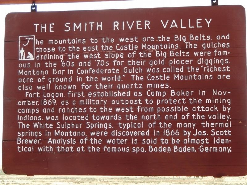
The mountains to the west are the Big Belts, and those to the east the Castle Mountains. The gulches draining the west slope of the Big Belts were famous in the ‘60s and ‘70s for their gold placer diggings. Montana Bar in Confederate Gulch was called the “richest acre of ground in the world.” The Castle Mountains are also well known for their quartz mines.
Fort Logan, first established as Camp Baker in November, 1869, as a military outpost to protect the mining camps and ranches to the west from possible attack by Indians, was located towards the north end of the valley. The White Sulphur Springs, typical of the many thermal springs in Montana, were discovered in 1866 by Jas. Scott Brewer. Analysis of the water is said to be almost identical with that at the famous spa, Baden Baden, Germany.
Topics. This historical marker is listed in these topic lists: Forts and Castles • Industry & Commerce • Natural Resources • Settlements & Settlers.
Location. 46° 26.134′ N, 110° 54.278′ W. Marker is near White Sulphur Springs, Montana, in Meagher County. Marker is on US Highway 89 (U.S. 12) 7˝ miles south of Main Street (State Highway 360), on the right when traveling south. Marker is located in a pull-out on the west side of the highway. Touch for map. Marker is in this post office area: White Sulphur Springs MT 59645, United States of America. Touch for directions.
Other nearby markers. At least 2 other markers are within 8 miles of this marker, measured as the crow flies. Fort Logan (approx. 7.7 miles away); Wellman Block (approx. 7.9 miles away).
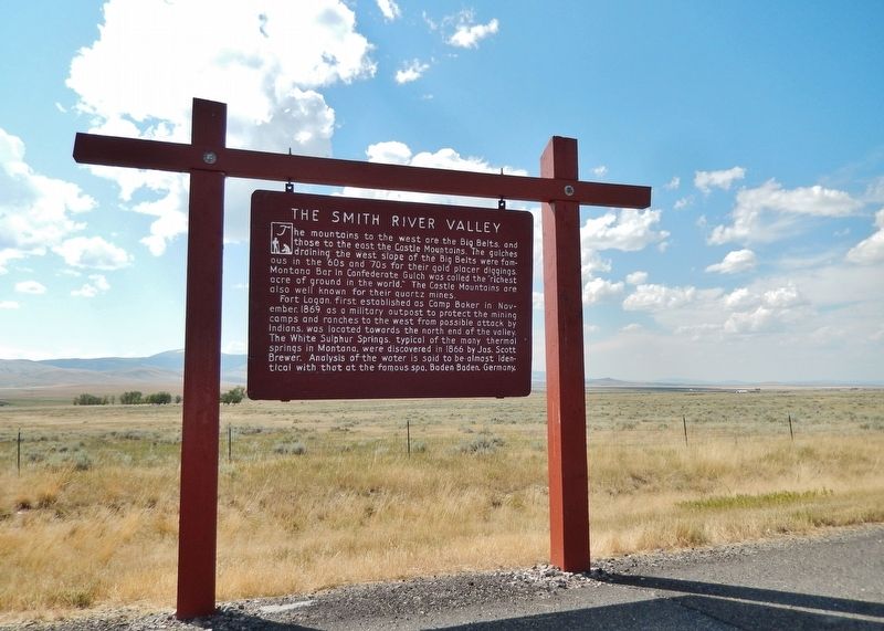
More about this marker. This is a large, painted wooden "billboard-style" marker, hanging from a heavy-duty wooden frame.
Related markers. Click here for a list of markers that are related to this marker. Fort Logan Montana (1869-1880)
Also see . . .
1. Gold Mining History of Confederate Gulch. Gold was first discovered at the gulch by former Confederate soldiers in 1864. When the Civil War ended the government issued an amnesty to all former Confederate soldiers in Arkansas if they went west by the Missouri River. Some of these soldiers heard of gold discoveries in Montana and decided to try their luck there. They discovered placer gold in a gulch located near the big Belt Mountains. This later became known as the Confederate Gulch. A surge in the arrival of miners took place after news spread of the discovery of gold late in 1864, swelling the number of inhabitants in Confederate Gulch to over 10,000 during its peak. (Submitted on December 26, 2018, by Cosmos Mariner of Cape Canaveral, Florida.)
2. Fort Logan (1869-1880). Legends of America entry:
Fort Logan was first established by the U.S. Army in 1869, and called Camp Baker for Major E.M. Baker of Fort Ellis. Its objective was to the protect the Fort Benton to Helena freight road, as well as the area miners and settlers. The provided troops for many of the campaigns in western Montana, including the Nez Perce War in 1877. In 1878, the post was renamed Fort Logan in honor of Captain William Logan who was killed at the Battle of the Big Hole. The fort was abandoned in 1880. (Submitted on December 26, 2018, by Cosmos Mariner of Cape Canaveral, Florida.)
Credits. This page was last revised on February 20, 2021. It was originally submitted on December 26, 2018, by Cosmos Mariner of Cape Canaveral, Florida. This page has been viewed 610 times since then and 46 times this year. Photos: 1, 2. submitted on December 26, 2018, by Cosmos Mariner of Cape Canaveral, Florida. • Bill Pfingsten was the editor who published this page.

