Gerrardstown in Berkeley County, West Virginia — The American South (Appalachia)
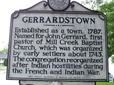
Gerrardstown
Erected 1974 by West Virginia Department of Archives and History.
Topics and series. This historical marker is listed in these topic lists: Churches & Religion • Colonial Era • Settlements & Settlers • War, French and Indian. In addition, it is included in the West Virginia Archives and History series list. A significant historical year for this entry is 1787.
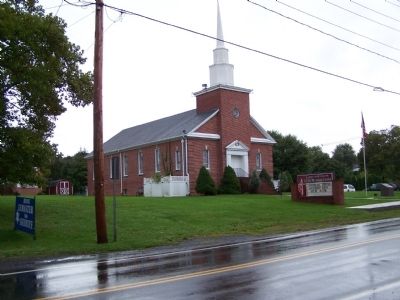
Location. 39° 22.293′ N, 78° 5.783′ W. Marker is in Gerrardstown, West Virginia, in Berkeley County. Marker is on Gerrardstown Road (West Virginia Route 51) 0.1 miles east of Reunion Corner Road, on the left when traveling west. Touch for map. Marker is at or near this postal address: 1716 Gerrardstown Rd, Gerrardstown WV 25420, United States of America. Touch for directions.
Other nearby markers. At least 8 other markers are within 4 miles of this marker, measured as the crow flies. Malin-Wilson-Gray House (about 300 feet away, measured in a direct line); Gerrardstown Veterans Memorial (about 400 feet away); Gerard House (about 700 feet away); Mill Creek Baptist Church (approx. 0.2 miles away); Morgan Cabin (approx. 2.8 miles away); Cool Spring Presbyterian Church (approx. 2.8 miles away); Zacquill Morgan House (approx. 2.8 miles away); Christ Church (approx. 3.3 miles away). Touch for a list and map of all markers in Gerrardstown.
Credits. This page was last revised on April 26, 2020. It was originally submitted on October 21, 2008, by Bill Pfingsten of Bel Air, Maryland. This page has been viewed 2,085 times since then and 77 times this year. Photos: 1, 2. submitted on October 21, 2008, by Bill Pfingsten of Bel Air, Maryland.

