St. Gabriel in Iberville Parish, Louisiana — The American South (West South Central)
The Old Saint Gabriel Church
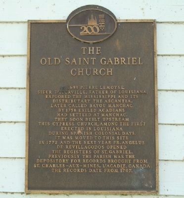
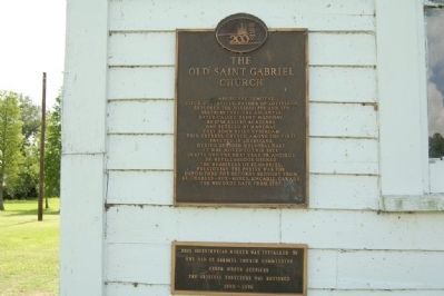
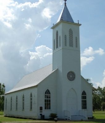
In 1699 Pierre Lemoyne, Sieur D'Iberville, father of Louisiana, explored the Mississippi and its distributary the Ascantia, later called Bayou Manchac. By 1758 exiled Acadians had settled at Manchac. They soon built upstream this cypress church, among the first erected in Louisiana during Spanish Colonial days. It was moved to this site in 1772 and the next year Fr. Angelus de Revillagodos opened the registers of St. Gabriel. Previously the parish was the depository for records brought from St. Charles-Aux-Mines, L'Acadie, Canada. The records date from 1707.
Erected 1976 by The Old St. Gabriel Church Commission.
Topics. This historical marker is listed in these topic lists: Churches & Religion • Settlements & Settlers. A significant historical year for this entry is 1699.
Location. 30° 15.278′ N, 91° 6.128′ W. Marker is in St. Gabriel, Louisiana, in Iberville Parish. Marker can be reached from State Highway 75, 0.2 miles south of State Highway 74, on the left when traveling south. Mounted beside entrance door to church. Touch for map. Marker is at or near this postal address: 3625 LA-75, Saint Gabriel LA 70776, United States of America. Touch for directions.
Other nearby markers. At least 8 other markers are within 5 miles of this marker, measured as the crow flies. Capt. Pierre Joseph Landry (within shouting distance of this marker); St. Gabriel Church (within shouting distance of this marker); St - Gabriel (within shouting distance of this marker); St. Raphael Cemetery (approx. one mile away); Bayou Paul Colored School (approx. 3.4 miles away); A Civil War Soldier (approx. 3.7 miles away); The STAR (approx. 4.3 miles away); The Daughters of Charity (approx. 4.3 miles away). Touch for a list and map of all markers in St. Gabriel.
Related markers. Click here for a list of markers that are related to this marker. To better understand the relationship, study each marker in the order shown.
Also see . . .
1. A Brief History of St. Gabriel the Archangel. Church website entry (Submitted on July 19, 2015.)
2. St. Gabriel Roman Catholic Church. National Park System website entry (Submitted on February 12, 2018, by Jude Ramagosa of White Castle, Louisiana.)
Additional commentary.
1. Moving of the Old St. Gabriel Church and Historic Gravestone.
Old St. Gabriel Church was moved from being closer to the river after bank undercutting. Also grave of famous artist Pierre Joseph Landry, who sculpted the "Wheel of Life" now located in the New Orleans Museum of Art, was originally located with the church and it's gravestone was also moved behind the church.
— Submitted December 29, 2018, by Kenneth Ramagost of Unknown, Louisiana.
Credits. This page was last revised on December 2, 2023. It was originally submitted on July 18, 2015. This page has been viewed 1,230 times since then and 37 times this year. Last updated on December 29, 2018. Photos: 1, 2, 3. submitted on July 18, 2015. 4. submitted on December 10, 2018, by Kenneth Ramagost of Unknown, Louisiana. • Andrew Ruppenstein was the editor who published this page.


