León, Guanajuato, Mexico — The Central Highlands (North America)
Plaza of Martyrs
Inscription.
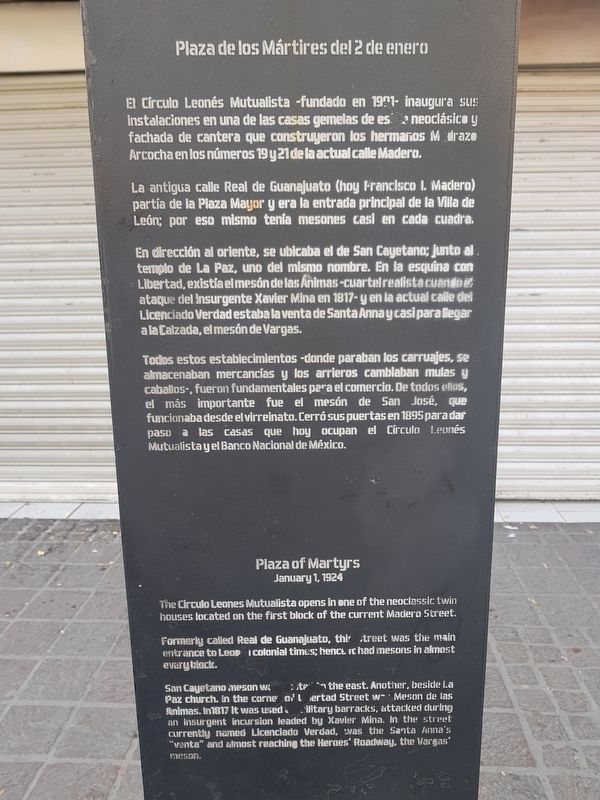
El Círculo Leonés Mutualista – fundado en 1901 – inaugura sus instalaciones en una de las casas gemelas de estilo neoclásico y fachada de cantera que construyeron los hermanos Madrazo Arcocha en los números 19 y 21 de la actual calle Madero.
La antigua calle Real de Guanajuato (hoy Francisco I. Madero) partía de la Plaza Mayor y era la entrada principal de la Villa de León; por eso mismo tenía mesones casi en cada cuadra.
En dirección al oriente, se ubicaba el de San Cayetano; junto al templo de la Paz, uno del mismo nombre. En la esquina con Libertad, existía el mesón de las Ánimas – cuartel realista cuando el ataque del insurgente Xavier Mina en 1817 – y en la actual calle del Licenciado Verdad estaba la venta de Santa Anna y casi para llegar a la Calzada, el mesón de Vargas.
Todos estos establecimientos – donde paraban los carruajes, se almacenaban mercancías y los arrieros cambiaban mulas y caballos - , fueron fundamentales para el comercio. De todos ellos, el más importante fue el mesón de San José, que funcionaba desde el virreinato. Cerró sus puertas en 1895 para dar paso a las casas que hoy ocupan el Círculo Leonés Mutualista y el Banco Nacional de México.
Plaza of Martyrs
January 1, 1924
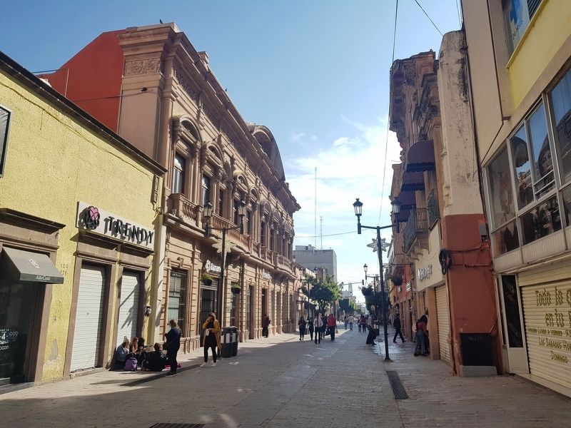
The Circulo Leones Mutualista opens in one of the neoclassic twin houses located on the first block of the current Madero Street.
Formerly called Real de Guanajuato, this Street was the main entrance to Leon in colonial times; hence it had mesons in almost every block.
San Cayetano meson was located to the east. Another, beside La Paz church. In the corner of Libertad Street was Meson de las Animas. In 1817 it was used as military barracks, attacked during an insurgent incursion leaded by Xavier Mina. In the street currently named Licenciado Verdad, was the Santa Anna’s “venta” and almost reaching the Heroes’ Roadway, the Vargas’ meson.
Topics. This historical marker is listed in these topic lists: Architecture • Colonial Era • Man-Made Features • Parks & Recreational Areas. A significant historical date for this entry is January 1, 1924.
Location. 21° 7.302′ N, 101° 40.854′ W. Marker is in León, Guanajuato. Marker is on Calle Francisco I. Madero just east of 5 de Mayo, on the right when traveling east. The marker is some 200 meters east of the actual Plaza de los Mártires in central
León. Touch for map. Marker is at or near this postal address: Calle Francisco I Madero 130, León GTO 37000, Mexico. Touch for directions.
Other nearby markers. At least 8 other markers are within walking distance of this marker. House of María Joaquina de la Portilla y Torres (about 180 meters away, measured in a direct line); Manuel Doblado Theater (about 180 meters away); Royal Houses and Early Municipal Council (about 180 meters away); House of Cecilio Louis Long (about 210 meters away); Massacre of January 2, 1946 (about 210 meters away); City Hall (approx. 0.2 kilometers away); Metropolitan Cathedral Basilica of Our Blessed Mother of Light (approx. 0.3 kilometers away); Templo Expiatorio (approx. 0.6 kilometers away). Touch for a list and map of all markers in León.
Credits. This page was last revised on January 8, 2019. It was originally submitted on January 8, 2019, by J. Makali Bruton of Accra, Ghana. This page has been viewed 148 times since then and 15 times this year. Photos: 1, 2, 3. submitted on January 8, 2019, by J. Makali Bruton of Accra, Ghana.


