Dover in Kent, England, United Kingdom — Northwestern Europe (the British Isles)
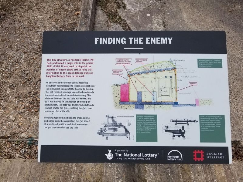
Finding the Enemy
An observer at the window used a receiving instrument with telescope to locate a suspect ship. The instrument calculated the bearing to the ship. This cell received bearings transmitted electrically from an identical cell some distance away. The distance between the two cells was known, and so it was easy to fix the position of the ship by triangulation. The data was transferred electrically to dials next to the guns, enabling the gun crews to aim and fire at the ship.
By taking repeated readings, the ship's course and speed could be calculated, the gun aimed at a predicted position and fired, even when the gun crew couldn't see the ship.
( photo captions )
- This drawing, dated 1897, is a section through a PF Cell showing details of its fittings and construction.
- A receiving instrument from a PF cell. The telescope allowed tracking of the target while the electrical wire brought data from another PF Cell (the transmitting cell). The data was combined on a map under the telescope and the target position fixed.
- This PF Cell was later adapted for a depression range finder (DRF), which worked out the target position by trigonometry from just one PF Cell. A DRF (pictured left) was mounted on the surviving concrete pillar in the building.
Topics. This historical marker is listed in this topic list: War, World I. A significant historical year for this entry is 1897.
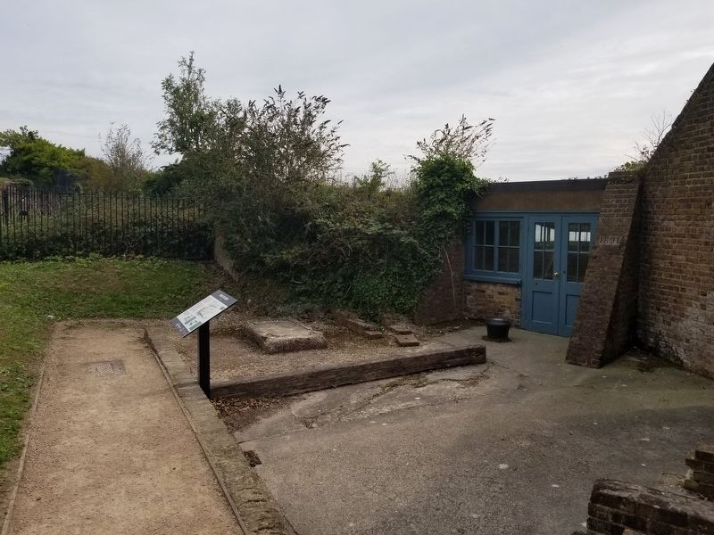
Location. 51° 7.609′ N, 1° 19.506′ E. Marker is in Dover, England, in Kent. Marker can be reached from the intersection of Castle Hill Road and Canons Gate Road, on the left when traveling south. Located at the Hospital Battery at the cliff’s edge next to Dover Castle. Touch for map. Marker is in this post office area: Dover, England CT16 1HU, United Kingdom. Touch for directions.
Other nearby markers. At least 8 other markers are within walking distance of this marker. The Signal Platform (a few steps from this marker); A View to the East (a few steps from this marker); A View of the Harbour (a few steps from this marker); A View to the West (a few steps from this marker); Command, Control and Communication (a few steps from this marker); Fighting the Enemy in the Sky (within shouting distance of this marker); Operation Dynamo (within shouting distance of this marker); Ramsay: retreat and return (within shouting distance of this marker). Touch for a list and map of all markers in Dover.
Also see . . .
1. English Heritage - Dover Castle.
(Submitted on January 11, 2019, by Michael Herrick of Southbury, Connecticut.)
2. Dover Castle on Wikipedia. (Submitted on January 11, 2019, by Michael Herrick of Southbury, Connecticut.)
Credits. This page was last revised on January 27, 2022. It was originally submitted on January 11, 2019, by Michael Herrick of Southbury, Connecticut. This page has been viewed 167 times since then and 7 times this year. Photos: 1, 2, 3. submitted on January 11, 2019, by Michael Herrick of Southbury, Connecticut.


