El Dorado Hills in El Dorado County, California — The American West (Pacific Coastal)
Mormon Island Relocation Cemetery
Established 1954
Photographed By Syd Whittle, January 13, 2019
1. Mormon Island Relocation Cemetery Marker
Click on photo to view photos and photo captions.
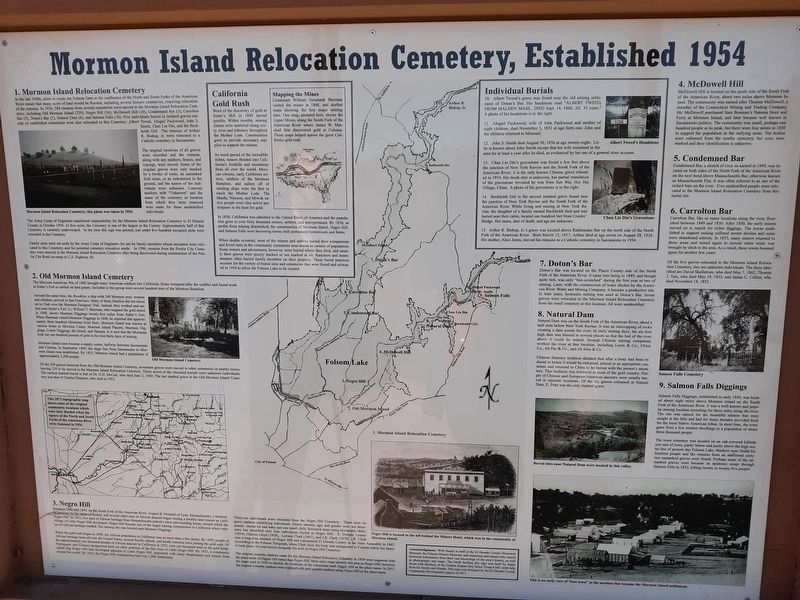
Mormon Island Relocation Cemetery. Established 1954. , 1. Mormon Island Relocation Cemetery , In the late 1940s, plans to create the Folsom Dam at the confluence of the North and South Forks of the American River meant many acres of land would be flooded, including several historic cemeteries, requiring relocation of the remains. In 1954, 384 remains from several cemeteries were moved to the Mormon Island Relocation Cemetery, including Old Mormon Island (239), Negro Hill (36), McDowell Hill (10), Condemned Bar (5), Carrolton Bar (5), Dotonís Bar (7), Natural Dam (6), and Salmon Falls (76). Five individuals buried in isolated graves outside of established cemeteries were also relocated to this cemetery: Albert Tweed, Abigail Packwood, John S. Smith, Chan Lin Din, and the Beckholdt Girl. The remains of Arthur R. Bishop, Jr. were relocated to a Catholic cemetery in Sacramento. , The original locations of all graves were recorded and remains, along with any markers, fences, and copings, were moved. Some of the original graves were only marked by a border of rocks, an unmarked field stone, or an indentation in the ground, and names of the individuals were unknown. Concrete markers with “Unknown” and the name of the cemetery or location from which they were removed were made for these individuals. , The Army Corp of Engineers transferred responsibility for the Mormon Island Cemetery to El Dorado County in October 1954. At five acres, the Cemetery is one of the largest in the County. Approximately half of this Cemetery is currently undeveloped. At the time this sign was printed, just under five hundred occupied plots were recorded in the Cemetery. , Family plots were set aside by the Army Corp of Engineers for use by family members whose ancestors were relocated to this Cemetery, and for potential cemetery relocation needs. In 1996, remains from the Prairie City Cemetery were interred in the Mormon Island Relocation Cemetery after being discovered during construction of the Prairie City Road on-ramp to U.S. Highway 50., 2. Old Mormon Island Cemetery , The Mexican-American War of 1846 brought many American soldiers into California. Some remained after the conflict and found work at Sutterís Fort or settled on land grants. Included in this group were several hundred men of the Mormon Battalion. , Around the same time, the Brooklyn, a ship with 240 Mormon men, women and children, arrived in San Francisco. Many of these families did not travel on to Utah over the Mormon Emigrant Trail. Instead, they worked and settled near Sutterís Fort. Lt. William T. Sherman, who mapped the gold mines in 1848, shows Mormon Diggings twenty-five miles from Sutterís Fort. When Sherman visited Mormon Diggings in 1848, he reported that approximately three hundred Mormons lived there. Mormon Island was known at various times as Mormon Camp, Mormon Island Placers, Mormon Diggings, Lower Diggings, the Island, and Natoma. It is said that Mormons took out one hundred pounds of gold in the first thirty days of mining. , Mormon Island soon became a supply center, halfway between Sacramento and Coloma. In September 1849, the stage line from Sacramento to Mormon Island was established. By 1853, Mormon Island had a population of approximately 2,500 people. , Of the 256 graves removed from the Old Mormon Island Cemetery, seventeen graves were moved to other cemeteries in nearby towns. The earliest marked burial is that of Dr. D.H. McCall, who died June 2, 1850. The last marked grave at the Old Mormon Island Cemetery was that of Charles Simpson, who died in 1853. , , 3. Negro Hill , Between 1848 and 1849, on the South Fork of the American River, August B. Newhall of Lynn, Massachusetts, a Methodist preacher by the name of Kelsey, and several other men of African descent began mining a locality later known as Little Negro Hill. In 1852, two men of African heritage from Massachusetts started a store and boarding house, around which the village of Little Negro Hill developed. Negro Hill became one of the larger communities in California where miners of African heritage resided. The mining site was located near Mormon Diggings. , When the gold rush began in 1848, the African population in California was no more than a few dozen. By 1849, people of African heritage from all over the United States, several Pacific islands, and South America were joining the gold rush. Of the approximately two thousand people of African descent in California in 1852, over one thousand were in the gold fields. Portuguese and Chinese prospectors built on other portions of the flat close to Little Negro Hill. By 1852, a community called Big Negro Hill had developed adjacent to Little Negro Hill, populated with many shopkeepers and miners from around the world. By 1853, the Negro Hill communities had over 1,200 inhabitants. , Thirty-six individuals were relocated from the Negro Hill Cemetery. There were no grave markers identifying individuals. Ethnic identity, age, and gender were not determined, except for one baby and one small child. Research done using newspaper obituaries has identified only four individuals buried at Negro Hill: E. Dwight Lyman (1854), Charles Lloyd (1858), Lavinia Clark (1861), and J.R. Clark (1870). J.R. Clark was a long-time resident of Negro Hill and represented El Dorado County in the State Assembly in 1863. According to the Folsom Telegraph, when Clark died, his body was transported to Folsom where his funeral took place. He was buried alongside his wife in Negro Hill Cemetery. , The original concrete markers made for Mormon Island Relocation Cemetery in 1954 were engraved with the place name of Nigger Hill rather than Negro Hill. Most early maps identify this area as Negro Hill ; however, the maps used in 1954 to identify the locations of the cemeteries used Nigger Hill as the place name. In 2011, the original concrete markers were replaced with grey granite markers using Negro Hill as the place name. , 4. McDowell Hill , McDowell Hill is located on the south side of the South Fork of the American River, about two miles above Mormon Island. The community was named after Thomas McDowell, a member of the Connecticut Mining and Trading Company. Mr. McDowell purchased Sam Brannanís Natoma Store and Ferry at Mormon Island, and later became well known in Sacramento politics. The community was small, perhaps one hundred people at its peak, but there were four stores in 1850 to support the population in the outlying areas. Ten bodies were exhumed from the nearby cemetery, but none were marked and their identification is unknown. , 5. Condemned Bar , Condemned Bar, a stretch of river so named in 1849, was located on both sides of the North Fork of the American River on the next bend above Massachusetts Bar, otherwise known as Massachusetts Flat. It was often referred to as one of the richest bars on the river. Five unidentified people were relocated to the Mormon Island Relocation Cemetery from this burial site. , 6. Carrolton Bar , Carrolton Bar, like so many locations along the river, flourished between 1849 and 1850. After 1850, the early miners moved on to search for richer diggings. The towns established to support mining suffered severe decline and some were abandoned entirely. In 1853, many miners returned to these areas and mined again in earnest when water was brought by ditch to the area. As a result, these towns boomed again for another few years. , Of the five graves relocated to the Mormon Island Relocation Cemetery, two are unknown individuals. The three identified are David Skallstrom, who died May 7, 1862, Thomas J. Tate, who died May 19th, 1855, and James C. Collier. Who died November 18, 1852. , 7. Dotonís Bar , Dotonís Bar was located on the Placer County side of the North Fork of the American River. It came into being in 1849, and though quite rich, was only “hen-scratched” during the first year or two of mining. Later, with the construction of water ditches by the American River Water and Mining Company, it became a productive site. In later years, hydraulic mining was used at Doltonís Bar. Seven graves were relocated to the Mormon Island Relocation Cemetery from the small cemetery at this location. All were unidentified. , 8. Natural Dam , Natural Dam was on the South Fork of the American River, about a half mile below New York Ravine. It was an outcropping of rocks creating a dam across the river. In early mining days, the six-foot high dam was blasted in several places so that the bed of the river above it could be mined. Several Chinese mining companies worked the river at this location, including Leon and Co., China Co., Ah Pac and Co., and Ah Shin and Co. , Chinese funerary tradition dictated that after a body had been reduced to bones it would be exhumed, placed in an appropriate container, and returned to China to be buried with the personís ancestors. This tradition was followed in most of the gold country. People of Chinese and European/American ancestry were usually buried in separate locations. Of the six graves exhumed at Natural Dam, E. Pratt was the only marked grave,, 9. Salmon Falls Diggings , Salmon Falls Diggings, established in early 1849, was located about eight miles above Mormon Island on the South Fork of the American River. It was a well-known and popular mining location stretching for three miles along the river. The site was named for the bountiful salmon that were caught at the falls and had for many decades provided food for the local Native American tribes. In short time, the town grew from a few modest dwellings to a population of about three thousand people. , The town cemetery was located on an oak-covered hillside just east of town, partly below and partly above the high water line of present day Folsom Lake. Markers were found for fourteen people and the remains from an additional sixty-two unmarked graves were found. Perhaps some of the unmarked graves were because an epidemic swept through Salmon Falls in 1852, killing twenty to twenty-five people. ,
Individual Burials. 10. Albert Tweedís grave was found near the old mining settlement of Dotonís Bar. His headstone read Albert Tweed, from Malden, Mass., Died Sept. 4, 1860, AE. 35 Years.” A photo of his headstone is to the right., 11. Abigail Packwood, wife of John Packwood and mother of eight children, died November 5, 1851 at age forty-one. John and the children returned to Missouri. , 12. John S. Smith died August 30, 1856 at age twenty-eight. Little is known about John Smith except that his wife remained in the area for at least a year after he died, as evidenced by her use of a general store account. , 13. Chan Lin Dinís gravestone was found a few feet above the junction of New York Ravine and the South Fork of the American River; it is the only known Chinese grave relocated in 1954. His death date is unknown, but partial translation of the gravestone revealed he was from Sun Wai, Hoi Hai Village, China. A photo of his gravestone is to the right. , 14. Beckholdt Girl is the second isolated grave found near the junction of New York Ravine and the South Fork of the American River. While living and mining at New York Ravine, the daughter of a family named Beckholdt died and was buried near their cabin, located one hundred feet from Crooksí Bridge. Her name, date of death, and age are unknown. , 15. Arthur R. Bishop, Jr.ís grave was located above Rattlesnake Bar on the north side of the North Fork of the American River. Born March 12, 1917, Arthur R. Bishop, Jr.ís grave was located above Rattlesnake Bar on the north side of the North Fork of the American River. Born March 12, 1917, Arthur died at age seven on August 28, 1924. His mother, Alice Jones, moved his remains to a Catholic cemetery in Sacramento in 1954., Acknowledgements. With thanks to staff at the El Dorado County Historical Museum, the Folsom History Museum, and numerous individuals who shared historical information from their vast knowledge of the area's history, as well as photographs and maps. The kiosk holding this sign was built by Eagle Scout Josh Michael, of The Golden Empire Boy Scout Troop #645, with help from his family and friends. This sign was designed by the El Dorado County Community Development Agency in 2017.
1. Mormon Island Relocation Cemetery
In the late 1940s, plans to create the Folsom Dam at the confluence of the North and South Forks of the American River meant many acres of land would be flooded, including several historic cemeteries, requiring relocation of the remains. In 1954, 384 remains from several cemeteries were moved to the Mormon Island Relocation Cemetery, including Old Mormon Island (239), Negro Hill (36), McDowell Hill (10), Condemned Bar (5), Carrolton Bar (5), Dotonís Bar (7), Natural Dam (6), and Salmon Falls (76). Five individuals buried in isolated graves outside of established cemeteries were also relocated to this cemetery: Albert Tweed, Abigail Packwood, John S. Smith, Chan Lin Din, and the Beckholdt Girl. The remains of Arthur R. Bishop, Jr. were relocated to a Catholic cemetery in Sacramento.
The original locations of all graves were recorded and remains, along with any markers, fences, and copings, were moved. Some of the original graves were only marked by a border of rocks, an unmarked field stone, or an indentation in the ground, and names of the individuals were unknown. Concrete markers with “Unknown” and the name of the cemetery or location from which they were removed were made for these individuals.
The Army Corp of Engineers transferred responsibility 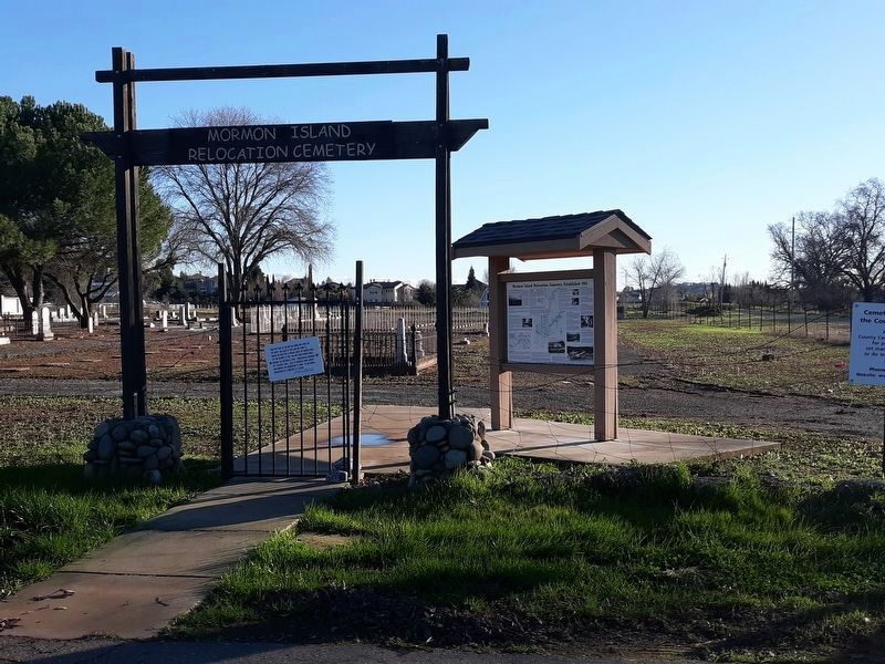
Photographed By Syd Whittle, January 21, 2019
2. Mormon Island Relocation Cemetery Marker With Cemetery in the Background
 Click or scan to see
this page online
for the Mormon Island Cemetery to El Dorado County in October 1954. At five acres, the Cemetery is one of the largest in the County. Approximately half of this Cemetery is currently undeveloped. At the time this sign was printed, just under five hundred occupied plots were recorded in the Cemetery.
Family plots were set aside by the Army Corp of Engineers for use by family members whose ancestors were relocated to this Cemetery, and for potential cemetery relocation needs. In 1996, remains from the Prairie City Cemetery were interred in the Mormon Island Relocation Cemetery after being discovered during construction of the Prairie City Road on-ramp to U.S. Highway 50.
2. Old Mormon Island Cemetery
The Mexican-American War of 1846 brought many American soldiers into California. Some remained after the conflict and found work at Sutterís Fort or settled on land grants. Included in this group were several hundred men of the Mormon Battalion.
Around the same time, the Brooklyn, a ship with 240 Mormon men, women and children, arrived in San Francisco. Many of these families did not travel on to Utah over the Mormon Emigrant Trail. Instead, they worked and settled near Sutterís Fort. Lt. William T. Sherman, who mapped the gold mines in 1848, shows Mormon Diggings twenty-five miles from Sutterís Fort. When Sherman visited Mormon Diggings 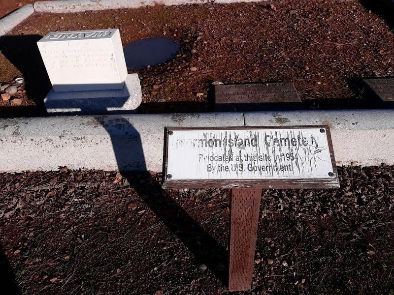
Photographed By Syd Whittle, January 21, 2019
3. Mormon Island Cemetery
Relocated at this site in 1954
By the U.S. Government
Mormon Island soon became a supply center, halfway between Sacramento and Coloma. In September 1849, the stage line from Sacramento to Mormon Island was established. By 1853, Mormon Island had a population of approximately 2,500 people.
Of the 256 graves removed from the Old Mormon Island Cemetery, seventeen graves were moved to other cemeteries in nearby towns. The earliest marked burial is that of Dr. D.H. McCall, who died June 2, 1850. The last marked grave at the Old Mormon Island Cemetery was that of Charles Simpson, who died in 1853.
3. Negro Hill
Between 1848 and 1849, on the South Fork of the American River, August B. Newhall of Lynn, Massachusetts, a Methodist preacher by the name of Kelsey, and several other men of African descent began mining a locality later known as Little Negro Hill. In 1852, two men of African heritage from Massachusetts started a store and boarding house, around which the village of Little Negro Hill developed. Negro Hill became one of the larger communities in California where miners of African 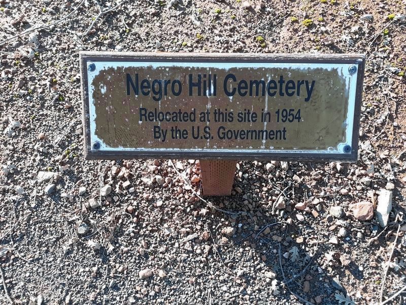
Photographed By Syd Whittle, January 21, 2019
4. Negro Hill Cemetery
Relocated at this site in 1854
By the U.S. Government
When the gold rush began in 1848, the African population in California was no more than a few dozen. By 1849, people of African heritage from all over the United States, several Pacific islands, and South America were joining the gold rush. Of the approximately two thousand people of African descent in California in 1852, over one thousand were in the gold fields. Portuguese and Chinese prospectors built on other portions of the flat close to Little Negro Hill. By 1852, a community called Big Negro Hill had developed adjacent to Little Negro Hill, populated with many shopkeepers and miners from around the world. By 1853, the Negro Hill communities had over 1,200 inhabitants.
Thirty-six individuals were relocated from the Negro Hill Cemetery. There were no grave markers identifying individuals. Ethnic identity, age, and gender were not determined, except for one baby and one small child. Research done using newspaper obituaries has identified only four individuals buried at Negro Hill: E. Dwight Lyman (1854), Charles Lloyd (1858), Lavinia Clark (1861), and J.R. Clark (1870). J.R. Clark was a long-time resident of Negro Hill and represented El Dorado County in the State Assembly in 1863. According to the Folsom Telegraph, when Clark died, his body was transported to Folsom where his funeral 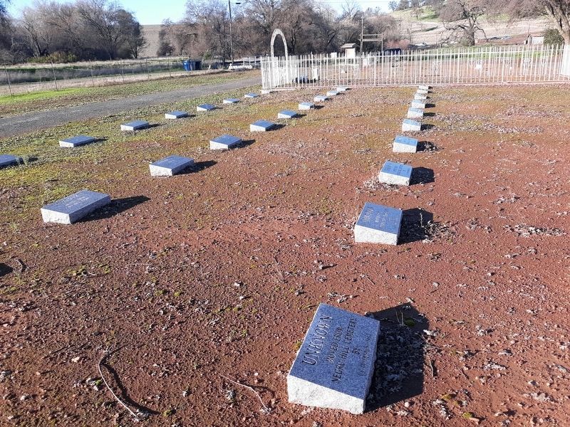
Photographed By Syd Whittle, January 21, 2019
5. Negro Hill Cemetery Relocations
Concrete grave markers which replaced original grave markers in 2011
The original concrete markers made for Mormon Island Relocation Cemetery in 1954 were engraved with the place name of Nigger Hill rather than Negro Hill. Most early maps identify this area as Negro Hill ; however, the maps used in 1954 to identify the locations of the cemeteries used Nigger Hill as the place name. In 2011, the original concrete markers were replaced with grey granite markers using Negro Hill as the place name.
4. McDowell Hill
McDowell Hill is located on the south side of the South Fork of the American River, about two miles above Mormon Island. The community was named after Thomas McDowell, a member of the Connecticut Mining and Trading Company. Mr. McDowell purchased Sam Brannanís Natoma Store and Ferry at Mormon Island, and later became well known in Sacramento politics. The community was small, perhaps one hundred people at its peak, but there were four stores in 1850 to support the population in the outlying areas. Ten bodies were exhumed from the nearby cemetery, but none were marked and their identification is unknown.
5. Condemned Bar
Condemned Bar, a stretch of river so named in 1849, was located on both sides of the North Fork of the American River on the next bend above Massachusetts Bar, 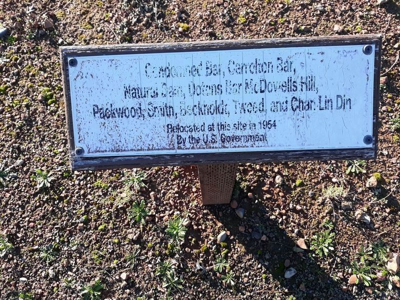
Photographed By Syd Whittle, January 21, 2019
6. Condemned Bar, Carrolton Bar, Natural Dam, Dotons Bar, McDowell Hill, Packwood Smith, Beckholt,
Tweed, and Chan Lin Din
Relocated at this site in 1954
By the US Government
6. Carrolton Bar
Carrolton Bar, like so many locations along the river, flourished between 1849 and 1850. After 1850, the early miners moved on to search for richer diggings. The towns established to support mining suffered severe decline and some were abandoned entirely. In 1853, many miners returned to these areas and mined again in earnest when water was brought by ditch to the area. As a result, these towns boomed again for another few years.
Of the five graves relocated to the Mormon Island Relocation Cemetery, two are unknown individuals. The three identified are David Skallstrom, who died May 7, 1862, Thomas J. Tate, who died May 19th, 1855, and James C. Collier. Who died November 18, 1852.
7. Dotonís Bar
Dotonís Bar was located on the Placer County side of the North Fork of the American River. It came into being in 1849, and though quite rich, was only “hen-scratched” during the first year or two of mining. Later, with the construction of water ditches by the American River Water and Mining Company, it became a productive site. In later years, hydraulic mining was used at Doltonís Bar. Seven graves 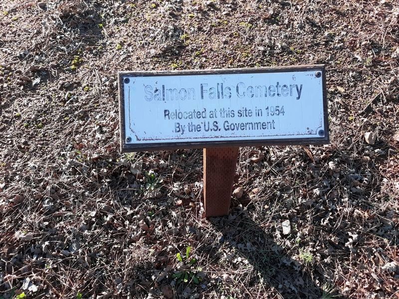
Photographed By Syd Whittle, January 21, 2019
7. Salmon Falls Relocation Cemetery
Relocated at this site in 1954
By the U.S. Government
8. Natural Dam
Natural Dam was on the South Fork of the American River, about a half mile below New York Ravine. It was an outcropping of rocks creating a dam across the river. In early mining days, the six-foot high dam was blasted in several places so that the bed of the river above it could be mined. Several Chinese mining companies worked the river at this location, including Leon & Co., China Co., Ah Pac & Co., and Ah Shin & Co.
Chinese funerary tradition dictated that after a body had been reduced to bones it would be exhumed, placed in an appropriate container, and returned to China to be buried with the personís ancestors. This tradition was followed in most of the gold country. People of Chinese and European/American ancestry were usually buried in separate locations. Of the six graves exhumed at Natural Dam, E. Pratt was the only marked grave,
9. Salmon Falls Diggings
Salmon Falls Diggings, established in early 1849, was located about eight miles above Mormon Island on the South Fork of the American River. It was a well-known and popular mining location stretching for three miles along the river. The site was named for the bountiful salmon that were caught at the falls and had for many decades 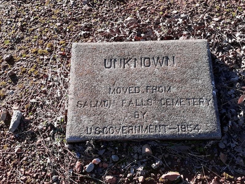
Photographed By Syd Whittle, January 21, 2019
8. Unknown Grave Marker
The town cemetery was located on an oak-covered hillside just east of town, partly below and partly above the high water line of present day Folsom Lake. Markers were found for fourteen people and the remains from an additional sixty-two unmarked graves were found. Perhaps some of the unmarked graves were because an epidemic swept through Salmon Falls in 1852, killing twenty to twenty-five people.
Individual Burials
10. Albert Tweedís grave was found near the old mining settlement of Dotonís Bar. His headstone read Albert Tweed, from Malden, Mass., Died Sept. 4, 1860, AE. 35 Years.” A photo of his headstone is to the right.
11. Abigail Packwood, wife of John Packwood and mother of eight children, died November 5, 1851 at age forty-one. John and the children returned to Missouri.
12. John S. Smith died August 30, 1856 at age twenty-eight. Little is known about John Smith except that his wife remained in the area for at least a year after he died, as evidenced by her use of a general store account.
13. Chan Lin Dinís gravestone was found a few feet above the junction of New York Ravine and the South Fork of the American River; it 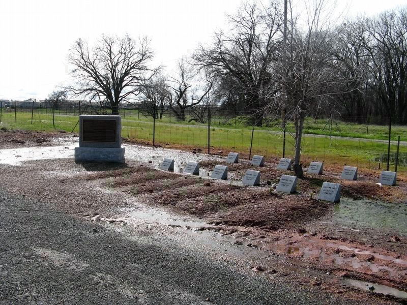
Photographed By Syd Whittle, February 17, 2009
9. Prairie City Cemetery Grave Relocation Site
See "Nearby Marker" for additional information.
14. Beckholdt Girl is the second isolated grave found near the junction of New York Ravine and the South Fork of the American River. While living and mining at New York Ravine, the daughter of a family named Beckholdt died and was buried near their cabin, located one hundred feet from Crooksí Bridge. Her name, date of death, and age are unknown.
15. Arthur R. Bishop, Jr.ís grave was located above Rattlesnake Bar on the north side of the North Fork of the American River. Born March 12, 1917, Arthur R. Bishop, Jr.ís grave was located above Rattlesnake Bar on the north side of the North Fork of the American River. Born March 12, 1917, Arthur died at age seven on August 28, 1924. His mother, Alice Jones, moved his remains to a Catholic cemetery in Sacramento in 1954.
Acknowledgements
With thanks to staff at the El Dorado County Historical Museum, the Folsom History Museum, and numerous individuals who shared historical information from their vast knowledge of the area's history, as well as photographs and maps. The kiosk holding this sign was built by Eagle Scout Josh Michael, of The Golden Empire Boy Scout Troop #645, with help from his family and friends. This sign was designed by the El Dorado County Community Development Agency in 2017.
Erected 2017.
Topics. This historical marker is listed in this topic list: Cemeteries & Burial Sites. A significant historical year for this entry is 1954.
Location. 38° 41.911′ N, 121° 6.572′ W. Marker is in El Dorado Hills, California, in El Dorado County. Marker is on Shadowfax Lane south of Green Valley Road. The marker is placed at the entrance to the cemetery. Touch for map. Marker is at or near this postal address: 2547 Shadowfax Lane, El Dorado Hills CA 95762, United States of America. Touch for directions.
Other nearby markers. At least 8 other markers are within 3 miles of this marker, measured as the crow flies. Prairie City Cemetery (about 300 feet away, measured in a direct line); Mormon Island, Negro Hill, Salmon Falls, and Condemned Bar (approx. 0.2 miles away); a different marker also named Mormon Island (approx. one mile away); Folsom Dam Improvements (approx. 1.1 miles away); Johnny Cash Trail (approx. 1.9 miles away); Sterlingshire (approx. 2 miles away); Railroad Gate (approx. 2.8 miles away); Prison Doodlebug (approx. 2.8 miles away). Touch for a list and map of all markers in El Dorado Hills.
Also see . . .
1. . Find-A-Grave - Includes photos of grave markers and headstones. (Submitted on January 17, 2019.)
2. Mormon Island. Historical information and photos of the Mormon Island mining town. (Submitted on January 17, 2019.)
Credits. This page was last revised on January 24, 2019. It was originally submitted on January 17, 2019, by Syd Whittle of Mesa, Arizona. This page has been viewed 637 times since then and 42 times this year. Photos: 1. submitted on January 17, 2019, by Syd Whittle of Mesa, Arizona. 2, 3, 4, 5, 6, 7, 8. submitted on January 21, 2019, by Syd Whittle of Mesa, Arizona. 9. submitted on February 18, 2009, by Syd Whittle of Mesa, Arizona.


