La Villita in San Antonio in Bexar County, Texas — The American South (West South Central)
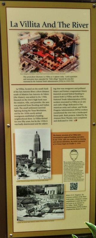
La Villita And The River
Bronze plaques along the River Walk identify features designed by Robert H.H. Hugman. The plaques replicate the stamp that was imprinted on his architectural drawings. Hugman's initial concept for beautification and commercial development of the San Antonio River was conceived in 1929. Construction began on the River Walk project in 1939 with partial funding from the Works Progress Administration. To learn more about Hugman and the River Walk, please scan this QR code with your smartphone or go to www.HugmanTour.com.
Topics. This historical marker is listed in these topic lists: Charity & Public Work • Notable Places • Settlements & Settlers • Waterways & Vessels. A significant historical year for this entry is 1941.
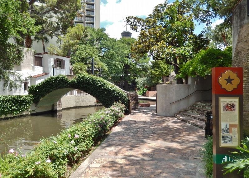
Location. 29° 25.347′ N, 98° 29.335′ W. Marker is in San Antonio, Texas, in Bexar County. It is in La Villita. Marker can be reached from King Philip V north of Villita Street when traveling north. Marker is on the San Antonio River Walk at the Villita, on the south side of the river, just west of Rosita's Bridge. Touch for map. Marker is at or near this postal address: 101 King Philip V, San Antonio TX 78205, United States of America. Touch for directions.
Other nearby markers. At least 8 other markers are within walking distance of this marker. Naming of San Antonio (within shouting distance of this marker); Articles of Capitulation (within shouting distance of this marker); The Pajalache Acequia (Ditch) (within shouting distance of this marker); Losana House (within shouting distance of this marker); Bowen-Kirchner House (within shouting distance of this marker); Address by President Lincoln (within shouting distance of this marker); Juarez Plaza
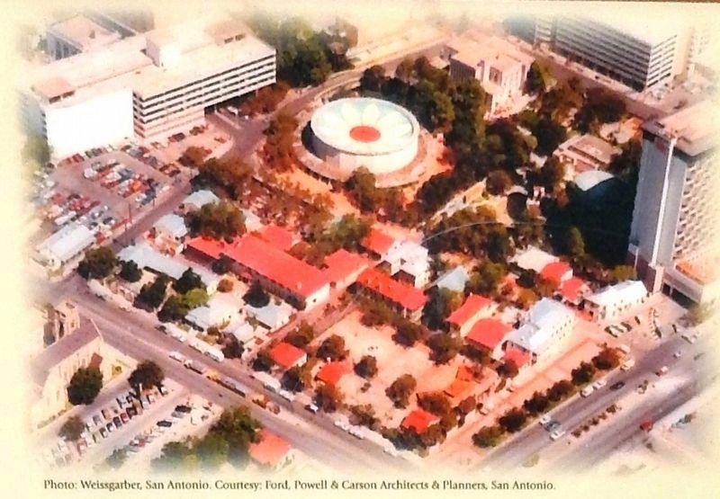
Photographed By Weissgarber, San Antonio. Courtesy: Ford, Powell & Carson Architects & Planners, San Antonio
2. Marker detail: Aerial photo of La Villita
This aerial photo illustrates La Villita as it appears today. Land acquisition and restoration have expanded the “little village” beyond the area first renovated by the National Youth Administration (NYA) in 1939-1941.
More about this marker. Marker is a large, framed composite interpretive panel, mounted on a six-foot tall metal support.
Also see . . .
1. La Villita. La Villita was restored as a result of a city ordinance of October 12, 1939, and is owned by the city and operated as a craft and recreational center. The National Youth Administration assisted in the two-year restoration, during which 1,800 youths were trained in arts and crafts. San Antonio architect O'Neil Ford and others contributed to the project. During World War II La Villita was used as a Red Cross Center. At the end of the war it was returned to the purpose of preserving early Texas and Spanish culture, fostering arts and crafts, and providing a community center. (Submitted on January 17, 2019, by Cosmos Mariner of Cape Canaveral, Florida.)
2. Arneson River Theater. The open-air venue was erected by the Works Progress Administration. The design was supervised by architect Robert H.H. Hugman. It is named after Edwin Arneson, the regional
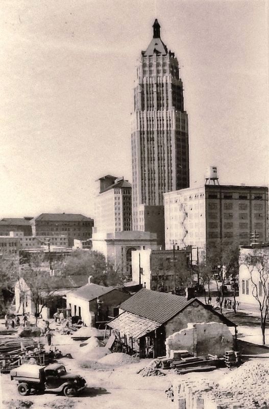
Courtesy: Texana/Genealogy Collection, San Antonio Public Library
3. Marker detail: La Villita circa 1930s
The historic structures of La Villita were surrounded by neglected buildings and debris by the 1930s. After two months of site cleaning and selective demolition, the initial restoration of six houses began on October 9, 1939.
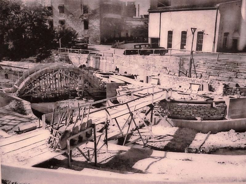
Courtesy: San Antonio Light Collection, Institute of Texas Cultures, San Antonio
4. Marker detail: amphitheater construction circa 1941
Robert H. H. Hugman, the visionary architect of the River Walk project, designed a unique amphitheater to span the river and serve as an entrance to La Villita. Works Progress Administration (WPA) workers completed the theater in 1941.
Photographed By Cosmos Mariner, May 22, 2018
5. La Villita & The River Marker (wide view; San Antonio River & Rosita's Bridge in background)
from Wikipedia: A nearby stone bridge is often made part of the performance space. It is now called Rosita's Bridge in honor of Rosita Fernandez, a pioneer of Tejano music, who performed here as star of the summer-long Fiesta Noche del Rio for almost 25 years.
Credits. This page was last revised on February 2, 2023. It was originally submitted on January 17, 2019, by Cosmos Mariner of Cape Canaveral, Florida. This page has been viewed 264 times since then and 32 times this year. Photos: 1, 2, 3, 4, 5, 6. submitted on January 17, 2019, by Cosmos Mariner of Cape Canaveral, Florida. • Andrew Ruppenstein was the editor who published this page.
