Aberdeen Proving Ground in Harford County, Maryland — The American Northeast (Mid-Atlantic)
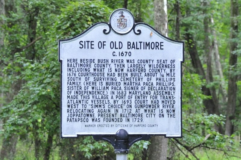
Site of Old Baltimore
c. 1670
Erected by Citizens of Harford County.
Topics. This historical marker is listed in these topic lists: Cemeteries & Burial Sites • Colonial Era • Settlements & Settlers. A significant historical year for this entry is 1670.
Location. 39° 24.445′ N, 76° 14.532′ W. Marker is in Aberdeen Proving Ground, Maryland, in Harford County. Marker can be reached from Old Baltimore Road near Chilbury Point. Marker is in a restricted area of Aberdeen Proving Ground and no longer accessible to the public. Touch for map. Marker is in this post office area: Aberdeen Proving Ground MD 21005, United States of America. Touch for directions.
Other nearby markers. At least 8 other markers are within 5 miles of this marker, measured as the crow flies. Captain John Smith (approx. 3½ miles away); a different marker also named Site of “Old Baltimore” (approx. 3½ miles away); Gov. William Paca (approx. 4.1 miles away); Cokesbury College (approx. 4.1 miles away); Sophia’s Dairy (approx. 4½ miles away); Harford Town (approx. 4.6 miles away); This Tablet (approx. 4.7 miles away); "The Bush Declaration" (approx. 4.7 miles away).
Credits. This page was last revised on February 21, 2021. It was originally submitted on January 25, 2019, by Bill Pfingsten of Bel Air, Maryland. This page has been viewed 467 times since then and 31 times this year. Last updated on April 30, 2020, by Carl Gordon Moore Jr. of North East, Maryland. Photo 1. submitted on January 25, 2019, by Bill Pfingsten of Bel Air, Maryland.
