Nanjemoy in Charles County, Maryland — The American Northeast (Mid-Atlantic)
Unique Environment
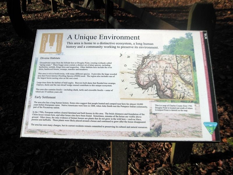
This area is home to a distinctive ecosystem, a long human history
— and a community working to preserve its environment. —
Inscription.
Diverse Habitats
Groundwater seeps from the hillside here at Douglas Point, creating wetlands called "spring seeps." These boggy areas contain a distinct set of plant species, including bayberries, orchids, fringe trees and magnolias. Other habitats here include river shore, hardwood forests, swamps, marshes and meadows.
This area is rich in biodiversity, with many different species. It provides the large wooded area that Forest Interior Dwelling Species (FIDS) need. The region also includes the largest heron nesting sites on the east coast.
Large trees form the habitat of bald eagles. Beavers built dams that flooded tree swamps. Ospreys, ducks and the rare dwarf wedge mussel contribute to this unique ecosystem.
This area also contains fossils—including shark, turtle and crocodile fossils—some of which are 55 million years old.
Early Settlement
The area also has a long human history. Some sites suggest that people hunted and camped near here for almost 10,000 years before Europeans came. Native Americans were here in 1608, when John Smith met the Potopaco Indian community part of the Piscataway nation.
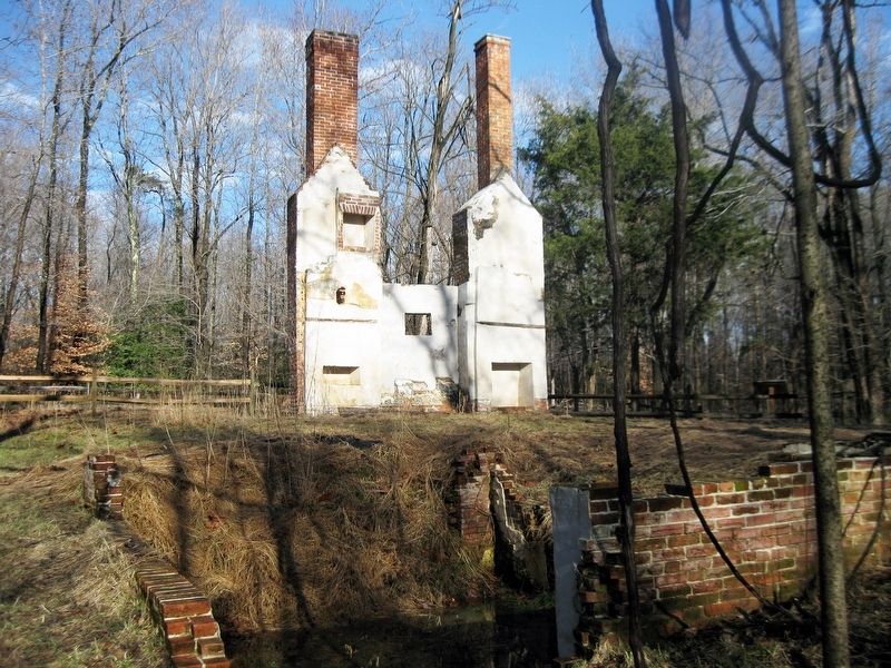
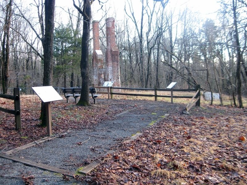
In the 1700s, European settlers cleared farmland and built houses in this area. The brick chimneys and foundation of he Chiles house remain here, and other house sites have been found. Sometimes, remains of the house ae visible above ground. Other times, the only evidence of former houses are plants that do not grow in the wild here—such as lilacs, peonies and daffodils. These plants were likely placed around a house and continued to grow after the house disappeared.
The area has seen many changes, but its current residents remain committed to preserving its cultural and natural resources.
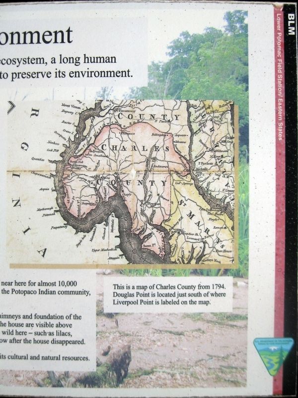
(Map)
This is a map of Charles County from 1794. Douglas Point is located just south of where Liverpool Point is labeled on the map.
(Icon in the upper-left corner for the Chiles Homesite.)
(Icon in the lower-right corner for the Department of the Interior, Bureau of Land Management.)
Erected by Department of the Interior, Bureau of Land Management.
Topics. This historical marker is listed in these topic lists: Colonial Era • Environment • Native Americans. A significant historical year for this entry is 1608.
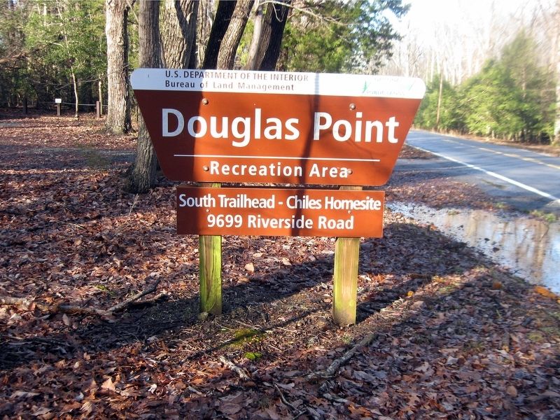
Location. 38° 26.6′ N, 77° 15.283′ W. Marker is in Nanjemoy, Maryland, in Charles County. Marker can be reached from Riverside Road (Route 224) 1.1 miles Liverpool Point Road (Route 426). Douglas Point Recreation Area has three parking areas. Use the one with the sign reading "South Trailhead—Chiles
Homesite, 9699 Riverside Road." Follow trail for half a mile to reach the five markers at the Chile Homesite. Touch for map. Marker is at or near this postal address: 9699 Riverside Road, Nanjemoy MD 20662, United States of America. Touch for directions.
Other nearby markers. At least 8 other markers are within 3 miles of this marker, measured as the crow flies. Memories of Douglas Point (here, next to this marker); Minister's House, Family Farm (here, next to this marker); Archeology Reveals Outbuildings (here, next to this marker); Life Cycle of a House (here, next to this marker); Mallows Bay (approx. 1.8 miles away); a different marker also named Mallows Bay (approx. 1.8 miles away); Points of Interest (approx. 1.8 miles away); Washington's Farm (approx. 2.2 miles away). Touch for a list and map of all markers in Nanjemoy.
Also see . . .
1. Douglas Point, Charles County, Maryland Department of Natural Resources. (Submitted on January 27, 2019.)
2. Mount Pleasant (Chiles Site), Maryland Inventory of Historic Properties. (Submitted on January 27, 2019.)
3. Chiles Homesite, Douglas Point, Maryland, William & Mary. (Submitted on January 27, 2019.)
4. Douglas Point Special Recreation Management Area, Bureau of Land Management. (Submitted on January 27, 2019.)
Credits. This page was last revised on January 28, 2019. It was originally submitted on January 27, 2019. This page has been viewed 203 times since then and 17 times this year. Photos: 1, 2, 3, 4, 5, 6. submitted on January 27, 2019. • Bill Pfingsten was the editor who published this page.
