Knights Ferry in Stanislaus County, California — The American West (Pacific Coastal)
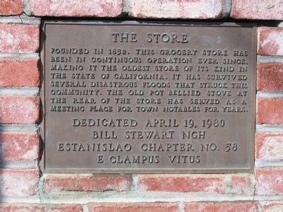
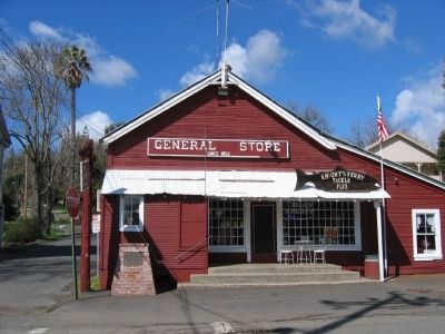
Knights Ferry - The Store
Erected 1980 by Bill Stewart NGH, Estanislao Chapter No. 58, E. Clampus Vitus, April 19, 1980.
Topics and series. This historical marker is listed in these topic lists: Industry & Commerce • Notable Buildings • Notable Places • Settlements & Settlers. In addition, it is included in the E Clampus Vitus series list. A significant historical year for this entry is 1852.
Location. 37° 49.164′ N, 120° 40.274′ W. Marker is in Knights Ferry, California, in Stanislaus County. Marker is at the intersection of Main Street-Sonora Road and Dean Street, on the right when traveling west on Main Street-Sonora Road. Touch for map. Marker is at or near this postal address: 17701 Main Street, Oakdale CA 95361, United States of America. Touch for directions.
Other nearby markers. At least 8 other markers are within walking distance of this marker. Knights Ferry No. 2 (a few steps from this marker); Miller's Saloon (a few steps from this marker); Knight's Ferry (about 300 feet away, measured in a direct line); Knights Ferry Hook & Ladder (about 400 feet away); Power Generation (approx. 0.3 miles away); Tulloch’s Mill (approx. 0.4 miles away); Mill House (approx. 0.4 miles away); Knights Ferry Covered Bridge (approx. 0.4 miles away). Touch for a list and map of all markers in Knights Ferry.
Regarding Knights Ferry - The Store. Also see: All other nearby Knights Ferry markers for additional information.
Also see . . .
1. Ghost Towns: Knights Ferry. (Submitted on October 24, 2008.)
2. Knights Ferry. (Submitted on October 24, 2008.)
Additional keywords. Gold Rush
Credits. This page was last revised on June 16, 2016. It was originally submitted on October 24, 2008, by Syd Whittle of Mesa, Arizona. This page has been viewed 1,255 times since then and 18 times this year. Photos: 1, 2. submitted on October 24, 2008, by Syd Whittle of Mesa, Arizona.

