St. Marks in Wakulla County, Florida — The American South (South Atlantic)
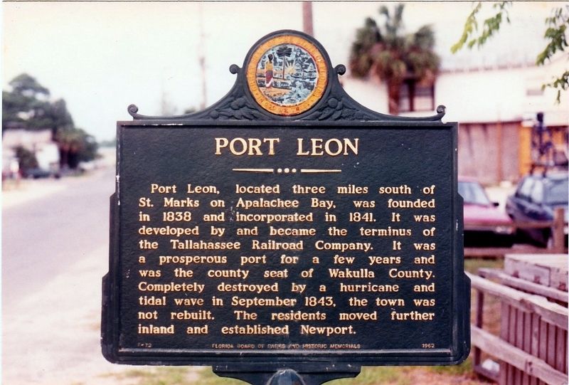
Port Leon
Erected 1962 by Florida Board of Parks and Historic Memorials. (Marker Number F-72.)
Topics. This historical marker is listed in these topic lists: Railroads & Streetcars • Settlements & Settlers. A significant historical year for this entry is 1838.
Location. Marker is missing. It was located near 30° 9.274′ N, 84° 12.208′ W. Marker was in St. Marks, Florida, in Wakulla County. Marker was at the intersection of Riverside Drive and Port Leon Drive (State Road 363), on the left when traveling west on Riverside Drive. Touch for map. Marker was in this post office area: Saint Marks FL 32355, United States of America. Touch for directions.
Other nearby markers. At least 8 other markers are within walking distance of this location. Bo Lynn's Grocery (within shouting distance of this marker); a different marker also named Port Leon (within shouting distance of this marker); Telltale Bones (about 300 feet away, measured in a direct line); St. Marks Bike Trail Park (about 700 feet away); The City of St. Marks (approx. 0.2 miles away); San Marcos de Apalache (approx. 0.4 miles away); The Old Store on the Wakulla River (approx. 0.4 miles away); Fort St. Marks Military Cemetery (approx. half a mile away). Touch for a list and map of all markers in St. Marks.
Credits. This page was last revised on February 2, 2019. It was originally submitted on January 31, 2019, by Tim Fillmon of Webster, Florida. This page has been viewed 321 times since then and 34 times this year. Photo 1. submitted on January 31, 2019, by Tim Fillmon of Webster, Florida. • Bernard Fisher was the editor who published this page.
