Rancho Palos Verdes in Los Angeles County, California — The American West (Pacific Coastal)
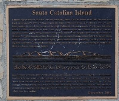
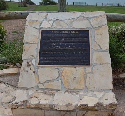
Santa Catalina Island
In conjunction with the Palos Verdes Peninsula, the island is thought to be utilized as a navigational landmark by grey whales as they migrate along the North American coastline 5,000-7,000 miles south from the cold waters of Alaska to the warm water of Baja California, Mexico. The fall months through spring are known as whale-watching season where 2,500 to 3,000 whales on average are spotted annually from the Palos Verdes Peninsula. So look closely because you may see a whale near the coastline.
Erected 2000.
Topics. This historical marker is listed in these topic lists: Animals • Environment • Exploration. A significant historical month for this entry is October 1797.
Location. 33° 44.597′ N, 118° 22.774′ W. Marker is in Rancho Palos Verdes, California, in Los Angeles County. Marker is on Palos Verdes Drive South, ¼ mile east of Sea Cove Drive, on the right when traveling east. Touch for map. Marker is in this post office area: Rancho Palos Verdes CA 90275, United States of America. Touch for directions.
Other nearby markers. At least 8 other markers are within 4 miles of this marker, measured as the crow flies. Portuguese Bend (here, next to this marker); Palos Verdes Peninsula Habitat (here, next to this marker); Harden Gatehouse (approx. 0.4 miles away); Villa Francesca (approx. 0.6 miles away); Portuguese Bend Whaling Station (approx. 1.6 miles away); Point Vicente Lighthouse (approx. 1.8 miles away); Site of the First Japanese American Farm on the Palos Verdes Peninsula (approx. 1.9 miles away); “The Farmery” (approx. 3.3 miles away). Touch for a list and map of all markers in Rancho Palos Verdes.
Regarding Santa Catalina Island. William Wrigley, Jr. bought Catalina Island in 1919 and in 1921 he moved the Chicgo Cubs spring training operations to the Island. From 1921 to 1941 Major League Baseball played an important role on the island.

Photographed By Mike Roberts Color Productions, Catalina Color Cards
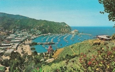
3. View of Avalon and the Harbor - Santa Catalina Island
Description on postcard:
Avalon and the Harbor as viewed from the grounds of Mt. Ada which was originally built as a home by William Wrigley, Jr. This view looks northwest towards the Chimes Tower and Casino across the bay.
Avalon and the Harbor as viewed from the grounds of Mt. Ada which was originally built as a home by William Wrigley, Jr. This view looks northwest towards the Chimes Tower and Casino across the bay.
Credits. This page was last revised on September 13, 2023. It was originally submitted on May 3, 2011, by Eric Polk of Lakewood, California. This page has been viewed 1,211 times since then and 29 times this year. Last updated on October 10, 2020, by Craig Baker of Sylmar, California. Photos: 1, 2. submitted on May 3, 2011, by Eric Polk of Lakewood, California. 3. submitted on May 5, 2011. 4. submitted on April 16, 2017, by Denise Boose of Tehachapi, California. • J. Makali Bruton was the editor who published this page.


