Near Campbellsville in Taylor County, Kentucky — The American South (East South Central)
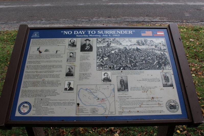
"No Day to Surrender"
Saturday Morning, July 4, 1863
You are now directly at the Union's forward defended position - a rifle pit, shielded by earthworks, sharpened sticks, and fence rails. Its 50 to 60 riflemen had clear fields of fire and were ordered to resist the initial Confederate assault and then withdraw.
At sunrise Union Pickets opened fire on approaching southern forces. The Confederate Battery, on the knoll 525 yards to your right, fired into the rifle pit, causing casualties.
At 7 AM, in an open field in front of the rifle pit, the Southern commander, Brig. Gen. John Hunt Morgan, demanded surrender. Moore replied, "Present my compliments to General Morgan and say, 'This being the fourth of July, I cannot entertain the proposition to surrender'."
Moore, who had no artillery, ordered his sharpshooters to pick off the Confederate gunners. Maj. Ed Byrne's battery was silenced.
The dismounted cavalry of the 7th and 11th Kentucky, under Adam Johnson, advanced on the double quick to the rifle pit and the Union defended position. The fighting was savage, with intensive firing at close range and hand-to-hand combat.
Col. Basil Duke sent the 5th Kentucky to reinforce the attackers. A total of eight heroic but futile charges were made. Behind where you are standing, the 11th Kentucky made a flanking maneuver down the bluff to the left of the Union position. Its commander, Col. D. Waller Chenault, his men falling all around him, was shot from his horse, a few feet from the Federal line.
When the southerners were about to outflank his position, Col. Moore sounded his bugle and the Confederate commanders thought reinforcements had arrived. In fact, no reinforcements were within thirty miles. After losing 17 commissioned officers and over sixty brave men killed and wounded, Gen. Morgan withdrew his troops and bypassed the position. Col. Moore lost 6 killed and 24 wounded.
Organization of Command:
USA: Col. Orlando H. Moore, 25th Michigan Infantry, Companies D, E, F, K, I - about 200 men. The Federals had no artillery.
CSA: Brig. Gen. John Hunt Morgan, 10 Cavalry Regiments - 2,460 men, only committed 3 regiments, 5th KY, 7th KY, 11th KY, some members of the 6th KY, 8th KY, 10th KY, 14th KY, - about 800 men - and a battery of four guns. The rest of his force, led by Col. Roy Cluke, flanked the position.
First Brigade, Col. Basil W. Duke
5th Kentucky Cav, Col. D. Howard Smith
Second Brigade, Col. Adam Johnson
7th Kentucky Cav, Lt. Col. J.M. Huffman
11th Kentucky Cav, Col. D. Waller Chenault
Length of engagement: 3 1/2 hours
"The conflict was fierce and bloody...in almost a hand-to-hand fight." Col. Orlando Moore, 25th Michigan, Official Report
"This Colonel Moore is a gallant man, and the entire arrangement of his defense entitles him to the highest credit for military skill. We would mark such a man in our army for promotion." Lt. Col. R.W. Alston, Morgan's Adj. Gen.
"The men occupied one side of the fallen timber while we held the other. The men fought with a desperation I never saw equalled." Three Rivers, Michigan, Reporter
"The Confederates swarmed up the ravine like locusts. Here was the most desperate part of the battle, and here the rebel dead lay thickest in the field." Lt. Benjamin Travis, 25th Michigan
"The dead men were laying all over." Pvt. John Wilterdink, 25th Michigan, in a letter to his parents, July, 1863.
"The bullets flew on all sides...Sometimes we and the Rebs were only six or eight feet from each other." Pvt. Dirk Van Raalte, 25th Michigan
Interesting Facts:
• Disguised as a private, a female named Lizzie Compton was discovered fighting for the North after the battle.
• Commands were given to some of the Michigan troops in their native language - Dutch. • Colonel Moore's horse, Lion, who had been trained to respond to Moore's bugle commands, was shot out from under him during the battle.
• The southerners screamed the rebel yell while the northerners were silent so as not to reveal the small number of their troops.
Erected by Kentucky Heartland Civil War Trails Commission.
Topics and series. This historical marker is listed in this topic list: War, US Civil. In addition, it is included in the John Hunt Morgan Heritage Trail in Kentucky series list. A significant historical date for this entry is July 4, 1863.
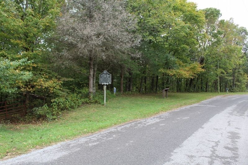
Location. 37° 14.272′ N, 85° 21.227′ W. Marker is near Campbellsville, Kentucky, in Taylor County. Marker is on Tebbs Bend Road, half a mile west of Harley Road, on the left when traveling west. Touch for map. Marker is in this post office area: Campbellsville KY 42718, United States of America. Touch for directions.
Other nearby markers. At least 8 other markers are within walking distance of this marker. Battle of Green River Bridge (a few steps from this marker); Morgan's Demand for Surrender (approx. 0.2 miles away); Confederate Artillery Position (approx. 0.6 miles away); Independence Day - 1863 (approx. 0.7 miles away); Michigan at Tebbs Bend (approx. 0.7 miles away); "Nobly Did They Die" (approx. 0.7 miles away); Federal Stockade (approx. 0.7 miles away); Green River Bridge / Green River Bridge Skirmish Site (approx. 0.8 miles away). Touch for a list and map of all markers in Campbellsville.
Also see . . . Tebbs Bend-Green River Bridge Battlefield Association. (Submitted on October 31, 2016.)
Credits. This page was last revised on February 3, 2019. It was originally submitted on October 23, 2016, by Tom Bosse of Jefferson City, Tennessee. This page has been viewed 498 times since then and 24 times this year. Last updated on February 2, 2019, by Bradley Owen of Morgantown, West Virginia. Photos: 1, 2. submitted on October 23, 2016, by Tom Bosse of Jefferson City, Tennessee. • Andrew Ruppenstein was the editor who published this page.

