Almaden in San Jose in Santa Clara County, California — The American West (Pacific Coastal)
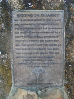
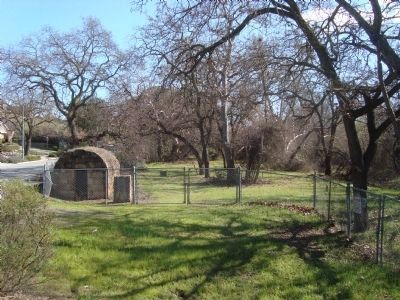
Goodrich Quarry
Erected 1978 by E Clampus Vitus, Mountain Charlie Chapter No. 1850.
Topics and series. This historical marker is listed in these topic lists: Industry & Commerce • Natural Resources. In addition, it is included in the E Clampus Vitus series list. A significant historical year for this entry is 1875.
Location. 37° 13.358′ N, 121° 51.029′ W. Marker is in San Jose, California, in Santa Clara County. It is in Almaden. Marker is at the intersection of Greystone Lane and Pfeiffer Ranch Road, on the right when traveling east on Greystone Lane. Touch for map. Marker is at or near this postal address: 6632 Greystone Lane, San Jose CA 95120, United States of America. Touch for directions.
Other nearby markers. At least 8 other markers are within 3 miles of this marker, measured as the crow flies. El Senator Mine (approx. 2.3 miles away); El Senador Mine (approx. 2.3 miles away); The Buena Vista (approx. 2½ miles away); Santa Isabel Shaft (approx. 2.6 miles away); Almadén Vineyards (approx. 2.7 miles away); De Anza Expedition 1775 - 1776 (approx. 2.7 miles away); Day Tunnel (approx. 2.8 miles away); Chores Around the Ranch House (approx. 2.9 miles away). Touch for a list and map of all markers in San Jose.
Credits. This page was last revised on February 7, 2023. It was originally submitted on February 18, 2012, by Barry Swackhamer of Brentwood, California. This page has been viewed 959 times since then and 54 times this year. Last updated on February 5, 2019, by Craig Baker of Sylmar, California. Photos: 1, 2. submitted on February 18, 2012, by Barry Swackhamer of Brentwood, California. 3. submitted on February 5, 2019, by Craig Baker of Sylmar, California.


