Near Soda Springs in Nevada County, California — The American West (Pacific Coastal)
Summit Valley Native American Mortars
Hwy 40 Scenic Bypass
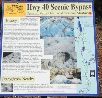
For thousands of years Native Americans from what is now Nevada called Summit Valley their summer home. They came to hunt, fish, gather food, and trade with Native Americans from what is now California. We can see evidence of their presence in dozens of bedrock mortar sites around the edges of the meadow and some in the interior.
Sierra granite is one of the hardest rocks on earth. As you discover the sites and explore the mortars, imagine the time it must have taken, only grinding during the summers, to develop the mortars in the rock. Over the centuries groups of women and girls passed on one generation's wisdom to another in the same places, summer after summer, century after century. In some places there are many mortars in groups and one can imagine busy communal kitchens with many women grinding seeds. In other places there are only single mortars. Why? Were they different clans? Were the single grinding rock outcasts?
Nearby are thousands of basalt stone chips (two lower pictures to the right) which are not native to the immediate area. We can imagine men and boys knapping rocks into useful tools, atlatl and spear points. The chips are leftovers. The basalt was carried from miles away, possibly from Devil's Peak. At the knapping sites lessons too were imparted and learned summer after summer, generation after generation, and the basalt flakes grew in number. Now they litter areas of open ground.
There are also metates (large grinding surfaces - see the bottom picture with the mano used for grinding on top), cupolas (small depressions with perhaps mystical significance - see left), and a few petroglyphs.
The Martis culture (2000 B.C. or earlier to 600 A.D.) lived all around the valley for thousands of years grinding seeds and hunting. The King Beach culture (A.D. 1000-1850) was a fishing culture and occupied only a small portion of the valley much later.
Two sites to find: mortar on top of single rock - 39º 19.285N, 120º 22.320W 150 yards south from here. Low rock with five mortars and a metate 656 yards from here SE at 39º 19.148N, 120º 22.342W (feel the east end of the rock for the rectangular metate).
Petroglyphs Nearby
To see Native American petroglyphs, head east on Old 40 to the turn just below Rainbow Bridge. You will see a 20 Mile Museum sign for the petroglyphs and be able to explore that facet of Native American presence on Donner Summit.
Erected by Donner Summit Historical Society.
Topics and series. This historical marker is listed in these topic lists: Anthropology & Archaeology • Native Americans. In addition, it is included in the Donner Summit Historical Society series list.
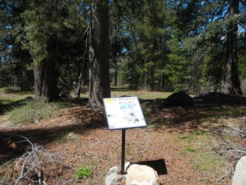
Location. 39° 19.339′ N, 120° 22.258′ W. Marker is near Soda Springs, California, in Nevada County. Marker is on Lake Van Norden Road near Soda Springs Road, on the right when traveling east. Touch for map. Marker is in this post office area: Soda Springs CA 95728, United States of America. Touch for directions.
Other nearby markers. At least 8 other markers are within one mile of this marker, measured as the crow flies. Central Sierra Snow Lab (about 800 feet away, measured in a direct line); Lake Van Norden Dam (approx. 0.3 miles away); Soda Springs Hotel (approx. half a mile away); Dutch Flat Donner Lake Wagon Road (approx. 0.7 miles away); Soda Springs Store (approx. 0.7 miles away); Truckee Trail - Leaving Summit Valley (approx. 0.8 miles away); Emigrant Wagon Route (approx. 0.9 miles away); Donner Summit Lodge (approx. one mile away). Touch for a list and map of all markers in Soda Springs.
More about this marker. Lake Van Norden Road; this dirt, gravel muddy road was once part of the Lincoln Highway. This contributor walked around the area suggested by the marker, but without a GPS could not find any mortars.
Credits. This page was last revised on February 7, 2019. It was originally submitted on February 5, 2019, by Barry Swackhamer of Brentwood, California. This page has been viewed 374 times since then and 38 times this year. Photos: 1, 2, 3. submitted on February 5, 2019, by Barry Swackhamer of Brentwood, California.


