Wewahitchka in Gulf County, Florida — The American South (South Atlantic)
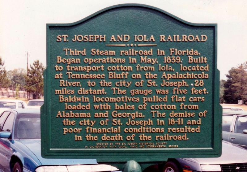
St. Joseph and Iola Railroad
Erected by The St. Joseph Historical Society in cooperation with local civic and governmental groups.
Topics. This historical marker is listed in this topic list: Railroads & Streetcars. A significant historical month for this entry is May 1839.
Location. Marker has been reported missing. It was located near 30° 6.3′ N, 85° 11.445′ W. Marker was in Wewahitchka, Florida, in Gulf County. Marker was on East River Road just east of Seasome Street, on the right when traveling east. Marker was located on the grounds of Wewahitchka High School. Touch for map. Marker was at or near this postal address: 933 East River Road, Wewahitchka FL 32465, United States of America. Touch for directions.
Other nearby markers. At least 7 other markers are within 18 miles of this location, measured as the crow flies. Wewahitchka Centennial (approx. 0.9 miles away); Gulf County Old Courthouse (approx. 0.9 miles away); Steamship Tragedy (approx. 15.8 miles away); British Fort Magazine (approx. 15.8 miles away); "Milly Francis" (approx. 15.8 miles away); Fort Gadsden (approx. 15.8 miles away); Fort Crèvecoeur (approx. 17.3 miles away).
Credits. This page was last revised on February 8, 2019. It was originally submitted on February 7, 2019, by Tim Fillmon of Webster, Florida. This page has been viewed 304 times since then and 31 times this year. Photo 1. submitted on February 7, 2019, by Tim Fillmon of Webster, Florida. • Bernard Fisher was the editor who published this page.
