Ellison Bay in Door County, Wisconsin — The American Midwest (Great Lakes)
Niagara Escarpment
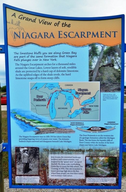
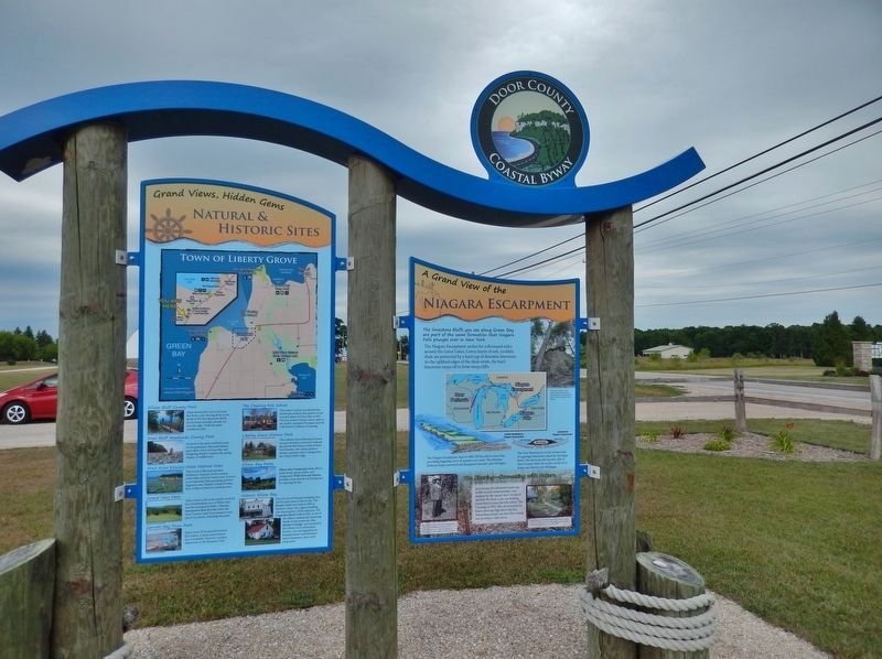
The limestone bluffs you see along Green Bay are part of the same formation that Niagara Falls plunges over in New York.
The Niagara Escarpment arches for a thousand miles around the Great Lakes. Lower layers of soft, erodible shale are protected by a hard cap of dolomite limestone. As the uplifted edges of the shale erode, the hard limestone snaps off to form steep cliffs.
Cedars as old as 1,200 years cling to the bluffs of the escarpment. Rare plants grow in the crumbled rocks below.
The Niagara Escarpment rises in cliffs 250 feet above Green Bay providing lingering views of sunsets over water. The dolomite bedrock slopes eastward and disappears beneath Lake Michigan.
The Door Peninsula is on the western rim of a geologic formation called the Michigan Basin. The rim forms the bayside cliffs of Door County while the incline of the bowl slopes east below Lake Michigan.
The Clearing – Connecting with Nature
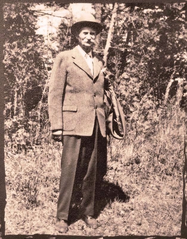
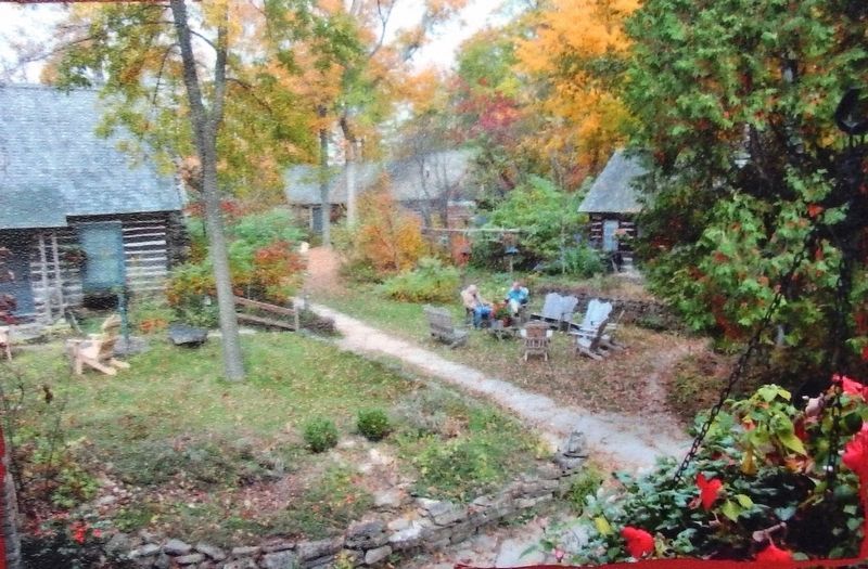
Jens Jensen, the renowned landscape architect and conservationist, was inspired by the "grand view" on top of this hill. He chose a site overlooking Green Bay to create his folk school, The Clearing, in 1935. This site is nestled in forest openings high above the Bay, where busy people can clear their minds and reconnect with nature.
Natural & Historic Sites
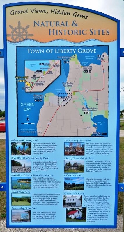
• Ellison Bluff County Park - Enjoy spectacular views of Green Bay from a safe viewing deck on the brink of 100-foot limestone bluffs. An enclosed catwalk extends out over the edge. Walk the quiet woodland trails.
• Door Bluff Headlands County Park - Located at the most northerly point on the peninsula, this undeveloped park offers views of Green Bay and Hedgehog Harbor. Explore the spring display of wildflowers.
• Mink River Estuary State Natural Area - This is one of the most pristine freshwater estuaries in the country, where lake and river waters mix. It serves as an important fish spawning and bird migration area. Paddle in from Rowleys Bay, or hike in from two parking areas.
• Grand View Park - Take a short walk to the nearby overlook for a breathtaking view of Ellison Bay and the escarpment bluffs. A byway interpretive hub describes how the Door County Land Trust preserves rare places for nature, including this park.
• Garrett Bay Town Park - Enjoy views of the peaceful Garrett Bay waters. A quiet sports launch area is available. Discover a sunken shipwreck on the Maritime Trail.
• The Clearing Folk School - This artist's retreat was founded by landscape architect Jens Jensen on the wooded shores of Green Bay in 1935. The Jens Jensen Visitor Center,
open to the public, interprets his legacy and the Folk School Tradition of learning.
• Liberty Grove Historic Park - This Liberty Grove Historical Society museum includes a restored Lutheran log church that houses artifacts from local families, two cherry picker's shacks, a granary, and a cottage from the Liberty Park Lodge.
• Ellison Bay Parks - Ellison Bay Community Park offers a sandy beach, picnic tables, and playground. Wills Park and Marina provides a boat launch and sitting area for enjoying the hay.
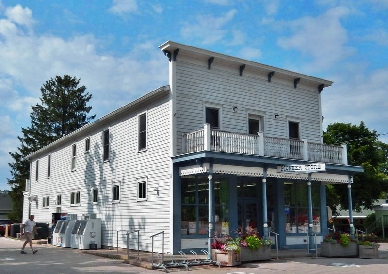
• Historic Ellison Bay - Discover several historic buildings that tell the early story of Ellison Bay. The Pioneer Store was built in 1900 as Ruckert’s Store; the original building was destroyed in a 2006 explosion. The Disgarden Hotel, built in 1902, is one of the oldest continuously operating hotels on the peninsula. Gus Klenke’s Garage was restored by the Liberty Grove Historical Society. Gus was legendary for helping farmers and fishermen repair equipment, often with scrap parts.
Erected by Door County Coastal Byway, Federal Highway Administration, and Wisconsin Department of Transportation.
Topics and series. This historical marker is listed in this topic list: Parks & Recreational Areas. In addition, it is included in the Jens Jensen series list.
Location.
45° 14.742′ N, 87° 5.157′ W. Marker is in Ellison Bay, Wisconsin, in Door County. Marker is on Sunnyside Lane (State Highway 42) 0.1 miles north of Porcupine Bay Road, on the left when traveling north. Marker is located on the west side of the highway, at the south entrance to Liberty Grove Historic Park and the Liberty Grove Historical Society complex. Touch for map. Marker is at or near this postal address: 11871 Wisconsin Highway 42, Ellison Bay WI 54210, United States of America. Touch for directions.
Other nearby markers. At least 8 other markers are within 5 miles of this marker, measured as the crow flies. Ellison Bay (here, next to this marker); The Clearing (approx. 1.3 miles away); Veterans Memorial (approx. 4.3 miles away); Nature of Sister Bay (approx. 4.3 miles away); Village of Sister Bay (approx. 4.3 miles away); a different marker also named Village of Sister Bay (approx. 4.3 miles away); The Hotz Estate (approx. 4.4 miles away); The Fishtug Skipper (approx. 4.4 miles away). Touch for a list and map of all markers in Ellison Bay.
More about this marker. This marker consists of two large, rectangular, composite plaques, mounted at eye-level, on the south-facing side of a heavy duty wooden-frame kiosk.
Related markers. Click here for a list of markers that are related to this marker. Door County Coastal Byway
Photographed By Cosmos Mariner, July 20, 2018
6. Pioneer Store, Ellison Bay, Wisconsin
On July 10, 2006, an explosion leveled the 136-year-old Pioneer Store, killed two vacationers and injured 13 others. The blast also burned down one cottage and damaged another. It is believed a propane gas leak caused the explosion. Less than a year later, the Pioneer Store was rebuilt to its original appearance.
Credits. This page was last revised on March 4, 2019. It was originally submitted on March 2, 2019, by Cosmos Mariner of Cape Canaveral, Florida. This page has been viewed 350 times since then and 19 times this year. Photos: 1, 2, 3, 4, 5, 6. submitted on March 2, 2019, by Cosmos Mariner of Cape Canaveral, Florida. • Bill Pfingsten was the editor who published this page.
