Logan Circle in Northwest Washington in Washington, District of Columbia — The American Northeast (Mid-Atlantic)
"Contraband" to Community
A Fitting Tribute
— Logan Circle Heritage Trail —
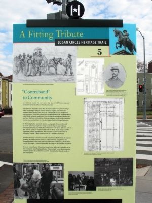
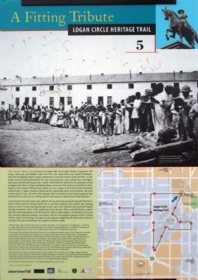
The Entire Block to Your Left was once a Civil War-era camp and hospital for formerly enslaved African Americans
After the Civil War broke out in 1861, thousands walked away from bondage. When some sought shelter at Fortress Monroe, Virginia, Union General Benjamin Butler allowed them to stay as “contrabands of war” or captured enemy property. Soon men, women, and children poured into Washington and other Union territories seeking new lives. In 1862, as housing near the Capitol and Navy Yard was overwhelmed, the Army relocated the formerly enslaved to wooden barracks built here for Captain Charles Bakers' Chicago Dragoons.
In 1862 Camp Barker reportedly housed 4,000 people. Overcrowding led to deadly epidemics, despite the camp's health facility. Contraband (later Freedmen's Hospital), was led by Major Alexander T. Augusta, M.D. the nation's first African American commissioned medical officer. Many refugees left for Freedmen's Village. Others remained here, in a growing community.
President Abraham Lincoln occasionally visited Camp Barker from his summer retreat at the Soldiers' Home, about 2.5 miles northeast. Mary Dines, who escaped bondage in Maryland and lived at the camp cooked for Lincoln at his retreat. She sang in a concert organize at the camp for the president and guests.
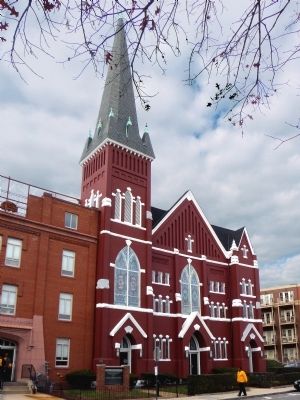
Vermont Avenue Baptist Church, just ahead to the right, was founded to serve the community seeded by Camp Barker. The politically active church attracted eminent speakers. In 1956 the Reverend Dr. Martin Luther King, Jr., spoke to the congregation.
Erected 2012 by Cultural Heritage, DC. (Marker Number 5.)
Topics and series. This historical marker is listed in these topic lists: African Americans • War, US Civil. In addition, it is included in the Logan Circle Heritage Trail series list. A significant historical year for this entry is 1861.
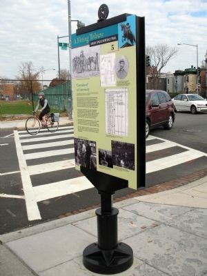
Location. 38° 54.754′ N, 77° 1.688′ W. Marker is in Northwest Washington in Washington, District of Columbia. It is in Logan Circle. Marker is at the intersection of R Street Northwest and Vermont Avenue Northwest, on the left when traveling west on R Street Northwest. Touch for map. Marker is at or near this postal address: 1210 R Street Northwest, Washington DC 20009, United States of America. Touch for directions.
Other nearby markers. At least 8 other markers are within walking distance of this marker. Vermont Avenue Baptist Church (within shouting distance of this marker); Like a Village (about 300 feet away, measured in a direct line); Logan Circle Cistern and BayScape (about 400 feet away); Zalmon Richards House (about 500 feet away); Alain Locke Residence (about 600 feet away); 10th Street Gateway (about 600 feet away); Washington Afro-American Newspaper Office Building (about 700 feet away); Benjamin Banneker Academic High School (about 700 feet away). Touch for a list and map of all markers in Northwest Washington.
Credits. This page was last revised on January 30, 2023. It was originally submitted on December 13, 2014, by Allen C. Browne of Silver Spring, Maryland. This page has been viewed 879 times since then and 26 times this year. Last updated on March 8, 2019, by Devry Becker Jones of Washington, District of Columbia. Photos: 1, 2, 3, 4, 5. submitted on December 13, 2014, by Allen C. Browne of Silver Spring, Maryland. • Bill Pfingsten was the editor who published this page.
