Mount Pleasant in Northwest Washington in Washington, District of Columbia — The American Northeast (Mid-Atlantic)
Defying the Restrictive Covenants
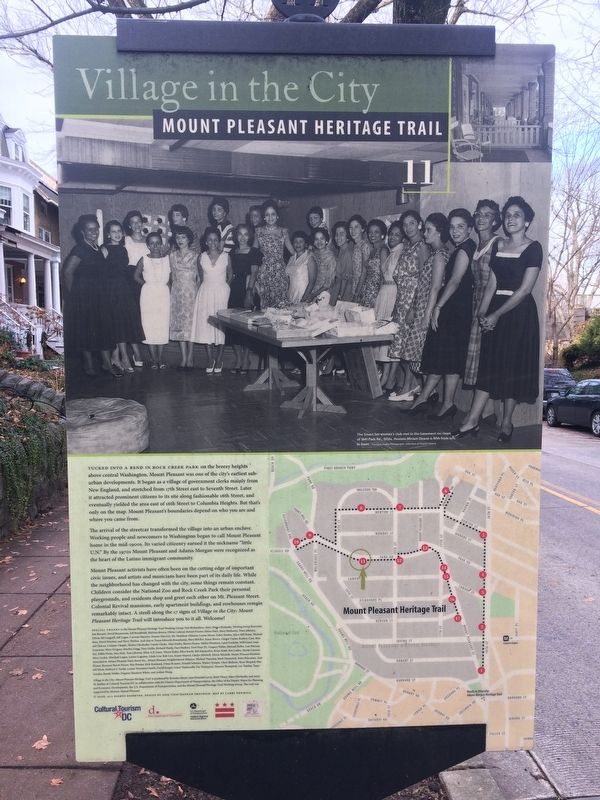
Village in the City
— Mount Pleasant Heritage Trail —

Photographed By Devry Becker Jones (CC0), December 24, 2017
1. Defying the Restrictive Covenants Marker
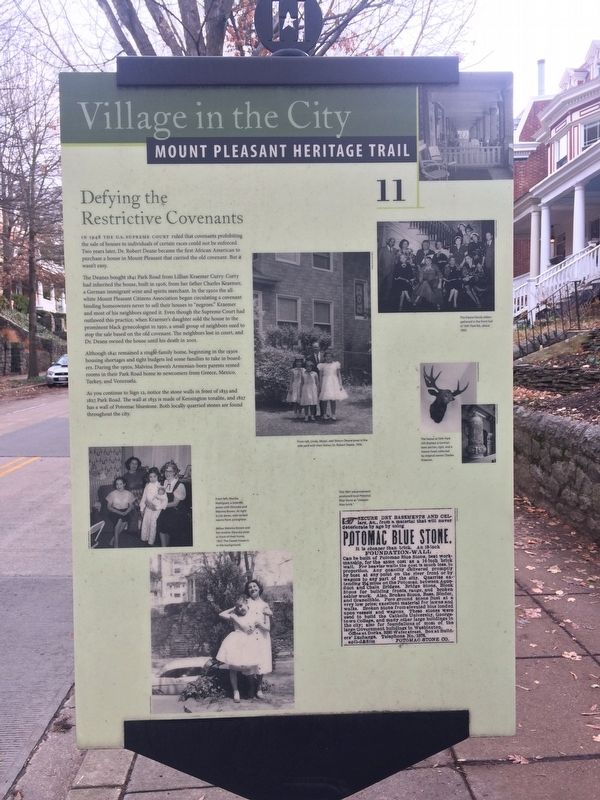
In 1948 the U.S. Supreme Court ruled that covenants prohibiting the sale of houses to individuals of certain races could not be enforced. Two years later, Dr. Robert Deane became the first African American to purchase a house in Mount Pleasant that carried the old covenant. But it wasn't easy.
The Deanes bought 1841 Park Road from Lillian Kraemer Curry. Curry had inherited the house, built in 1909, from her father Charles Kraemer, a German immigrant wine and spirits merchant. In the 1920s the all-white Mount Pleasant Citizens Associations began circulating a covenant binding homeowners never to sell their houses to "negroes." Kraemer and most of his neighbors signed it. Even though the Supreme Court had outlawed this practice, when Kraemer's daughter sold the hose to the prominent black gynecologist in 1950, a small group of neighbors sued to stop the sale based on the old covenant. The neighbors lost in court, and Dr. Deane owned the house until his death in 2001.
Although 1841 remained a single-family home, beginning in the 1930s housing shortages and tight budgets led some families to take in boarders. During the 1950s, Malvina Brown's Armenian-born parents rented rooms in their Park Road home to newcomers from Greece, Mexico, Turkey, and Venezuela.
As you continue to Sign 12, notice the stone walls in front of 1833 and 1827 Park Road. The wall at 1833 is made of Kensington tonalite, and 1827 has a wall of Potomac bluestone. Both locally quarried stones are found throughout the city.
Erected 2006 by Cultural Tourism DC. (Marker Number 11.)
Topics and series. This historical marker is listed in these topic lists: African Americans • Architecture • Civil Rights. In addition, it is included in the Mount Pleasant Heritage Trail series list. A significant historical year for this entry is 1948.
Location. 38° 55.934′ N, 77° 2.568′ W. Marker is in Northwest Washington in Washington, District of Columbia. It is in Mount Pleasant. Marker is on Park Road Northwest just east of 19th Street Northwest, on the right when traveling east. Touch for map. Marker is at or near this postal address: 1830 Park Road Northwest, Washington DC 20010, United States of America. Touch for directions.
Other nearby markers. At least 8 other markers are within walking distance of this marker. Changing Fashions (about 500 feet away, measured in a direct line); The Oldest House (about 700 feet away); Nacotchtank Family at the Piney Branch Quarry, ca. 1600 (approx. 0.2 miles away); Twenty-seven Little Flags (approx. 0.2 miles away); War and Peace (approx. 0.2 miles away); Harvest at Pleasant Plains (approx. 0.2 miles away); Czech Row

Photographed By Devry Becker Jones (CC0), December 24, 2017
2. Defying the Restrictive Covenants Marker

Photographed By Devry Becker Jones (CC0), December 24, 2017
3. Defying the Restrictive Covenants Marker
Credits. This page was last revised on January 30, 2023. It was originally submitted on December 24, 2017, by Devry Becker Jones of Washington, District of Columbia. This page has been viewed 248 times since then and 12 times this year. Last updated on March 8, 2019, by Devry Becker Jones of Washington, District of Columbia. Photos: 1, 2, 3. submitted on December 24, 2017, by Devry Becker Jones of Washington, District of Columbia. • Bill Pfingsten was the editor who published this page.