Livermore in Alameda County, California — The American West (Pacific Coastal)
Joaquin Murrieta and Murrieta's Well
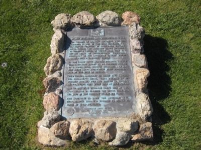
The legend of Joaquin Murrieta is one of the most enduring and fascinating of chapters in California history. Facts, fiction and romantic tales entangle to create a legend of unique aura that had become part of California's folklore, especially in the Livermore Valley where Joaquin was a frequent visitor.
In the early 1850's Joaquin Murrieta roamed this land. Most famous as an avenging outlaw or a Robin Hood, Joaquin Murrieta and his men were above everything else horsemen, and of the best of breeds.
Wild horses, abundant in those days around the Sacramento Delta, were rounded up by Joaquin and his men and driven to Sonora, Mexico, where they were sold at high prices.
One of Joaquin's favorite camps was at this spot because he claimed the water here was the best in the country where he rode.
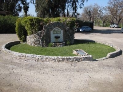
This fountain is over the artesian well that Joaquin Murrieta favored to water his herds of wild mustangs.
Dedicated April 16, 1994
Joaquin Murrieta Chapter 13
E Clampus Vitus
Erected 1994 by Joaquin Murrieta Chapter 13 of E Clampus Vitus.
Topics and series. This historical marker is listed in these topic lists: Hispanic Americans • Notable Places. In addition, it is included in the E Clampus Vitus series list. A significant historical date for this entry is July 25, 1853.
Location. 37° 39.56′ N, 121° 44.065′ W. Marker is in Livermore, California, in Alameda County. Marker can be reached from Mines Road. Touch for map. Marker is at or near this postal address: 3005 Mines Road, Livermore CA 94550, United States of America. Touch for directions.
Other nearby markers. At least 8 other markers are within 2 miles of this marker, measured as the crow flies. Concannon Vineyard (approx. 0.6 miles away); Wente Bros. Winery (approx. 0.6 miles away); This Cherry Tree is a Gift (approx. 1˝ miles away); Livermore Rodeo (approx. 1.7 miles away); William M. Mendenhall 1823 – 1911 / De Anza Expedition Campsite (approx. 1.7 miles away); J.S. van Buskirk / John Luders House (approx. 1.9 miles away); Ravenswood Historic Site Vineyards (approx. 2 miles away); From China to America (approx. 2 miles away). Touch for a list and map of all markers in Livermore.
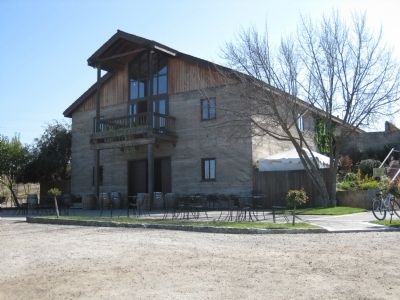
More about this marker. The marker is located on the grounds of Murrieta's Well Winery on Mines Road in Livermore. To find the marker, simply turn at the winery sign and follow the driveway to the parking lot. The marker is located in the parking lot, in front of the fountain.
Also see . . . Joaquin Murrieta: Literary Fiction or Historical Fact?. Contra Costa County Historical Society website entry (Submitted on April 14, 2009.)
Additional keywords. Outlaws
Photographed By Andrew Ruppenstein, April 5, 2009
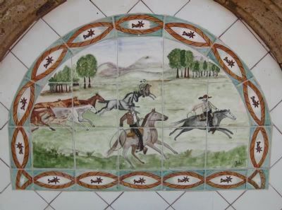
3. Murrieta's Well - Detail
Directly above the well's spigot are handpainted tiles of Joaquin and his men driving a herd of wild mustangs.
Although driving mustangs to Sonora may have been one way for Murrieta to earn a living, he is better known for having terrorized California until his death in 1853, having committed a large number of robberies and cold-blooded murders. But myths have both their attractions and uses, and so after his death Murrieta was transformed from a bloodthirsty bandit into a Robin Hood.
Although driving mustangs to Sonora may have been one way for Murrieta to earn a living, he is better known for having terrorized California until his death in 1853, having committed a large number of robberies and cold-blooded murders. But myths have both their attractions and uses, and so after his death Murrieta was transformed from a bloodthirsty bandit into a Robin Hood.
Photographed By Andrew Ruppenstein, April 5, 2009
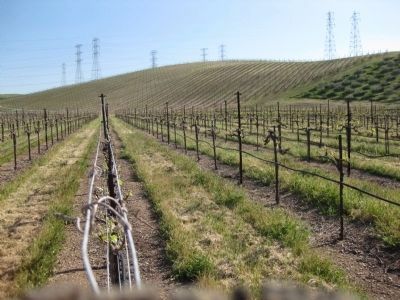
4. Murrieta's Well Winery Vineyards
Surrounding the winery are, naturally, vineyards. The Livermore Valley is one of, if not the, oldest winegrowing regions in California to commercially produce wine. The vineyards surrounding the winery were originally planted by Louis Mel in 1884, when he planted imported cuttings of Sauvignon Blanc, Semillon, and Red Bordeaux grapes.
Credits. This page was last revised on December 12, 2022. It was originally submitted on April 14, 2009, by Andrew Ruppenstein of Lamorinda, California. This page has been viewed 8,089 times since then and 158 times this year. Last updated on March 9, 2019, by Larry Mathewson of Hayward, California. Photos: 1, 2, 3, 4, 5. submitted on April 14, 2009, by Andrew Ruppenstein of Lamorinda, California. • Bill Pfingsten was the editor who published this page.
