Grand Detour in Ogle County, Illinois — The American Midwest (Great Lakes)
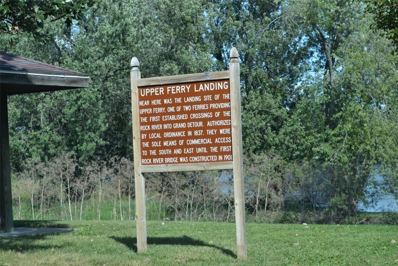
Upper Ferry Landing
Topics. This historical marker is listed in this topic list: Waterways & Vessels. A significant historical year for this entry is 1837.
Location. 41° 53.754′ N, 89° 24.753′ W. Marker is in Grand Detour, Illinois, in Ogle County. Marker can be reached from Illinois Route 2. Can be viewed from parking lot near the river. Touch for map. Marker is in this post office area: Dixon IL 61021, United States of America. Touch for directions.
Other nearby markers. At least 8 other markers are within 5 miles of this marker, measured as the crow flies. Grand Detour, Illinois (within shouting distance of this marker); The Grand Detour Plow Factory (within shouting distance of this marker); Erected to the memory of Leonard Andrus founder of the village of Grand Detour Illinois 1835 (within shouting distance of this marker); John Deere Home and Shop (approx. 0.2 miles away); La Sallier's Cabin (approx. 0.9 miles away); Site of the First Cabin Built for Hon. Joseph Crawford (approx. one mile away); Christopher Brookner House (approx. 4.8 miles away); Lincoln in the Black Hawk War (approx. 5 miles away). Touch for a list and map of all markers in Grand Detour.
Credits. This page was last revised on March 22, 2019. It was originally submitted on March 22, 2019. This page has been viewed 407 times since then and 36 times this year. Photos: 1, 2. submitted on March 22, 2019. • Andrew Ruppenstein was the editor who published this page.

