Near Ridge Farm in Vermilion County, Illinois — The American Midwest (Great Lakes)
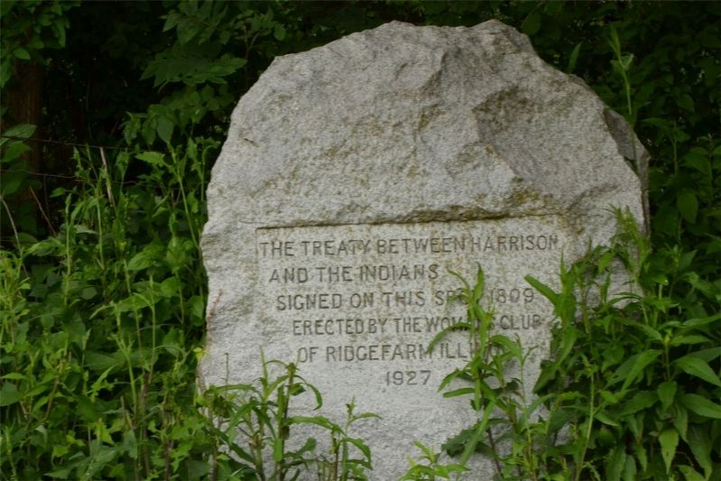
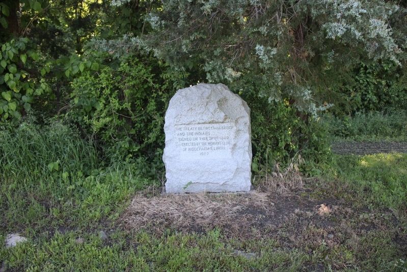
The Treaty Between Harrison and the Indians
Erected 1927 by Woman's Club of Ridgefarm Illinois.
Topics and series. This historical marker is listed in these topic lists: Native Americans • Peace • Settlements & Settlers • Wars, US Indian. In addition, it is included in the Former U.S. Presidents: #09 William Henry Harrison series list. A significant historical year for this entry is 1809.
Location. 39° 53.433′ N, 87° 36.808′ W. Marker is near Ridge Farm, Illinois, in Vermilion County. Marker is on County Road 1720 E, 0.4 miles south of County Highway 16, on the left when traveling south. Touch for map. Marker is in this post office area: Ridge Farm IL 61870, United States of America. Touch for directions.
Other nearby markers. At least 8 other markers are within 8 miles of this marker, measured as the crow flies. Dedicated to All Veterans (approx. 1.9 miles away); Abraham Lincoln - Eighth Judicial District (approx. 2.3 miles away); Pontiac Peace Treaty (approx. 4.4 miles away); Georgetown Parade of Patriots Monument (approx. 6 miles away); Georgetown Area Honor Roll (approx. 6 miles away); 73rd and 125th Illinois Volunteer Infantry (approx. 6.2 miles away); Veterans Honor Roll (approx. 7.2 miles away); Thy Wonderous Story, Illinois (approx. 7.3 miles away). Touch for a list and map of all markers in Ridge Farm.
More about this marker. Marker may be obscured by vegetation.
Regarding The Treaty Between Harrison and the Indians. This grove of trees, Pilot Grove, was used as a reference point to calculate the amount of territory to be ceded by the Delawares, Kickapoos, Pottowatomies, Miamis, and Eel River Native Americans under the Treaty of Fort Wayne (1809).
This information can be found in the following books:
"History of Vermilion County, Illinois: a tale of its evolution, settlement, and progress for nearly a century," by Lottie E. Jones (1911), volume 1, page 51-52.
https://archive.org/details/historyofvermili01jone/page/n8
"100 Years on the Ridge," by the Ridge Farm Centennial Committee (1974), page 1-3.
https://archive.org/details/100yearsonridge00poto
Additional commentary.
1. Precise location of the treaty boundary
This marker is actually 0.6 miles southwest of the corner of the treaty boundary. Old township plat maps and modern digital maps from the Illinois State Geological Survey show the northwestern corner of "Harrison's Purchase" at approximately 39.8992N, 87.6123W (now farmland). The boundary lines extend to the southeast into Indiana and southwest into Illinois (following the path of County Road 1720 E). The border of Vermilion County follows these boundary lines for a short distance, giving it an unusual shape.
Sources:
Indian Treaty boundary lines from the Illinois Public Land Survey System. ISGS, 1984 (revised 2003).
Vermilion County, Illinois, 1867, compiled by A. Bowman. Elwood Township.
An Illustrated Historical Atlas Map, Vermilion County, Ill., published by W. R. Brink & Co. (1875). Elwood Township.
Based on aerial photography from 1940, it appears the precise corner of the treaty area may have had some sort of marker at this date.
— Submitted March 30, 2019.
Credits. This page was last revised on July 3, 2022. It was originally submitted on March 22, 2019. This page has been viewed 786 times since then and 57 times this year. Photos: 1. submitted on March 22, 2019. 2. submitted on June 13, 2022, by Trevor L Whited of Kokomo, Indiana. • Bill Pfingsten was the editor who published this page.

