Gardner in Johnson County, Kansas — The American Midwest (Upper Plains)
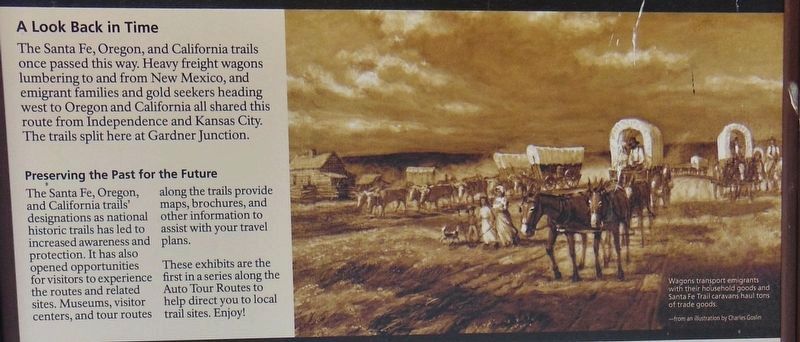
A Look Back in Time
The Santa Fe, Oregon, and California trails once passed this way
Inscription.
Heavy freight wagons lumbering to and from New Mexico, and emigrant families and gold seekers heading west to Oregon and California all shared this route from Independence and Kansas City. The trails split here at Gardner Junction.
Preserving the Past for the Future
The Santa Fe, Oregon, and California trails' designations as national historic trails has led to increased awareness and protection. It has also opened opportunities for visitors to experience the routes and related sites. Museums, visitor centers, and tour routes along the trails provide maps, brochures, and other information to assist with your travel plans. These exhibits are the first in a series along the Auto Tour Routes to help direct you to local trail sites. Enjoy!
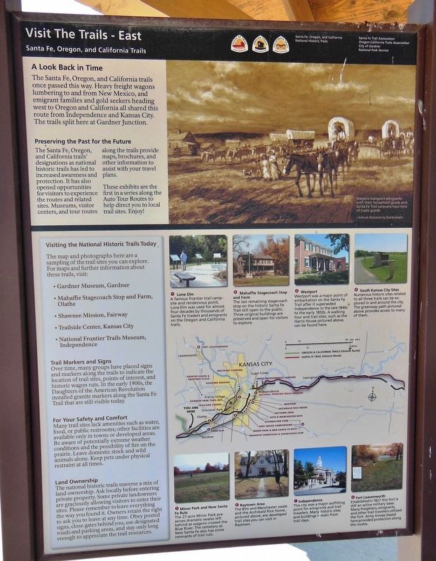
Visiting the National Historic Trails Today
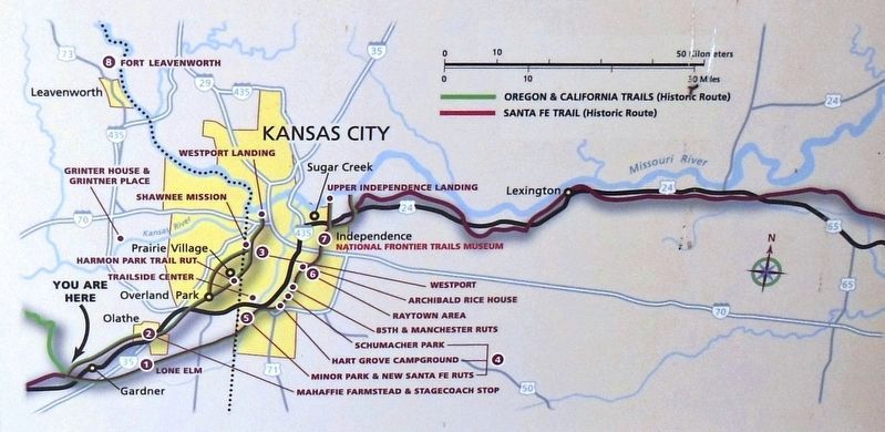
The map and photographs here are a sampling of the trail sites you can explore. For maps and further information about these trails, visit:
• Gardner Museum, Gardner
• Mahaffie Stagecoach Stop and Farm, Olathe
• Shawnee Mission, Fairway
• Trailside Center, Kansas City
• National Frontier Trails Museum, Independence
Trail Markers and Signs
Over time, many groups have placed signs and markers along the trails to indicate the location of trail sites, points of interest, and historic wagon ruts. In the early 1900s, the Daughters of the American Revolution installed granite markers along the Santa Fe Trail that are still visible today.
1. Lone Elm
A famous frontier trail camp-site and rendezvous point, Lone Elm was used for almost four decades by thousands of Santa Fe traders and emigrants on the Oregon and California trails.
2. Mahaffie Stagecoach Stop and Farm
The last remaining stagecoach stop on the historic Santa Fe Trail still open to the public. Three original buildings are preserved and open for visitors to explore.
3. Westport
Westport was a major point of embarkation on the Santa Fe Trail after it superseded Independence in the late 1840s to the early 1850s. A walking tour and trail sites, such as the Harris House pictured above, can be found here.
4. South Kansas City Sites
Numerous historic sites related to all three trails can be explored in and around the city. The greenway path pictured above provides access to many of them.
5. Minor Park and New Santa Fe Ruts
The 27-acre Minor Park preserves dramatic swales left behind as wagons crossed the Blue River. The cemetery at New Santa Fe also has some remnants of trail ruts.
6. Raytown Area
The 85th and Manchester swale and the Archibald Rice Home, pictured above, are developed trail sites you can visit in Raytown.
7. Independence
This city was a major outfitting point for emigrants and trail travelers. Many historic sites and buildings remain from trail days.
8. Fort Leavenworth
Established in 1827 this fort is still an active military base. Many freighters, emigrants, and other trail travelers utilized the fort. Army troops based here provided protection along the routes.
Erected by Santa Fe, Oregon and California National Historic Trails, City of Gardner and National Park Service.
Topics and series. This historical marker is listed in these topic lists: Roads & Vehicles • Settlements & Settlers. In addition, it is included in the California Trail, the Oregon Trail, and the Santa Fe Trail series lists. A significant historical year for this entry is 1827.
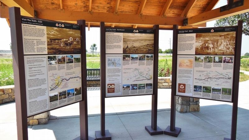
Location. 38° 47.786′ N, 94° 57.701′ W. Marker is in Gardner, Kansas, in Johnson County. Marker can be reached from the intersection of U.S. 56 and West 183rd Street, on the right when traveling west. This marker is the leftmost (east) panel of a three-panel marker kiosk near the parking lot at Gardner Junction Park. Touch for map. Marker is at or near this postal address: 32505 West 183rd Street, Gardner KS 66030, United States of America. Touch for directions.
Other nearby markers. At least 8 other markers are within 2 miles of this marker, measured as the crow flies. A different marker also named A Look Back in Time (here, next to this marker); a different marker also named A Look Back in Time (here, next to this marker); Eye of the Needle (within shouting distance of this marker); Following Their Dreams (within shouting distance of this marker); Apprehension and Conflict (within shouting distance of this marker); From Prairie Schooners to Locomotives (within shouting distance of this marker); Overland Trails (approx. 1.9 miles away); The Herman B. Foster Home (approx. 1.9 miles away). Touch for a list and map of all markers in Gardner.
Related markers. Click here for a list of markers that are related to this marker. Gardner Junction: Santa Fe, Oregon, and California Trails
Also see . . .
1. Santa Fe Trail Association. In 1821, the Santa Fe Trail became America's first great international commercial highway, and for nearly sixty years thereafter was one of the nation's great routes of adventure and western expansion. (Submitted on March 24, 2019, by Cosmos Mariner of Cape Canaveral, Florida.)
2. Oregon Trail (Wikipedia). The Oregon Trail was laid by
fur traders and traders from about 1811 to 1840, and was only passable on foot or by horseback. By 1836, when the first migrant wagon train was organized in Independence, Missouri, a wagon trail had been cleared to Fort Hall, Idaho. Wagon trails were cleared increasingly farther west, and eventually reached all the way to the Willamette Valley in Oregon. (Submitted on March 24, 2019, by Cosmos Mariner of Cape Canaveral, Florida.)
3. California Trail (Wikipedia). The California Trail was an emigrant trail of about 3,000 mi across the western half of the North American continent from Missouri River towns to what is now the state of California. After it was established, the first half of the California Trail followed the same corridor of networked river valley trails as the Oregon Trail and the Mormon Trail, namely the valleys of the Platte, North Platte and Sweetwater rivers to Wyoming. In the present states of Wyoming, Idaho, and Utah, the California and Oregon trails split into several different trails or cutoffs. (Submitted on March 24, 2019, by Cosmos Mariner of Cape Canaveral, Florida.)
Credits. This page was last revised on March 24, 2019. It was originally submitted on March 23, 2019, by Cosmos Mariner of Cape Canaveral, Florida. This page has been viewed 510 times since then and 62 times this year. Photos: 1, 2, 3, 4. submitted on March 24, 2019, by Cosmos Mariner of Cape Canaveral, Florida.


