Near Germantown in Montgomery County, Maryland — The American Northeast (Mid-Atlantic)
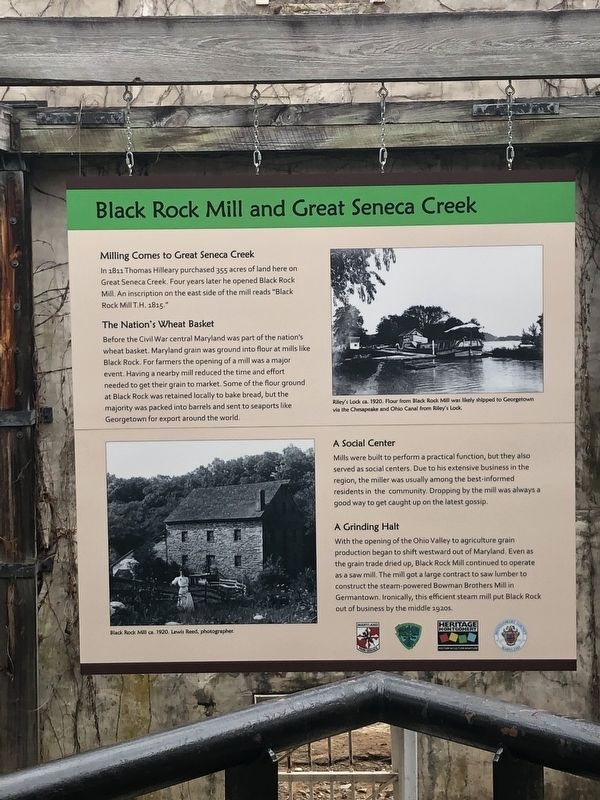
Black Rock Mill and Great Seneca Creek

Photographed By Devry Becker Jones (CC0), March 30, 2019
1. Black Rock Mill and Great Seneca Creek Marker
In 1811 Thomas Hilleary purchased 355 acres of land here on Great Seneca Creek. Four years later he opened Black Rock Mill. an inscription on the east side of the mill reads "Black Rock Mill T.H. 1815."
The Nation's Wheat Basket
Before the Civil War central Maryland was part of the nation's wheat basket. Maryland grain was ground into flour at mills like Black Rock. For farmers the opening of a mill was a major event. Having a nearby mill reduced the time and effort needed to get their grain to market. Some of the flour ground at Black Rock was retained locally to bake bread, but the majority was packed into barrels and sent to seaports like Georgetown for export around the world.
A Social Center
Mills were built to perform a practical function, but they also served as social centers. Due to his extensive business in the region, the miller was usually among the best-informed residents in the community. Dropping by the mill was always a good way to get caught up on the latest gossip.
A Grinding Halt
With the opening of the Ohio Valley to agriculture grain production began to shift westward out of Maryland. Even as the grain trade dried up, Black Rock Mill continued to operate as a saw mill. The mill got a large contract to saw lumber to construct the steam-powered Bowman Brothers Mill in Germantown. Ironically, this efficient steam mill put Black Rock out of business by the middle 1920s.
Erected by Maryland Park Service.
Topics. This historical marker is listed in these topic lists: Agriculture • Industry & Commerce • Waterways & Vessels. A significant historical year for this entry is 1811.
Location. 39° 7.614′ N, 77° 18.87′ W. Marker is near Germantown, Maryland, in Montgomery County. Marker can be reached from Black Rock Road north of Grey Pebble Way, on the left when traveling north. Touch for map. Marker is at or near this postal address: 16510 Black Rock Road, Germantown MD 20874, United States of America. Touch for directions.
Other nearby markers. At least 8 other markers are within 2 miles of this marker, measured as the crow flies. A Mixed Community (within shouting distance of this marker); How the Mill Worked (within shouting distance of this marker); White’s Ferry (approx. 1½ miles away); The Cliff Bland Recreation Area (approx. 1.7 miles away); Darnestown (approx. 1.8 miles away); The Signal Corps and Wartime Communications (approx. 2 miles away); The Civil War in Darnestown (approx. 2 miles away); Civil War Troops & Darnestown Residents (approx. 2.1 miles away). Touch for a list and map of all markers in Germantown.

Photographed By Devry Becker Jones (CC0), March 30, 2019
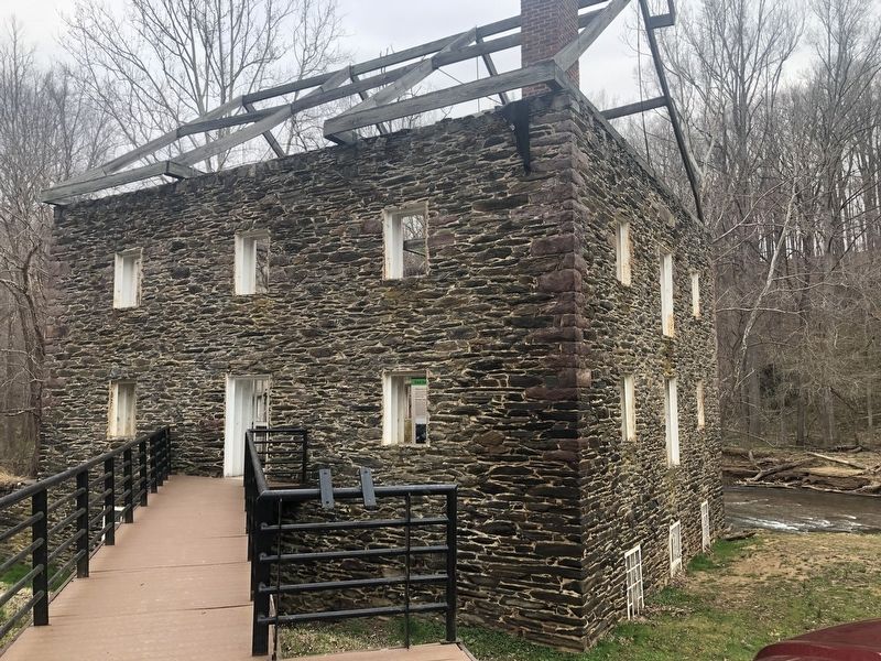
2. Black Rock Mill
The marker is inside the mill building, which has an open air roof.
Credits. This page was last revised on March 30, 2019. It was originally submitted on March 30, 2019, by Devry Becker Jones of Washington, District of Columbia. This page has been viewed 376 times since then and 30 times this year. Photos: 1, 2. submitted on March 30, 2019, by Devry Becker Jones of Washington, District of Columbia.