Dalton Wells
Civilian Conservation Corps
Camp DG-32 (Co. 234)
1935-1942
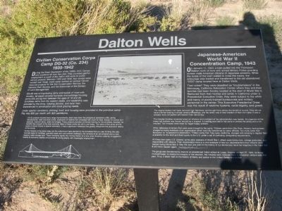
During the Great Depression of the 1930s, CCC Camps were scattered all over the USA. They provided gainful employment to youth of the nation with work on public service projects. Between 1933 and 1942, four camps were located near Moab. Each camp worked on various natural resource projects for the Soil Conservation Service, the National Park Service, and the forerunner of the Bureau of Land Management.
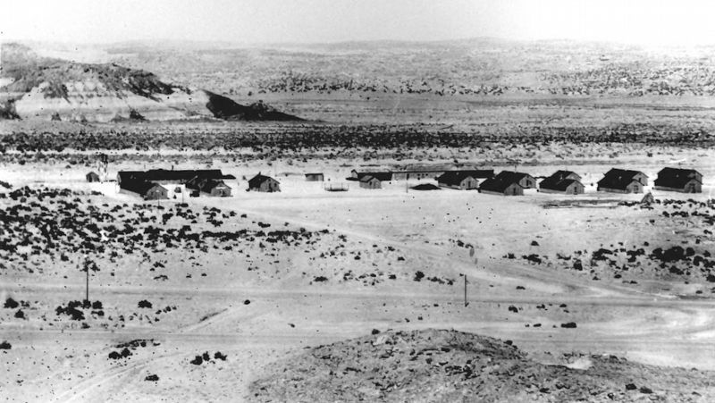
DG-32 was a long-lasting camp and typical of most with wooden, tar-paper covered barracks and building housing some 200 young men between the ages of 18 and 25. Enrollees came from the eastern states, and leadership was provided by the Army, Grazing Service, and local men experienced in construction and stock grazing needs.
Under spartan conditions, clothing, food, and housing were provided in the primitive camp. Pay was $30 per month with $25 sent home.
DG-32 projects included many range improvements: stock trails down the precipitous sandstone cliffs, spring developments, wells and stock ponds, eradication of rodents that competed with stock for feed, fences for corrals and pastures, reservoir dams, roads and bridges. These projects provided on-the-job training for the enrollees, besides the benefits they brought to the local economy.
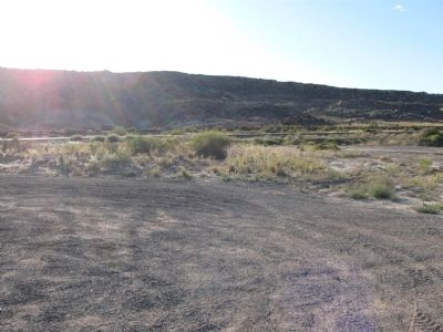
Many of these works are still in use today. The value of the camp and its works to Grand County is beyond estimation. It was a significant milestone that greatly influenced the economic history of the county.All that remains of the camp today are the cottonwood trees planted by the enrollees that you see fronting this site, concrete slabs for buildings, graveled roads and rock-outlined walkways, the remains of an old windmill and a rock masonry water storage tank. these remnants signify the moving history of a time when America valiantly struggled to restore its economic stability and provide its young people with meaningful employment.
Japanese-American
World War II
Concentration Camp, 1943
On January 11, 1943, a train pulled into the Thompson Station north of here with armed Military Police guarding sixteen male American citizens of Japanese ancestry. While the locals of the town waited to cross the tracks, the entourage was loaded and transferred to the old abandoned "CCC: camp located here at Dalton Wells.
Their crime? They were classified as "troublemakers" in the Manzanar, California Relocation Center where they and their families had been forcibly located at the start of World War II. Removed from their homes in California under a Presidential Executive Order, they were subject to the whim and mercy of poorly-trained bureaucrats
and military personnel in the center. The Executive Presidential Order was the result of wartime hysteria, racial bigotry, and greed.The original sixteen men were removed from Manzanar and brought here without the benefit of council. They did not have a formal hearing or proper arrest proceedings, and the action was in total violation of their civil rights. It was a process more compatible with fascism than democracy.
The inmates troubles worsened when an informer and confidant of the administration was beaten. An organizer of the mess hall workers was thrown into jail as a suspect. A meeting was held in the camp to protest the jailing and a riot resulted. Two inmates were killed by trigger-happy soldiers.
Other Japanese-American men were soon brought to the camp. Thirteen came from Gila River, Arizona, having been charged as being members of an organization which was fully sanctioned by camp officials. Ten more came from Manzanar as "suspected troublemakers." Fifteen came from Tule Lake, California, charged with refusing to register their availability for the draft and their loyalty fo the U.S. under a set of confusing, denigrating requirements.
All these men were U.S. citizens; some were veterans of World War I, others were family men, college graduates, and responsible U.S. citizens. Their incarceration here is a vivid example of how our Japanese-American
citizens were treated during World War II. May this sad, low point in the history of our democracy never be forgotten, in the hope that it will never happen again.
The group was transferred by truck to an abandoned Indian school at Leupp, Arizona, on April 27, 1943. As those involved began to realize the inequity of the situation, the inmates were released back to relocation centers later that year. Thus, a black mark in the history of liberty and justice in the United States was ended.
Topics and series. This historical marker is listed in these topic lists: Asian Americans • Charity & Public Work • Man-Made Features • War, World II. In addition, it is included in the Civilian Conservation Corps (CCC) series list. A significant historical month for this entry is January 1863.
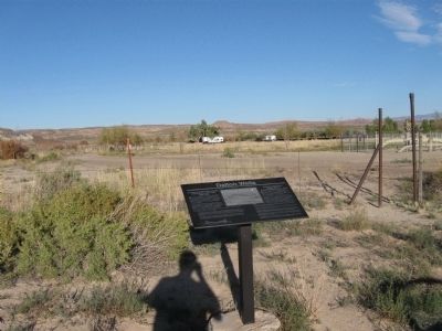
Location. 38° 42.693′ N, 109° 42.177′ W. Marker is in Moab, Utah, in Grand County. Marker can be reached from U.S. 191. Turn east on Dalton Wells Road to locate the marker. It's just off the highway. Touch for map. Marker is in this post office area: Moab UT 84532, United States of America. Touch for directions.
Other nearby markers. At least 8 other markers are within 9 miles of this marker, measured as the crow flies. Monitor and Merrimac (approx. 4.9 miles away); Navajo Sandstone (approx. 4.9 miles away); Ancient Sand Dunes (approx. 7 miles away); Balanced Rock (approx. 7˝ miles away); Utah Serviceberry
Credits. This page was last revised on April 14, 2019. It was originally submitted on September 25, 2011, by Jack Duffy of West Jordan, Utah. This page has been viewed 2,036 times since then and 76 times this year. Last updated on April 10, 2019, by Craig Baker of Sylmar, California. Photos: 1, 2, 3. submitted on September 25, 2011, by Jack Duffy of West Jordan, Utah. 4. submitted on April 12, 2019, by Craig Baker of Sylmar, California. • Andrew Ruppenstein was the editor who published this page.


