De Witt in Carroll County, Missouri — The American Midwest (Upper Plains)
Fort Orleans
(side 1)
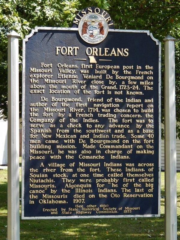
Fort Orleans, first European post in the Missouri Valley, was built by the French explorer Etienne Véniard De Bourgmond on the Missouri River close by, a few miles above the mouth of the Grand, 1723-24. The exact location of the fort is not known.
De Bourgmond, friend of the Indian and author of the first navigation report on the Missouri River, 1714, was chosen to build the fort by a French trading concern, The Company of the Indies. The fort was to serve as a check to any advance by the Spanish from the southwest and as a base for New Mexican and Indian trade. Some 40 men came with De Bourgmond on the fort building mission. Made Commandant on the Missouri, he was also in charge of making peace with the Comanche Indians.
A village of Missouri Indians was across the river from the fort. These Indians, of Souian stock, at one time called themselves Niutachis. They were probably first called Missouris, Algonquin for "he of the big canoe" by the Illinois Indians. The last of the Missouris died on the Oto Reservation in Oklahoma 1907.
(side 2)
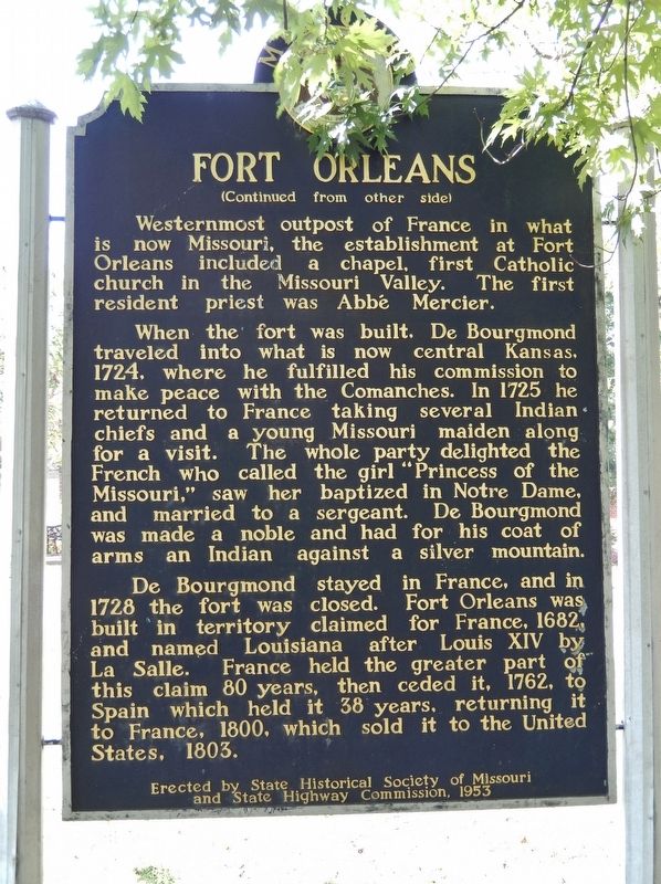
When the fort was built, De Bourgmond traveled into what is now central Kansas, 1724, where he fulfilled his commission to make peace with the Comanches. In 1725 he returned to France taking several Indian chiefs and a young Missouri maiden along for a visit. The whole party delighted the French who called the girl "Princess of the Missouri," saw her baptized in Notre Dame, and married to a sergeant. De Bourgmond was made a noble and had for his coat of arms an Indian against a silver mountain.
De Bourgmond stayed in France, and in 1728 the fort was closed. Fort Orleans was built in territory claimed for France, 1682, and named Louisiana after Louis XIV by La Salle. France held the greater part of this claim for 80 years, then ceded it, 1762, to Spain which held it 38 years, returning it to France, 1800, which sold it to the United States, 1803.
and State Highway Commission, 1953
Erected 1953 by State Historical Society of Missouri, and Missouri State Highway Commission.
Topics and series. This historical marker is listed in these topic lists: Colonial Era • Forts and Castles • Native Americans • Settlements & Settlers. In addition, it is included in the Missouri, The State Historical Society of series list. A significant historical year for this entry is 1723.
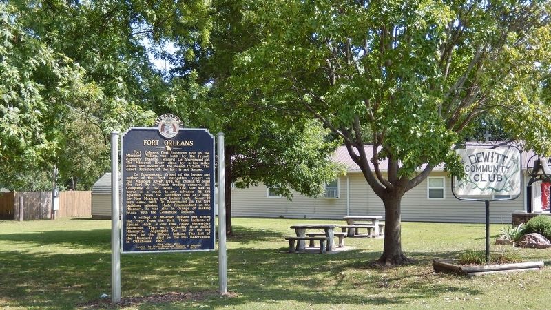
Location. 39° 23.075′ N, 93° 13.291′ W. Marker is in De Witt, Missouri, in Carroll County. Marker is at the intersection of Jefferson Street and 7th Street, on the right when traveling west on Jefferson Street. Marker is located in De Witt Community Park, near the southwest corner of the park. Touch for map. Marker is in this post office area: De Witt MO 64639, United States of America. Touch for directions.
Other nearby markers. At least 5 other markers are within 14 miles of this marker, measured as the crow flies. Trail of Death (a few steps from this marker); a different marker also named Fort Orleans (a few steps from this marker); a different marker also named Trail of Death (approx. 5.4 miles away); "World's Largest Pecan" (approx. 5½ miles away); Replica of The Statue of Liberty (approx. 14 miles away).
More about this marker. Marker was originally in a roadside park on US Highway 24, about 1.5 miles northeast of De Witt, but was moved to its current location in De Witt Community Park sometime before 2015.
Related markers.
Click here for a list of markers that are related to this marker. Fort Orleans, Missouri
Also see . . .
1. Fort Orleans, Missouri. Also called Fort D’Orleans, this was a French fort — the first built by any European country on the Missouri River and the first settlement in what is the State of Missouri today. (Submitted on April 11, 2019, by Cosmos Mariner of Cape Canaveral, Florida.)
2. Fort Orleans (Wikipedia). The fort was established in 1723 on the Missouri River by Étienne de Veniard, Sieur de Bourgmont. It was to be the Missouri River headquarters of the newly claimed La Louisiana territory. Like the newly founded New Orleans, Louisiana, it was named for the Duke of Orléans. The French abandoned Fort Orleans in 1726. One story says that when the garrison had been reduced to a contingent of eight soldiers, Native Americans attacked and burned it, killing all the troops. Another story says it was merely abandoned. Archeologists have not found evidence of the fort despite some promising starts, particularly south of the Missouri River. Lewis and Clark visited the area in June 1804 to seek the fort, but reported they found no trace of it. (Submitted on April 11, 2019, by Cosmos Mariner of Cape Canaveral, Florida.)
Credits. This page was last revised on April 11, 2019. It was originally submitted on April 10, 2019, by Cosmos Mariner of Cape Canaveral, Florida. This page has been viewed 787 times since then and 146 times this year. Photos: 1, 2, 3. submitted on April 10, 2019, by Cosmos Mariner of Cape Canaveral, Florida.


