Santa María del Río, San Luis Potosí, Mexico — The Northeast (and Central Highlands)
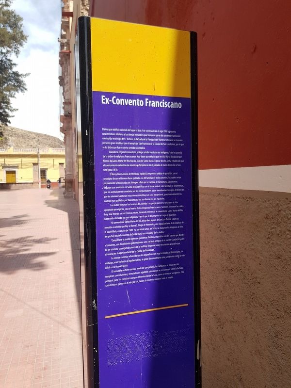
Former Franciscan Convent
El otro gran edificio colonial del lugar es éste. Fue construido en el siglo XVIII y presenta características similares a los demás inmuebles que formaron parte del convento Franciscano construido en el siglo XVII. Incluso, la fachada de la Parroquia de Nuestra Señora de la Asunción presenta gran similitud con el templo de San Francisco de la Ciudad de San Luis Potosí, por lo que se ha dicho que fue en cierto sentido una réplica.
Cuando se erigió el monasterio, el lugar estaba habitado por indigenas, bajo la custodia de la orden de religiosos Franciscanos. Hay datos que señalan que en 1592 fue la fundación por Alonso de Santa María del Río, hijo de Juan de Santa María. A pesar de ello, se ha establecido que el asentamiento definitivo de otomíes y chichimecas en el poblado de Santa María no se hizo sino hasta 1610.
El Virrey Don Antonio de Mendoza expidió la respectiva cédula de posesión, con el propósito de que el terreno fuese poblado con 40 familias de indios otomíes, los cuales serían previamente seleccionados de Jilotepec y Tula por el cacique de Santamaria. Los otomíes llegaron y se asentaron en Santa María del Río con el fin de reducir a las familias de chichimecas, que no aceptaban ser sometidas por los conquistadores y que merodeaban la región. El hecho de que los otomíes habitaran estas tierras constituye un caso excepcional, pues normalmente los núcleos eran poblados por tlaxcaltecas, por su alianza con los españoles.
Los indios tomaron los terrenos de acuerdo a su propio parecer y señalaron el sitio apropiado para iglesia, casa y huerta de los religiosos Franciscanos. También alinearon las calles. Fray José Arlegui en sus Crónicas relata, haciendo referencia al convento de Santa María del Río, haber sido atendido por seis religiosos, y en el que él desempeñó el cargo de guardián:
“El convento de Santa María del Río, dista doce leguas de San Luis Potosí, y tuvo su erección en el sitio que hoy se llama S. Diego de Atotonilco, dos leguas delante de la estancia de D. José Villela, en el año de 1589.Y a los veinte años, en 1610, se mudaron los religiosos al sitio en que hoy está el convento de Santa María en compañía de los indios.”
“Compónese el pueblo como de quinientas familias, repartidas en dos barrios que divide el convento, con dos distintos gobernadores, uno, y el más antiguo de la nación Guachichil y otro de los otomíes, cuyas jurisdicciones en lo político, llegan de una y otra nación a la calle que atraviesa por la iglesia delante de la Capilla de Guadalupe.”
La crónica continúa refiriendo que los lugareños eran muy inclinados al divino culto, sin embargo, eran violentos e ingobernables, al grado de considerarse esta jurisdicción como la más difícil en la Nueva España.
El inmueble no tiene torres a modo de campanario, las campanas se situán en dos templetes con columnas y rematados en tejadillos cónicos que se encuentran sobre la fachada principal, pero sin constituir cuerpos diferentes desde la base, como el resto de las iglesias. Esta característica, junto con el reloj de sol, hacen al convento único en todo el estada.
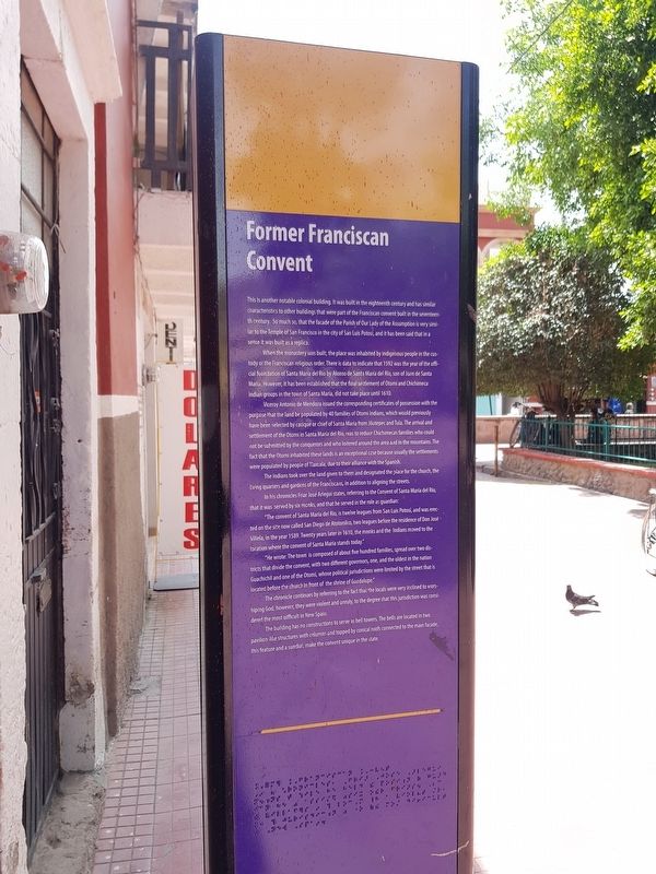
Former Franciscan Convent
This is another notable colonial building. It was built in the eighteenth century and has similar characteristics to other buildings that were part of the Franciscan convent built in the seventeenth century. So much so, that the facade of the Parish of Our Lady of the Assumption is very similar to the Temple of San Francisco in the city of San Luis Potosí, and it has been said that in a sense it was built as a replica.
When the monastery was built, the place was inhabited by indigenous people in the custody of the Franciscan religious order. There is data to indicate that 1592 was the year of the official foundation of Santa María del Río by Alonso de
Santa María del Río, son of Juan de Santa María. However, it has been established that the final settlement of Otomí and Chichimeca indian groups in the town of Santa María, did not take place until 1610.
Viceroy Antonio de Mendoza issued the corresponding certificates of possession with the purpose that the land be populated by 40 families of Otomi Indians, which would previously have been selected by cacique or chief of Santa María from Jilotepec and Tula. The arrival and settlement of the Otomi in Santa María del Río, was to reduce Chichimecas families who could not be submitted by the conquerors and who loitered around the area and in the mountains. The fact that the Otomi inhabited these lands is an exceptional case because usually the settlements were populated by people of Tlaxcala, due to their alliance with the Spanish.
The Indians took over the land given to them and designated the place for the church, the living quarters and gardens of the Franciscans, in addition to aligning the streets.
In his chronicles Friar José Arlegui states, referring to the Convent of Santa María del Río, that it was served by six monks, and that he served in the role as guardian:
“The convent of Santa María del Río, is twelve leagues from San Luis Potosí, and was erected on the site now called San Diego de Atotonilco, two leagues before the residence of Don José Villela, in the year 1589. Twenty years later in 1610, the monks and the Indians moved to the location where the convent of Santa María stands today.”
“He wrote: The town is composed of about five hundred families, spread over two districts that divide the convent, with two different governors, one, and the oldest in the nation Guachichil and one of the Otomi, whose political jurisdictions were limited by the street that is located before the church in front of the shrine of Guadalupe.”
The chronicle continues by referring to the fact that the locals were very inclined to worshiping God, however, they were violent and unruly, to the degree that this jurisdiction was considered the most difficult in New Spain.
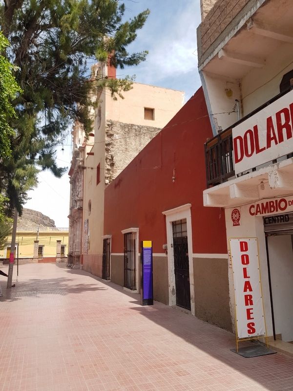
The building has no constructions to serve as bell towers. The bells are located in two pavilion-like structures with columns and topped by conical roofs connected to the main façade, this feature and a sundial, make the convent unique in the state.
Topics. This historical marker is listed in these topic lists: Churches & Religion • Colonial Era • Native Americans • Settlements & Settlers. A significant historical year for this entry is 1592.
Location. 21° 48′ N, 100° 44.167′ W. Marker is in Santa María del Río, San Luis Potosí. Touch for map. Touch for directions.
Other nearby markers. At least 8 other markers are within walking distance of this marker. Parish of Our Lady of the Assumption (within shouting distance of this marker); Hidalgo Garden (within shouting distance of this marker); a different marker also named Parish of Our Lady of the Assumption (within shouting distance of this marker); Martín Bautista Square (within shouting distance of this marker); Santísimo Chapel (within shouting distance of this marker); Building of the Convents of Santa María del Río (within shouting distance of this marker); Dividing Line Between Otomíes and Guachichiles (about 90 meters away, measured in a direct line); Primo Feliciano Velázquez Rodríguez (about 90 meters away). Touch for a list and map of all markers in Santa María del Río.
Credits. This page was last revised on April 14, 2019. It was originally submitted on April 14, 2019, by J. Makali Bruton of Accra, Ghana. This page has been viewed 99 times since then and 8 times this year. Photos: 1, 2, 3. submitted on April 14, 2019, by J. Makali Bruton of Accra, Ghana.


