Near Inverness in Citrus County, Florida — The American South (South Atlantic)
The Seminole in the Cove of the Withlacoochee
Seminole Heritage Trail
Inscription.
Seminole Migration
Story of Survival
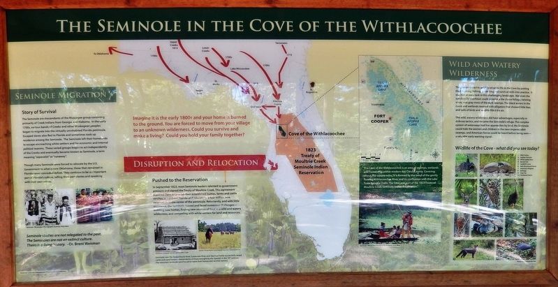
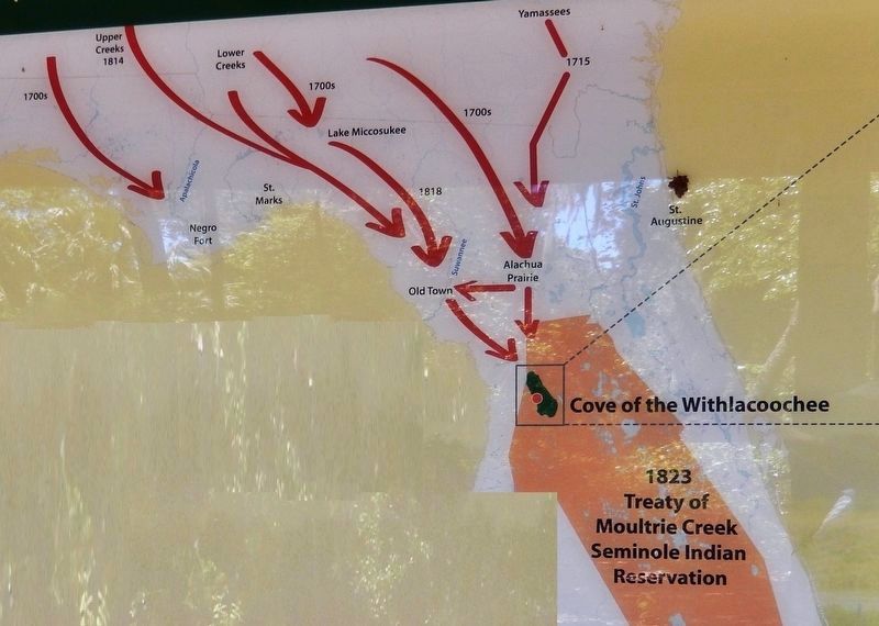
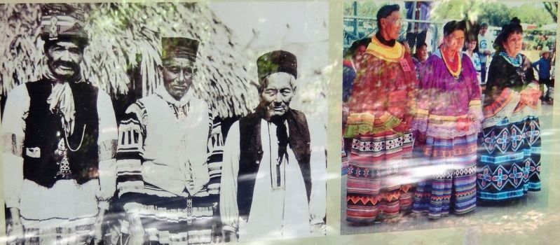
The Seminole are descendants of the Muscogee group consisting primarily of Creek Indians from Georgia and Alabama. In the early 1700s, various bands of Creeks and other Muskogean peoples began to migrate into the virtually uninhabited Florida peninsula. Escaped slaves also fled to Florida and sometimes took up residence among the Seminole. The Seminole left their homelands to escape encroaching white settlers and for economic and internal political reasons. These varied groups began to act independently of the Creeks and eventually became known as Seminole, a term meaning "separatist" or "runaway".
Though many Seminole were forced to relocate by the U.S. Government to what is now Oklahoma, those that remained in Florida never conceded defeat. They continue to be an important part of Florida's culture, telling their own stories and speaking with their own voices.
Imagine it is the early 1800s and your home is burned to the ground. You are forced to move from your village to an unknown wilderness. Could you survive and make a living? Could you hold your family together?
Disruption and Relocation
Pushed to the Reservation
In September 1823, most Seminole leaders relented to government pressure and signed the Treaty of Moultrie Creek. This agreement required them to give up their established homes, farms and cattle ranches in northern Florida and relocate to a four million acre reservation in the center of the peninsula. Reluctantly, and with little assistance, the Seminole moved and faced numerous challenges building new homes, finding new sources of food in a wild and watery wilderness, and competing with white settlers for land and resources.
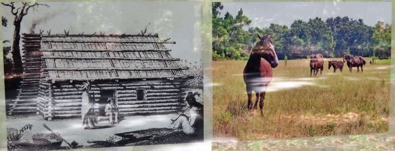
Seminole near the Apalachicola River, Suwannee River and Alachua Prairie successfully raised cattle and used horses — descendants of those brought by the Spanish in the 16th century. The relocated Seminole were forced to leave their homes and ranches behind.
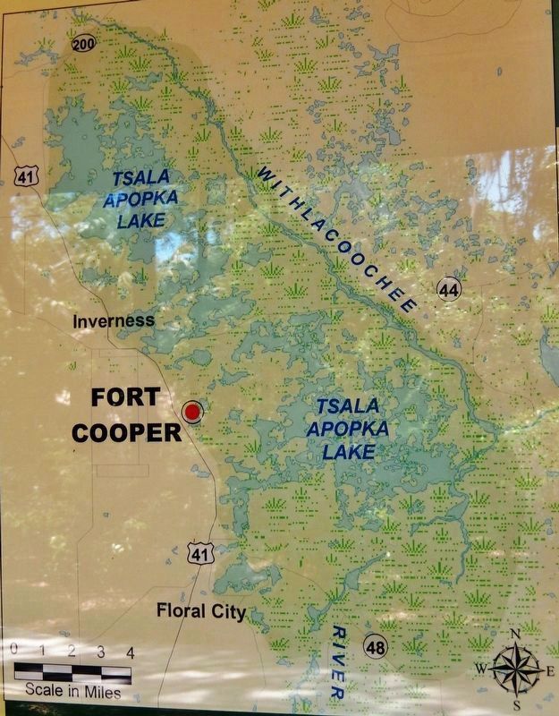
The Cove of the Withlacoochee is an area of swamps, wetlands and hammocks within modern day Citrus County. Covering about 100 square miles, it is formed by the bend of the gently flowing Withlacoochee River and its confluence with the Lake Tsala Apopka Chain. The Cove was part of the 1823 Treaty of Moultrie Creek Seminole Indian Reservation.
Wild and Watery Wilderness
The Seminole had to quickly adapt to life in the Cove by putting their hunting, fishing, gardening and survival skills into practice. It was not an easy task in this challenging landscape. Not even the sun directly overhead could penetrate the dense foliage, twisting vines, and gray moss of the dark swamps. The black waters in the rivers and wetlands teemed with alligators that showed little fear, and calls of birds and wildlife filled the air.
The wild, watery wilderness did have advantages, especially in defense tactics, and became the Seminole's refuge. The complex system of waterways had few approaches by land, the Seminole could hide the women and children in the near-impenetrable swamps, and American forces could be heard before being seen - a valuable early warning signal.
Wildlife of the Cove – what did you see today?
1) Wild Turkey
2) Gopher Tortoise
3) White-tailed Deer
4) Barred Owl
5) Sandhill Crane
6) Red-shouldered Hawk
7) American Alligator
8) Anhinga
9) Gray Fox
10) Tricolored Heron
Topics. This historical marker is listed in these topic lists: Colonial Era • Native Americans • Settlements & Settlers.
Location. 28° 48.523′ N, 82° 18.246′ W. Marker is near Inverness, Florida, in Citrus County. Marker can be reached from Old Floral City Road, 0.2 miles south of Carnegie Drive, on the right when traveling south. Marker is located within Fort Cooper State Park, along the Seminole Heritage Trail, about 6/10 mile inside the park and a short walk from the parking lot. Touch for map. Marker is at or
near this postal address: 3100 South Old Floral City Road, Inverness FL 34450, United States of America. Touch for directions.
Other nearby markers. At least 8 other markers are within walking distance of this marker. Florida's First People (here, next to this marker); Fort Cooper (about 300 feet away, measured in a direct line); Life Along the Withlacoochee (approx. 0.2 miles away); Old Military Road (approx. 0.4 miles away); War Comes to the Cove (approx. 0.4 miles away); Lonely Outpost in a Hostile Land (approx. 0.4 miles away); A Costly Florida War (approx. half a mile away); a different marker also named Fort Cooper (approx. 0.6 miles away). Touch for a list and map of all markers in Inverness.
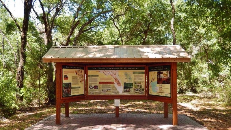
More about this marker. This marker is the center panel of a three-panel interpretive kiosk at this location.
Related markers. Click here for a list of markers that are related to this marker. Fort Cooper, The Seminole Heritage Trail, and the Second Seminole War
Also see . . . Treaty of Moultrie Creek (Wikipedia). (Submitted on April 18, 2019, by Cosmos Mariner of Cape Canaveral, Florida.)
Credits. This page was last revised on April 18, 2019. It was originally submitted on April 16, 2019, by Cosmos Mariner of Cape Canaveral, Florida. This page has been viewed 1,449 times since then and 227 times this year. Photos: 1, 2, 3, 4, 5, 6. submitted on April 17, 2019, by Cosmos Mariner of Cape Canaveral, Florida.
