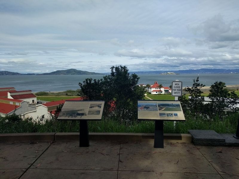
Presidio of San Francisco in San Francisco City and County, California — The American West (Pacific Coastal)
Aviation Firsts: Crissy Army Airfield
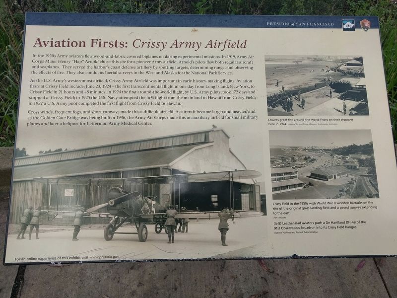
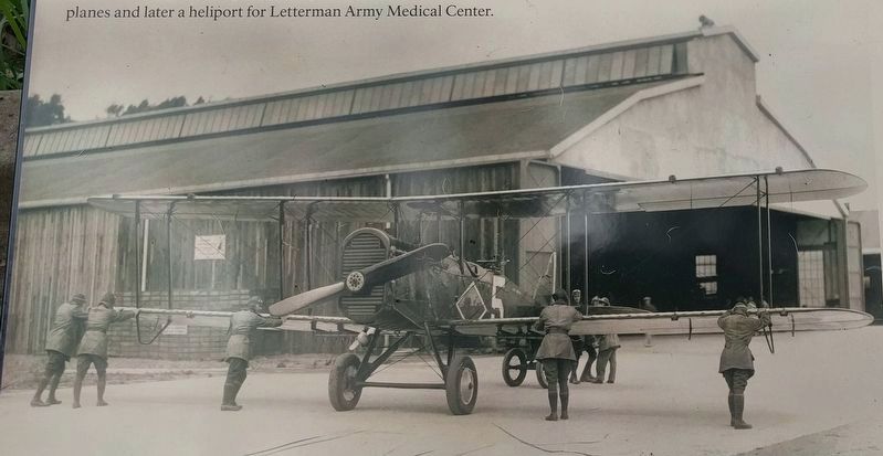
In the 1920s Army aviators flew wood-and-fabric covered biplanes on daring experimental missions. In 1919, Army Air Corps Major Henry "Hap" Arnold chose this site for a pioneer Army airfield. Arnold's pilots flew both regular aircraft and seaplanes. They served the harbor's coast defense artillery by spotting targets, determining range, and observing the effects of fire. They also conducted aerial surveys in the West and Alaska for the National Park Service.
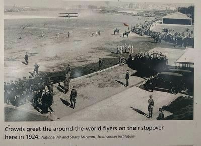
As the U.S. Army's westernmost airfield, Crissy Army Airfield was important in early history-making flights. Aviation firsts at Crissy Field include: June 23, 1924 — the first transcontinental flight in one day from Long Island, New York, to Crissy Field in 21 hours and 48 minutes; in 1924 the first around-the-world flight, by U.S. Army pilots, took 172 days and stopped at Crissy Field; in 1925 the U.S. Navy attempted the first flight from the mainland to Hawaii from Crissy Field; in 1927 a U.S. Army pilot completed the first flight from Crissy Field to Hawaii.
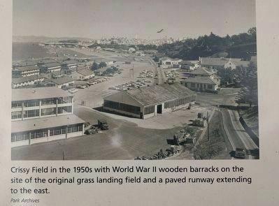
Cross winds, frequent fogs, and short runways made this a difficult airfield. As aircraft became larger and heavier, and as the Golden Gate Bridge was being built in 1936, the Army Air Corps made this an auxiliary airfield for small military planes and later a heliport for Letterman Army Medical Center.
Erected by Presidio of San Francisco, National Park Service.
Topics. This historical marker is listed in these topic lists: Air & Space • Forts and Castles. A significant historical date for this entry is June 23, 1924.
Location. 37° 48.248′ N, 122° 28.162′ W. Marker is in San Francisco, California, in San Francisco City and County. It is in Presidio of San Francisco. Marker is on Lincoln Boulevard south of Ledrum Court, on the left when traveling south. This marker is about 0.4 mile south of the Golden Gate Bridge Welcome Center. Touch for map. Marker is in this post office area: San Francisco CA 94129, United States of America. Touch for directions.
Other nearby markers. At least 8 other markers are within walking distance of this marker. Crissy Field Transformed (here, next to this marker); Gulf of the Farallones National Marine Sanctuary (approx. 0.2 miles away); Daring Pilots, Youthful Heroes (approx. 0.2 miles away); Braving Wind and Waves (approx. 0.2 miles away); Crissy Field (approx. 0.3 miles away); Setting A Deadly Obstacle Course (approx. 0.3 miles away); Fort Point National Historic Site (approx. 0.3 miles away); Resisting the Twisting (approx. 0.4 miles away). Touch for a list and map of all markers in San Francisco.
Also see . . .
1. Crissy Field. Wikipedia article (Submitted on April 20, 2019, by Joel Seewald of Madison Heights, Michigan.)
2. Crissy Field. Web page on the Presidio of San Francisco (National Park Service) website. (Submitted on April 20, 2019, by Joel Seewald of Madison Heights, Michigan.)
3. Crissy Army Airfield. Web page on the Military History and Museums Program website, a site devoted to preserving California's military heritage. (Submitted on April 20, 2019, by Joel Seewald of Madison Heights, Michigan.)
Additional keywords. Aviation Firsts: Crissy Army Airfield
via Abandoned & Little-Known Airfields, 1937
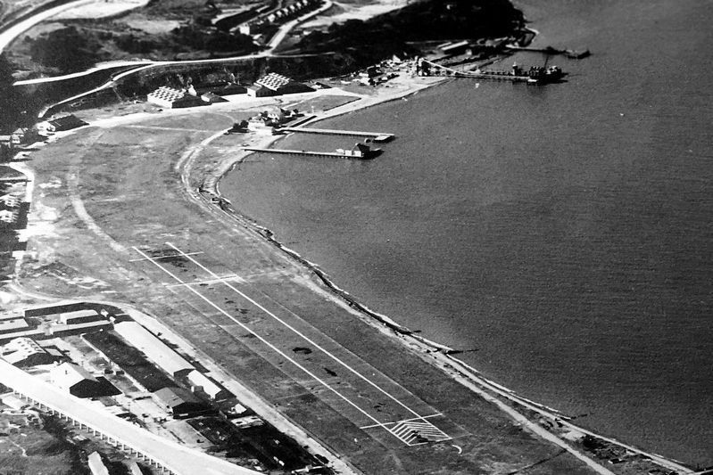
6. A 1937 aerial view looking northwest at Crissy Field (courtesy of Kevin Walsh)
Abandoned & Little-Known Airfields: California: San Francisco area website entry
History of the airfield and many historic photos.
Click for more information.
History of the airfield and many historic photos.
Click for more information.
Credits. This page was last revised on February 7, 2023. It was originally submitted on April 20, 2019, by Joel Seewald of Madison Heights, Michigan. This page has been viewed 362 times since then and 42 times this year. Photos: 1, 2, 3, 4, 5. submitted on April 20, 2019, by Joel Seewald of Madison Heights, Michigan. 6. submitted on May 2, 2021, by Larry Gertner of New York, New York.
