Prosperity in Newberry County, South Carolina — The American South (South Atlantic)
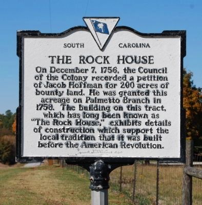
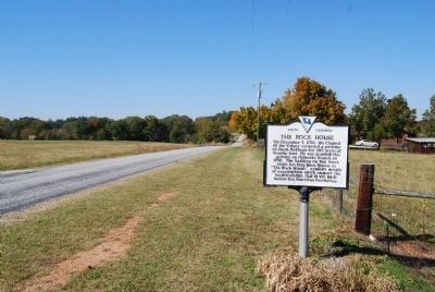
The Rock House
Erected 1970 by Newberry County Historical Society. (Marker Number 36-8.)
Topics. This historical marker is listed in these topic lists: Colonial Era • Notable Buildings. A significant historical month for this entry is December 1812.
Location. 34° 13.367′ N, 81° 36.05′ W. Marker is in Prosperity, South Carolina, in Newberry County. Marker is on St. Luke's Church Road, on the right when traveling west. Touch for map. Marker is in this post office area: Prosperity SC 29127, United States of America. Touch for directions.
Other nearby markers. At least 10 other markers are within 4 miles of this marker, measured as the crow flies. Bush River Quaker Meeting (approx. 2.2 miles away); Mollohon Mill and Village (approx. 3.2 miles away); Henry McNeal Turner (approx. 3.3 miles away); Calvin Crozier Murder Site (approx. 3.4 miles away); Newberry Village Cemetery (approx. 3˝ miles away); Newberry Cotton Mills (approx. 3.7 miles away); Korean War (approx. 3.7 miles away); Newberry County Confederate Monument (approx. 3.7 miles away); Calvin Crozier (approx. 3.7 miles away); National WWII Memorial (approx. 3.7 miles away).
Credits. This page was last revised on June 16, 2016. It was originally submitted on November 3, 2008, by Brian Scott of Anderson, South Carolina. This page has been viewed 2,213 times since then and 71 times this year. Photos: 1, 2. submitted on November 3, 2008, by Brian Scott of Anderson, South Carolina.

