Near Matson in St. Charles County, Missouri — The American Midwest (Upper Plains)
Daniel Boone's Missouri Golden Years

Photographed By Devry Becker Jones (CC0), April 24, 2019
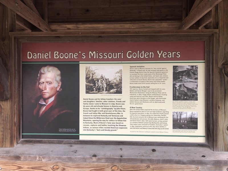
1. Daniel Boone's Missouri Golden Years Marker
Daniel Boone and his fellow travelers—his sons' and daughters' families, other relations, friends and family slaves—came to Missouri in 1799. Boone was 65 years old and already famous in America and Europe, thanks to his "autobiography" by John Filson. Boone had fought in both great wars of the time, the French and Indian War and the Revolutionary War. In between he explored Kentucky and Tennessee and helped blaze the Wilderness Road over the Appalachian Mountains, opening the way for settlers to follow him to Kentucky. Much of Boone's fame was based on rescues, captures and battles involving the Shawnee Indians, as various tribes resisted American expansion into Kentucky's "dark and bloody ground."
Spanish Invitation
Boone came to Missouri because he "was soured against Kentucky," a friend said. He had received land grants in the Femme Osage district from the Spanish lieutenant governor in Louisiana Territory. Lands west of the Mississippi River did not belong to the United States, and Spain was anxious to have settlers of any kind, especially one as respected and influential as Daniel Boone. Boone was appointed "syndic," a combination of justice of the peace and militia leader. Boone made most of his income selling furs in St. Louis.
Frontiersman to the End
Still vigorous, Boone hunted and trapped with his sons, Nathan and Daniel Morgan—soon to be prominent Missourians themselves—along the Missouri River and its tributaries. In 1803, Osage Indians raided Boone's hunting camp and took furs and rifles. Boone and his fellow Americans were intruders to the Osages, who dominated most of what is now Missouri, northern Arkansas, and eastern Kansas and Oklahoma until an 1808 treaty with the U.S. government.
A New Country
After the United States acquired the territory of Missouri, Boone worked for years to sort out legal problems regarding his Spanish land grant. In 1814, his supporters finally passed a bill in the U.S. Congress giving him ownership. Besides that, by most accounts life in Missouri was satisfying for the old woodsman and pioneer. His wife, Rebecca, died in 1813, and Daniel died in 1820. Both were buried, as they wished in a cemetery between present-day Marthasville and Dutzow. Their bodies were removed to Frankfurt, Kentucky's capital, in 1845. Arguments continue to this day about whether it was truly Daniel's and Rebecca's bones that were dug up and moved.
Topics and series. This historical marker is listed in these topic lists: Cemeteries & Burial Sites • Settlements & Settlers • War, French and Indian

Photographed By Chester Harding
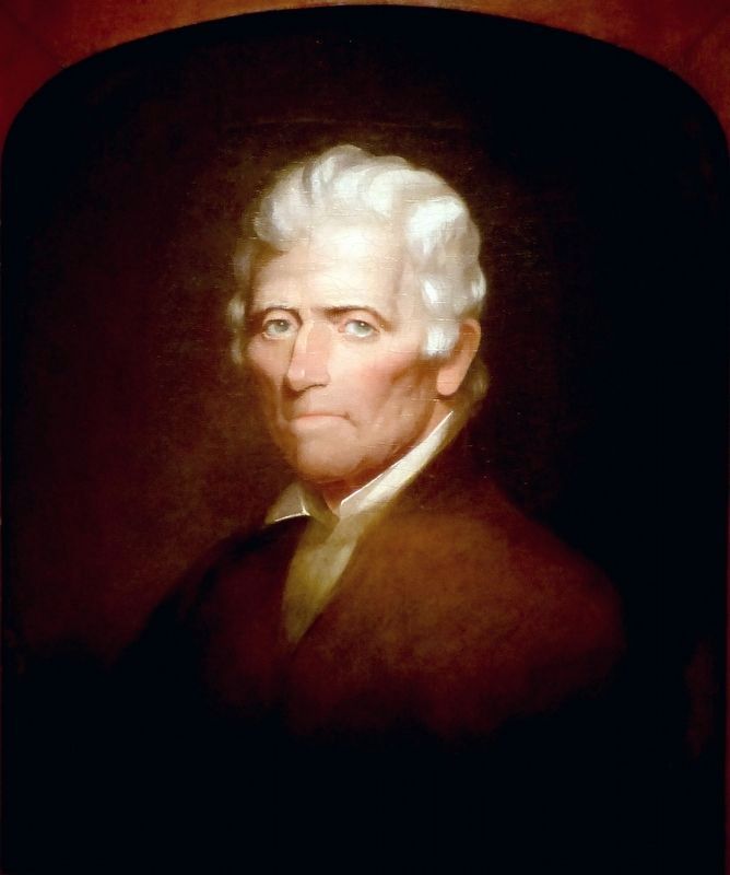
2. Daniel Boone
This portrait of Daniel Boone (1820 and 1860) by Chester Harding hangs in the National Portrait Gallery in Washington, DC.
When the young artist Chester Harding first encountered Daniel Boone on the Missouri frontier in June 1820, the legendary frontiersman was cooking venison wrapped on a ramrod over a fire. On learning that the artist had come to paint his portrait, Harding said, he “hardly knew what I meant.” Nevertheless he agreed to pose. The Gallery’s recently acquired version of Harding’s Boone was originally a full-length image, which later became severely damaged. But the face remained unscathed, and in 1860 Harding mounted it on a fresh canvas, where he made it the focal point of a simpler head-and-shoulders likeness. -- National Portrait Gallery
When the young artist Chester Harding first encountered Daniel Boone on the Missouri frontier in June 1820, the legendary frontiersman was cooking venison wrapped on a ramrod over a fire. On learning that the artist had come to paint his portrait, Harding said, he “hardly knew what I meant.” Nevertheless he agreed to pose. The Gallery’s recently acquired version of Harding’s Boone was originally a full-length image, which later became severely damaged. But the face remained unscathed, and in 1860 Harding mounted it on a fresh canvas, where he made it the focal point of a simpler head-and-shoulders likeness. -- National Portrait Gallery
Location. 38° 36.524′ N, 90° 47.685′ W. Marker is near Matson, Missouri, in St. Charles County. Marker is on Lucille Avenue east of Alice Avenue, on the left when traveling east. Touch for map. Marker is at or near this postal address: 3512 Alice Avenue, Defiance MO 63341, United States of America. Touch for directions.
Other nearby markers. At least 8 other markers are within 3 miles of this marker, measured as the crow flies. Matson to Augusta (here, next to this marker); Matson to Weldon Spring (here, next to this marker); Daniel Boone Judgment Tree Memorial (within shouting distance of this marker); The Boone Trace (about 300 feet away, measured in a direct line); A Defiant Tale (approx. 1.7 miles away); School Days In Defiance (approx. 1.7 miles away); Baseball in Defiance (approx. 2.1 miles away); Head's Store (approx. 2.3 miles away). Touch for a list and map of all markers in Matson.
Credits. This page was last revised on March 7, 2023. It was originally submitted on April 30, 2019, by Devry Becker Jones of Washington, District of Columbia. This page has been viewed 415 times since then and 35 times this year. Photos: 1. submitted on April 30, 2019, by Devry Becker Jones of Washington, District of Columbia. 2. submitted on May 1, 2019, by Allen C. Browne of Silver Spring, Maryland.
Editor’s want-list for this marker. A wide shot of the marker in context. • Can you help?