Near Richwood in Boone County, Kentucky — The American South (East South Central)
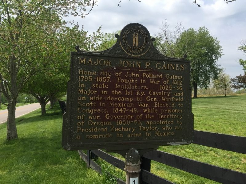
Major John P. Gaines
Home site of John Pollard Gaines. 1795-1857. Fought in War of 1812. In state legislature, 1825-36. Major in the 1st Kentucky Cavalry and an aide-de-camp to Gen. Winfield Scott, in Mexican war. Elected to Congress, 1847-49, while prisoner of war. Governor of the Territory of Oregon, 1850-53, appointed by President Zachary Taylor, who was a comrade in arms in Mexico.
Erected 1988 by Kentucky Historical Society and Kentucky Department of Transportation. (Marker Number 1194.)
Topics and series. This historical marker is listed in these topic lists: Government & Politics • War of 1812 • War, Mexican-American. In addition, it is included in the Former U.S. Presidents: #12 Zachary Taylor, and the Kentucky Historical Society series lists. A significant historical year for this entry is 1795.
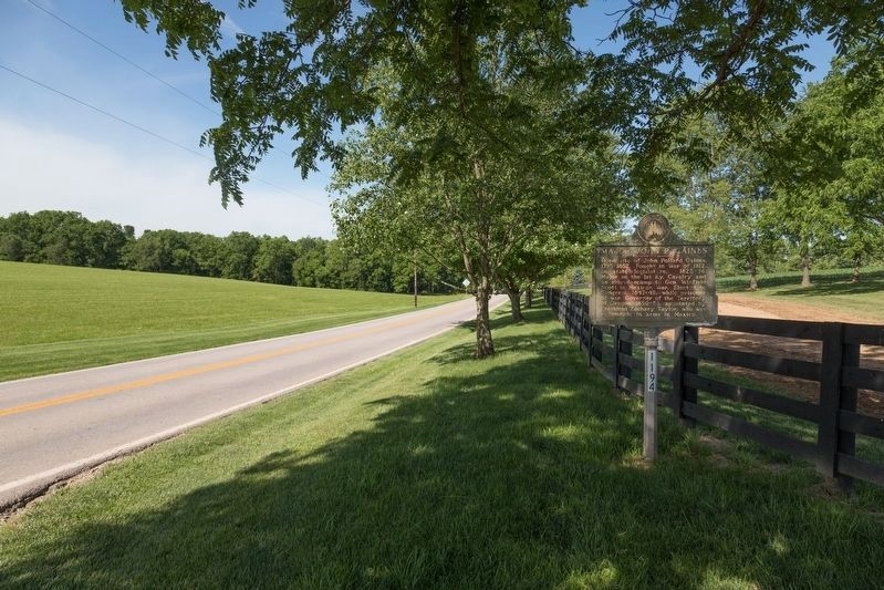
Location. 38° 53.896′ N, 84° 39.596′ W. Marker is near Richwood, Kentucky, in Boone County. Marker is on Richwood Road (Kentucky Route 338), on the right when traveling west. Touch for map. Marker is in this post office area: Walton KY 41094, United States of America. Touch for directions.
Other nearby markers. At least 8 other markers are within 5 miles of this marker, measured as the crow flies. Richwood Presbyterian Church (approx. 0.4 miles away); Skirmish at Snow’s Pond (approx. 2.4 miles away); Boone County, 1798 (approx. 3.1 miles away); Walton CCC Camp Bean Ridge (approx. 3.3 miles away); Walton Vernona Purple Heart Monument (approx. 3.4 miles away); Walton-Verona Veterans Memorial (approx. 3.4 miles away); John Hunt Morgan Escape Route (approx. 4.7 miles away); Mary Draper Ingles (approx. 4.8 miles away).
Also see . . . Wikipedia. (Submitted on April 30, 2019, by Steve Stoessel of Niskayuna, New York.)
Credits. This page was last revised on June 3, 2021. It was originally submitted on April 30, 2019, by Steve Stoessel of Niskayuna, New York. This page has been viewed 459 times since then and 34 times this year. Photos: 1. submitted on April 30, 2019, by Steve Stoessel of Niskayuna, New York. 2. submitted on July 1, 2019, by J. J. Prats of Powell, Ohio. 3. submitted on April 30, 2019, by Steve Stoessel of Niskayuna, New York. 4. submitted on July 1, 2019, by J. J. Prats of Powell, Ohio. • Bill Pfingsten was the editor who published this page.


