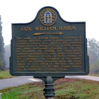
Near Powelton in Hancock County, Georgia — The American South (South Atlantic)
Gov. William Rabun
3 mi. →
Erected 1955 by Georgia Historical Commission. (Marker Number 070-9.)
Topics and series. This historical marker is listed in this topic list: Government & Politics. In addition, it is included in the Georgia Historical Society series list. A significant historical month for this entry is April 1797.
Location. 33° 22.532′ N, 82° 54.801′ W. Marker is near Powelton, Georgia, in Hancock County. Marker is at the intersection of Powelton Road (Georgia Route 22) and Reynolds Road, on the right when traveling north on Powelton Road. Touch for map. Marker is in this post office area: Sparta GA 31087, United States of America. Touch for directions.
Other nearby markers. At least 8 other markers are within 8 miles of this marker, measured as the crow flies. Camilla and Zack Hubert Homesite (approx. 3.1 miles away); Powelton Baptist Church (approx. 4.4 miles away); Nathan S.S. Beman at Mt. Zion (approx. 5.3 miles away); Mt. Zion Church (approx. 5.3 miles away); Gov. William Jonathan Northen (approx. 5˝ miles away); Rockby (approx. 6 miles away); "Old Dominion" (approx. 7.6 miles away); Sparta Cemetery (approx. 7.6 miles away).
Credits. This page was last revised on December 4, 2020. It was originally submitted on November 6, 2008, by David Seibert of Sandy Springs, Georgia. This page has been viewed 1,638 times since then and 19 times this year. Photo 1. submitted on November 6, 2008, by David Seibert of Sandy Springs, Georgia. • Bill Pfingsten was the editor who published this page.
Editor’s want-list for this marker. A wide view photo of the marker and the surrounding area together in context. • Can you help?
