Killeen in Bell County, Texas — The American South (West South Central)
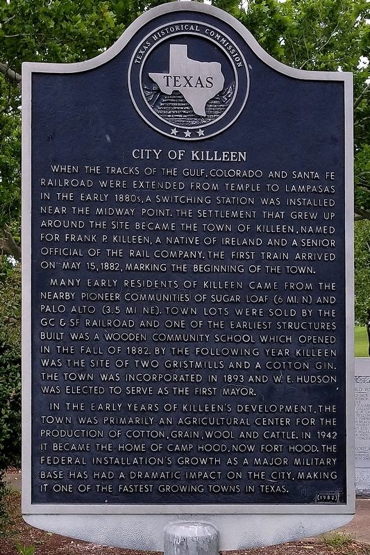
City of Killeen
Many early residents of Killeen came from the nearby pioneer communities of Sugar Loaf (6 mi. N) and Palo Alto (3.5 mi.NE). Town lots were sold by the GC & SF Railroad and one of the earliest structures built was a wooden community school which opened in the fall of 1882. By the following year Killeen was the site of two gristmills and a cotton gin. The town was incorporated in 1893 and W.E. Hudson was elected to serve as the first mayor.
In the early years of Killeen's development, the town was primarily an agricultural center for the production of cotton, grain, wool and cattle. In 1942 it became the home of Camp Hood, now Fort Hood. The federal installation's growth as a major military base has had a dramatic impact on the city, making it one of the fastest growing towns in Texas.
Erected 1982 by Texas Historical Commission. (Marker Number 887.)
Topics. This historical marker is listed in these topic lists: Railroads & Streetcars • Settlements & Settlers. A significant historical date for this entry is May 15, 1882.
Location. 31° 6.625′ N, 97° 43.192′ W. Marker is in Killeen, Texas, in Bell County. Marker is at the intersection of Conder Street and Sutton Drive, on the left when traveling south on Conder Street. Touch for map. Marker is in this post office area: Killeen TX 76541, United States of America. Touch for directions.
Other nearby markers. At least 8 other markers are within 11 miles of this marker, measured as the crow flies. Bethel Primitive Baptist Church (approx. 0.6 miles away); First National Bank of Killeen (approx. 0.9 miles away); Wednesday Review Club (approx. one mile away); Avenue D School (approx. 1.1 miles away); Killeen Herald (approx. 1.3 miles away); Immanuel Lutheran Church Cemetery (approx. 2.3 miles away); Nolanville Encampment (approx. 6.6 miles away); McBryde Cemetery (approx. 10.7 miles away). Touch for a list and map of all markers in Killeen.
Credits. This page was last revised on May 8, 2019. It was originally submitted on May 8, 2019, by Larry D. Moore of Del Valle, Texas. This page has been viewed 390 times since then and 28 times this year. Photos: 1, 2. submitted on May 8, 2019, by Larry D. Moore of Del Valle, Texas. • Bernard Fisher was the editor who published this page.

