Colerain Township near Cincinnati in Hamilton County, Ohio — The American Midwest (Great Lakes)
Bevis
"The Darkest of All Nights"
— John Hunt Morgan Heritage Trail —
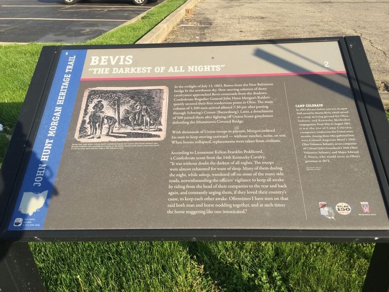
In the twilight of July 13, 1863, flames from the New Baltimore bridge lit the northwest sky. Slow-moving columns of dusty cavalrymen approached Bevis crossroads from the shadows Confederate Brigadier General John Hunt Morgan's Raiders quietly secured their first rendezvous point in Ohio. The main column of 1,500 men arrived around 7:30 pm after passing through Schwing's Corner (Barnesburg). Later, a detachment of 500 joined them after fighting off Union home guardsmen defending the Miamitown Covered Bridge.
With thousands of Union troops in pursuit, Morgan ordered his men to keep moving eastward without torches, noise, or rest. When horses collapsed, replacements were taken from civilians.
According to Lieutenant Kelion Franklin Peddicord a Confederate scout from the 14th Kentucky Cavalry, "It was without doubt the darkest of all nights. The troops were almost exhausted for want of sleep. Many of them during the night, while asleep, wandered off on some of the many side roads, notwithstanding the officers vigilance to keep all awake by riding from the head of their companies to the rear and back again, and constantly urging them, if they loved their country's cause, to keep each other awake. Oftentimes I have seen on that raid both man and horse nodding together, and at such times the horse staggering like one intoxicated."
Camp Colerain
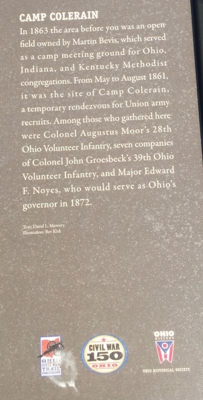
In 1863 the area before you was an open field owned by Martin Bevis, which served as a camp meeting ground for Ohio, Indiana, and Kentucky Methodist congregations. From May to August 1861, it was the site of Camp Colerain, a temporary rendezvous for Union army recruits. Among those who gathered here were Colonel Augustus Moor's 28th Ohio Volunteer Infantry, seven companies of Colonel John Groesbeck's 39th Ohio Volunteer Infantry, and Major Edward F. Noyes, who would serve as Ohio's governor in 1872.
Erected by Ohio Historical Society, Civil War 150 Ohio, Ohio Civil War Trail Commission. (Marker Number 2.)
Topics and series. This historical marker is listed in this topic list: War, US Civil. In addition, it is included in the John Hunt Morgan Heritage Trail in Ohio series list. A significant historical date for this entry is July 13, 1863.
Location. 39° 14.936′ N, 84° 35.766′ W. Marker is near Cincinnati, Ohio, in Hamilton County. It is in Colerain Township. Marker is at the intersection of Springdale Road and Colerain Avenue (U.S. 27), on the right when traveling east on Springdale Road. Marker is several yards east from the intersection beside a rundown strip mall and an Arby's. Marker is parallel to the road and down low. Touch for map. Marker is in this post office area: Cincinnati OH 45247, United States of America. Touch for directions.
Other nearby markers. At least 8 other markers are within 5 miles of this marker, measured as the crow flies. Mt. Healthy Christian Church (approx. 2.7 miles away); Inventor Obed Hussey Tests His Reaper, 1835 (approx. 2.7 miles away); Jediah Hill Covered Bridge (approx. 2.7 miles away); Greenhills (approx. 4.1 miles away); Greenhills Historic District (approx. 4.1 miles away); Commemorating our Nation’s Bicentennial and Freedom of the Press (approx. 4.1 miles away); John T. Crawford's Legacy (approx. 4.3 miles away); Dunlap's Station (approx. 4.3 miles away). Touch for a list and map of all markers in Cincinnati.
Credits. This page was last revised on February 6, 2023. It was originally submitted on May 10, 2019, by Steve Stoessel of Niskayuna, New York. This page has been viewed 923 times since then and 50 times this year. Photos: 1, 2. submitted on May 10, 2019, by Steve Stoessel of Niskayuna, New York. • Andrew Ruppenstein was the editor who published this page.

