El Pueblito in La Corregidora, Querétaro, Mexico — The Central Highlands (North America)
Platform and Pyramid
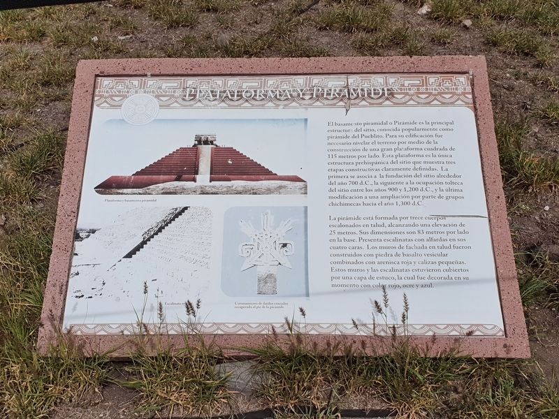
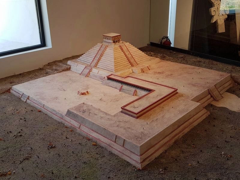
El basamento piramidal o Pirámide es la principal estructura del sitio, conocida popularmente como pirámide del Pueblito. Para su edificación fue necesario nivelar el terreno por medio de la construcción de una gran plataforma cuadrada de 115 metros por lado. Esta plataforma es la única estructura prehispánica del sitio que muestra tres etapas constructivas claramente definidas. La primera se asocia la fundición del sitio alrededor del año 700 d.C., la siguiente a la ocupación tolteca del sitio entre los años 900 y 1,200 d.C., y la última modificación a una ampliación por parte de grupos chichimecas hacia el año 1,300 d.C.
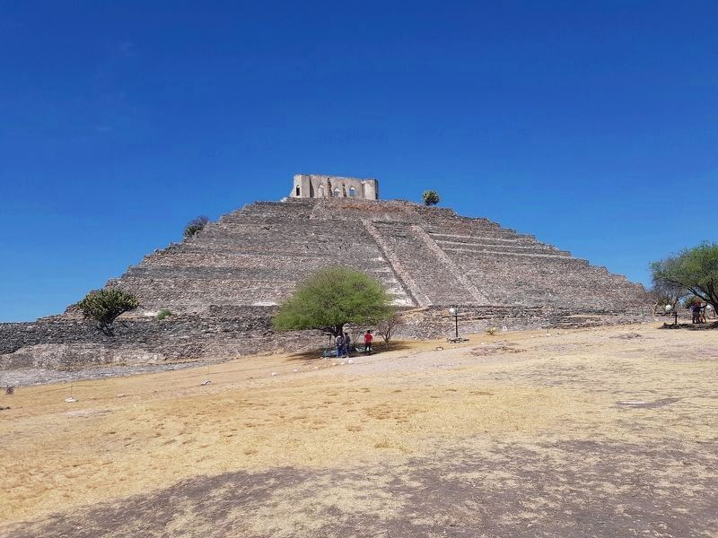
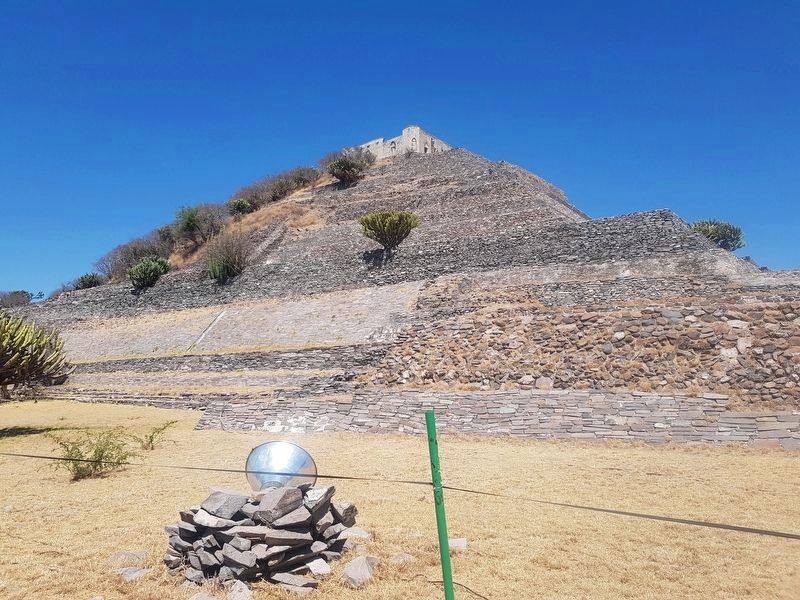
La pirámide está formada por trece cuerpos escalonados en talud, alcanzando una elevación de 25 metros. Sus dimensiones son 83 metros por lado en la base. Presenta escalinatas con alfardas en sus cuatro caras. Los muros de fachada en talud fueron construidos con piedra de basalto vesicular combinados con arenisca roja y calizas pequeñas. Estos muros y las escalinatas estuvieron cubiertos por una capa de estuco, la cual fue decorada en su momento con color rojo, ocre y azul.
Pie de dibujos:
Plataforma y basamento piramidal
Escalinata oriente
Coronamiento de dardos cruzados recuperado al pie de la pirámide
Platform and Pyramid
The Pyramid is the main structure of the site, popularly known as the Pueblito pyramid. For its construction it was necessary to level the land by means of creating a large square platform of 115 meters on each side. This platform is the only pre-Hispanic structure of the site that shows three clearly defined constructive stages. The first is associated with the founding of the site around 700 AD. The next stage is related to the Toltec occupation of the site between 900 and 1200 AD. The last modification was an expansion done by Chichimec groups around AD 1300.
The pyramid is formed by thirteen steps staggered up its slope, reaching an elevation of 25 meters. Its dimensions are 83 meters on each side at the base. It has staircases with stone railings on its four faces. The walls of the sloped facade were built with vesicular basalt stone combined with red sandstone and small limestone pieces. These walls and stairways were originally covered by a layer of stucco, which was decorated at the time with red, ocher and blue colors.
Captions:
Platform and pyramid base
A decorative piece made of crossed darts recovered
from the base of the pyramid
Erected by Secretaría de Cultura y el Instituto Nacional de Antropología e Historia (INAH).
Topics. This historical marker is listed in these topic lists: Architecture • Man-Made Features • Native Americans. A significant historical year for this entry is 1200.
Location. 20° 33.071′ N, 100° 26.606′ W. Marker is in El Pueblito, Querétaro, in La Corregidora. Marker can be reached from Camino el Cerrito just west of Capitán Pedro Urtiaga, on the right when traveling west. The marker is directly east of the Pyramid at the El Cerrito Archaeological Site. Touch for map. Marker is in this post office area: El Pueblito QUE 76900, Mexico. Touch for directions.
Other nearby markers. At least 8 other markers are within walking distance of this marker. The "Little Fort" (here, next to this marker); The Plaza of the Dancers (within shouting distance of this marker); The Plaza of the Sculptures (within shouting distance of this marker); The Altar of the Skulls (within shouting distance of this marker); The Building of the Four Altars (about 90 meters away, measured in a direct line); Obsidian Altar (about 150 meters away); The Earth and its Cosmic Paths (about 180 meters away); El Cerrito ("The Little Hill") (about 210 meters away). Touch for a list and map of all markers in El Pueblito.
Credits. This page was last revised on February 25, 2023. It was originally submitted on May 14, 2019, by J. Makali Bruton of Accra, Ghana. This page has been viewed 115 times since then and 5 times this year. Photos: 1. submitted on February 25, 2023, by J. Makali Bruton of Accra, Ghana. 2, 3, 4. submitted on May 14, 2019, by J. Makali Bruton of Accra, Ghana.


