Tenleytown in Northwest Washington in Washington, District of Columbia — The American Northeast (Mid-Atlantic)
Fort Reno
Rock Creek Park
— National Park Service, U.S. Department of the Interior —
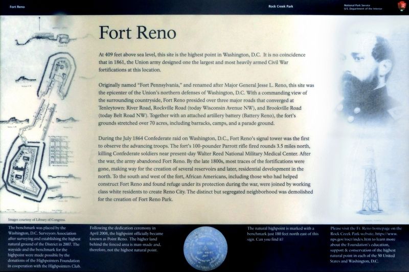
At 409 feet above sea level, this site is the highest point in Washington, D.C. It is no coincidence that in 1861, the Union army designed one the largest and most heavily armed Civil War fortifications at this location.
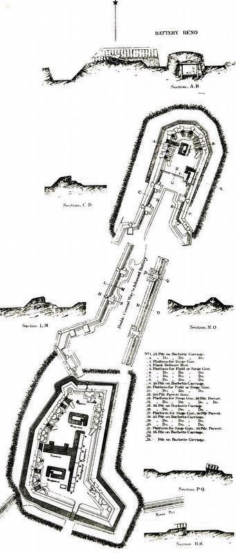
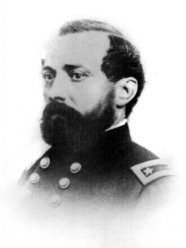
Originally named “Fort Pennsylvania,” and renamed after Major General Jesse L. Reno, this site was the epicenter of the Union's northern defenses of Washington, D.C. With a commanding view of the surrounding countryside, Fort Reno presided over three major roads that converged at Tenleytown: River Road, Rockville Road (today Wisconsin Avenue NW), and Brookville Road today Belt Road NW). Together with an attached artillery battery (Battery Reno), the fort's grounds stretched over 70 acres, including barracks, camps, and a parade ground.
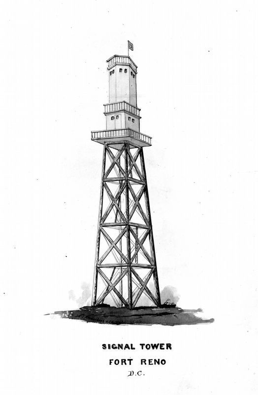
During the July 1864 Confederate raid on Washington, D.C., Fort Reno's signal tower was the first to observe the advancing troops. The fort's 100-pounder Parrott rifle fired rounds 3.5 miles north, killing Confederate soldiers near present-day Walter Reed National Military Medical Center. After the war, the army abandoned Fort Reno. By the late 1800s, most traces of the fortifications were gone, making way for the creation of several reservoirs and later, residential development in the north. To the south and west of the fort, African Americans, including those who had helped construct Fort Reno and found refuge under its protection during the war, were joined by working class white residents to create Reno City. The distinct but segregated neighborhood was demolished for the creation of Fort Reno Park.
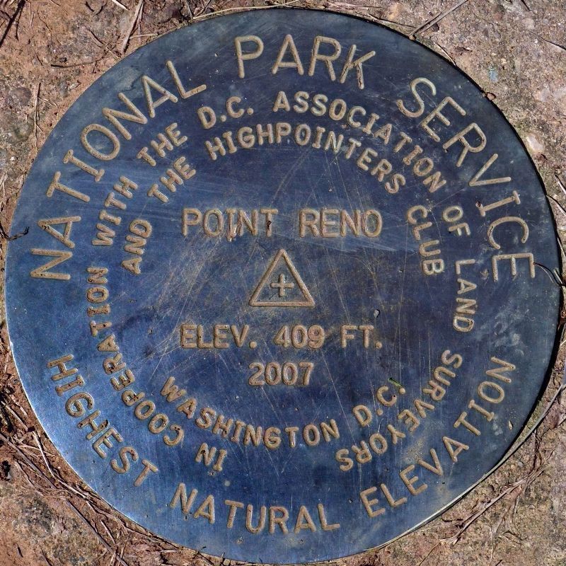
The benchmark was placed by the Washington, D.C. Surveyors Association after surveying and establishing the highest natural ground of the District in 2007. The wayside and the benchmark for the highpoint were made possible by the donations of the Highpointers Foundation in cooperation with the Highpointers Club.
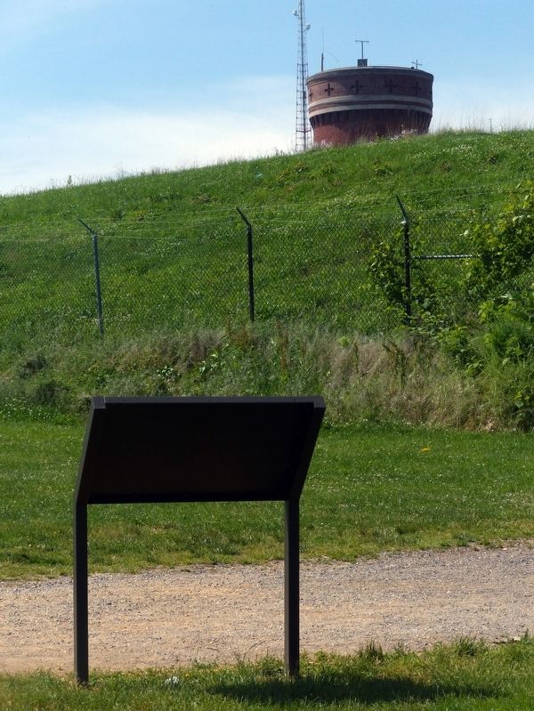
Following the dedication ceremony in April 2008, the highpoint officially became known as Point Reno. The higher land behind the fenced area is man-made and, therefore, not the highest natural point.
The natural highpoint is marked with a benchmark just 180 feet north east of this sign. Can you find it?
Please visit the Ft. Reno home page on the Rock Creek Park website https//www.nps.gov/rocr/index.htm to learn more about the Foundation's education, support and conservation of the highest natural point in each of the 50 United States and Washington, D.C.
Erected 2019 by National Park Service, U.S. Department of the Interior.
Topics and series. This historical marker is listed in these topic lists: Forts and Castles • War, US Civil. In addition, it is included in the Defenses of Washington series list. A significant historical year for this entry is 1861.
Location. 38° 57.102′ N, 77° 4.596′ W. Marker is in Northwest Washington in Washington, District of Columbia. It is in Tenleytown. Marker can be reached from Chesapeake Street Northwest west of Nebraska Avenue Northwest, on the right when traveling west. In Fort Reno Park in Tenleytown, Washington, DC. Touch for map. Marker is in this post office area: Washington DC 20016, United States of America. Touch for directions.
Other nearby markers. At least 8 other markers are within walking distance of this marker. A different marker also named Fort Reno (within shouting distance of this marker); a different marker also named Fort Reno (about 400 feet away, measured in a direct line); a different marker also named Fort Reno (about 400 feet away); The Civil War Defenses of Washington (about 400 feet away); Reservoir / Reno City (about 500 feet away); a different marker also named Fort Reno (about 500 feet away); Three R's (about 600 feet away); Schools (about 600 feet away). Touch for a list and map of all markers in Northwest Washington.
Credits. This page was last revised on January 30, 2023. It was originally submitted on May 18, 2019, by Allen C. Browne of Silver Spring, Maryland. This page has been viewed 277 times since then and 36 times this year. Photos: 1, 2, 3, 4, 5, 6. submitted on May 18, 2019, by Allen C. Browne of Silver Spring, Maryland. • Andrew Ruppenstein was the editor who published this page.
