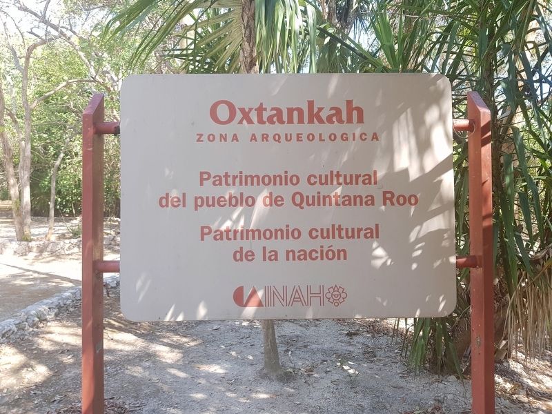
Near Calderitas in Othón P. Blanco, Quintana Roo, Mexico — The Yucatan Peninsula (The Southeast)
Oxtankah Archaeological Site
Zona arqueológica
Patriomonio Cultural de Quintana Roo y de la Nación
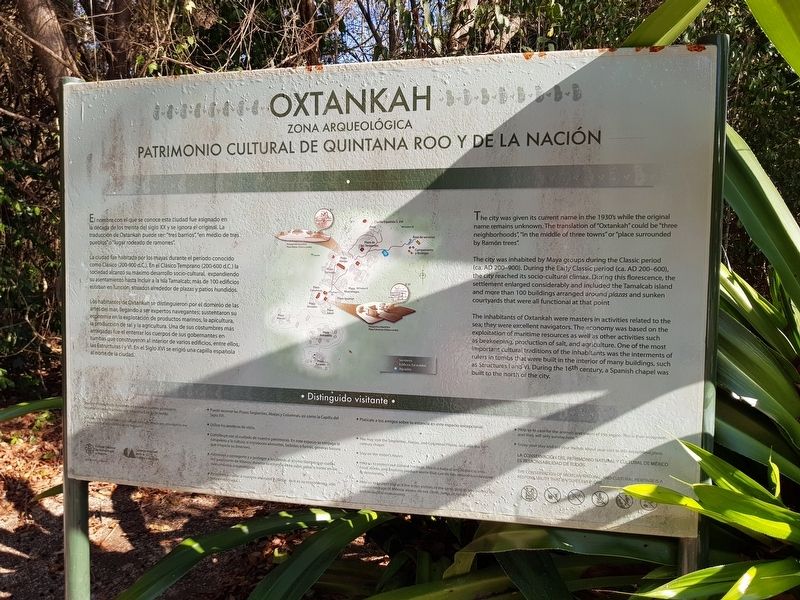
El nombre con el que se conoce esta ciudad fue asignado en la década de los treinta del siglo XX y se ignora el original. La traducción de Oxtankah puede ser: “tres barrios”, “en medio de tres pueblos” o “lugar rodeado de ramones”.
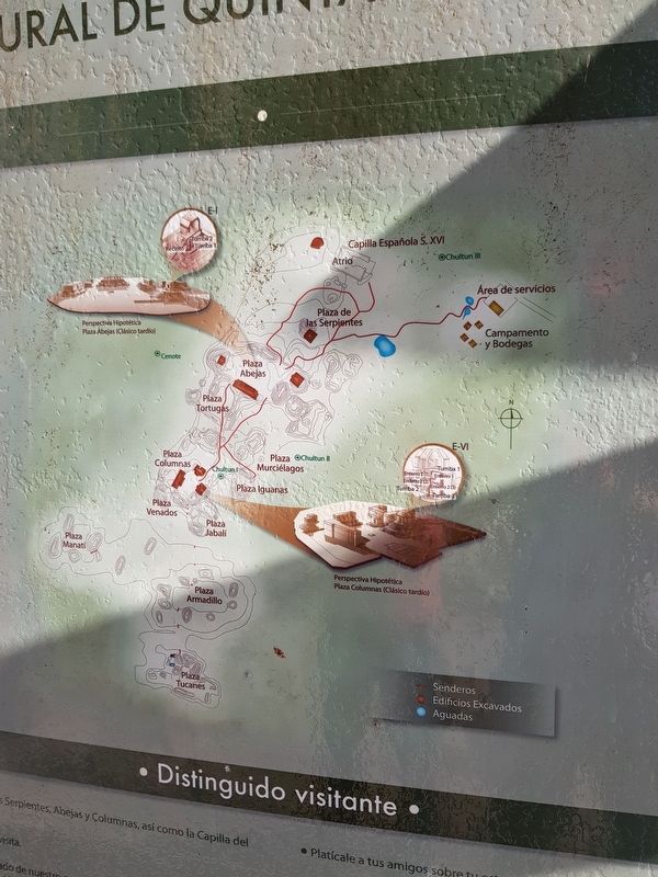
La ciudad fue habitada por los mayas durante el periodo conocido como Clásico (200-900 dC.). En el Clásico Temprano (200-600 d.C.) la socieded alcanzó su máximo desarrollo socio-cultural, expandiendo su asentamiento hasta incluir a la Isla Tamalcab; más de 100 edificios estaban en función, situados alrededor de plazas y patios hundidos.
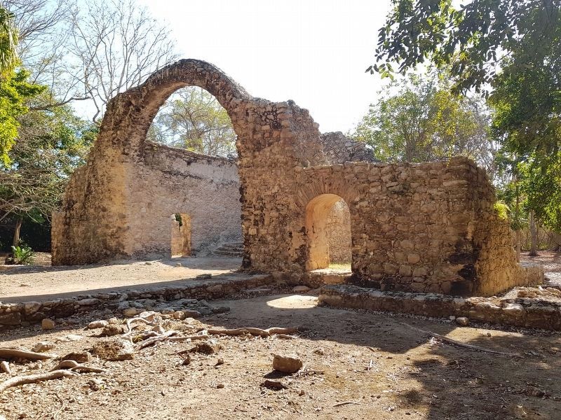
Los habitantes de Otankah se distinguieron por el dominio de las artes del mar, legando a ser expertos navegantes; sustentaron su economía en la explotación de productos marinos, la apicultura, la producción de sal y la agricultura. Una de sus costumbres más arraigadas fue el enterrar los cuerpos de sus gobernantes en tumbas que construyeron al interior de varios edificios, entre ellos, las Estructuras l y VI. En el Siglo XVI se erigió una capilla española al norte de la ciudad.
Oxtankah
Archaeological Zone
Cultural Heritage Site of Quintana Roo and of the Nation
The city was given its current name in the 1930's while the original name remains unknown. The translation of “Oxtankah” could be “three neighborhoods”, “in the middle of three towns” or “place surrounded by Ramón trees”.
The city was inhabited by Maya groups during the Classic period (ca. AD 200-900). During the Early Classic period (ca. AD 200-600), the city reached its socio-cultural climax. During this florescence, the settlement enlarged considerably and included the Tamalcab island and more than 100 buildings arranged around plazas and sunken courtyards that were all functional at that point.
The inhabitants of Oxtankah were masters in activities related to the sea; they were excellent navigators. The economy was based on the exploitation of maritime resources as well as other activities such as beekeeping, production of salt, and agriculture. One of the most important cultural traditions of the inhabitants was the interments of rulers in tombs that were built in the interior of many buildings, such as Structures I and IV. During the 16th century, a Spanish chapel was built to the north of the city.
Erected by
Instituto Nacional de Antropología e Historia (INAH).
Topics. This historical marker is listed in these topic lists: Anthropology & Archaeology • Colonial Era • Native Americans.
Location. 18° 36.508′ N, 88° 13.912′ W. Marker is near Calderitas, Quintana Roo, in Othón P. Blanco. Marker can be reached from Unnamed road just west of Calderitas Coastal Road, on the left when traveling north. Touch for map. Marker is in this post office area: Calderitas QR 77960, Mexico. Touch for directions.
Other nearby markers. At least 8 other markers are within 14 kilometers of this marker, measured as the crow flies. Structure IV at Oxtankah (approx. 0.4 kilometers away); An Altar at Oxtankah (approx. 0.4 kilometers away); Structure III at Oxtankah - Palace (approx. 0.4 kilometers away); Structure IX at Oxtankah - Palace (approx. 0.6 kilometers away); Chetumal - Kohunlich and Oxtankah (approx. 10.8 kilometers away); Heroes of April 1914 (approx. 11.8 kilometers away); Chetumal Meetings (approx. 12.5 kilometers away); The Chetumal Mask (approx. 13.4 kilometers away). Touch for a list and map of all markers in Calderitas.
Credits. This page was last revised on June 25, 2019. It was originally submitted on May 20, 2019, by J. Makali Bruton of Accra, Ghana. This page has been viewed 171 times since then and 8 times this year. Photos: 1, 2, 3. submitted on May 20, 2019, by J. Makali Bruton of Accra, Ghana. 4. submitted on June 25, 2019, by J. Makali Bruton of Accra, Ghana. 5. submitted on May 20, 2019, by J. Makali Bruton of Accra, Ghana.
