National Park in Gloucester County, New Jersey — The American Northeast (Mid-Atlantic)
Fort Mercer at Red Bank / Fort Mercer is Alerted
[Fort Mercer at Red Bank Side]:
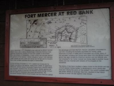
Late in September 1777, Philadelphia was captured by British General William Howe, with a serious disadvantage. Extensive American river defenses blocked the shipping of food and supplies to the British army and citizens of Philadelphia. A major attack was planned against the garrison at Fort Mercer. A British brigade of about 1200 Hessians under Colonel Carl Emil Ulrich Von Donop was ferried over to Coopers Ferry (now Camden) spending the night in Haddonfield.
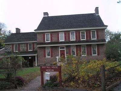
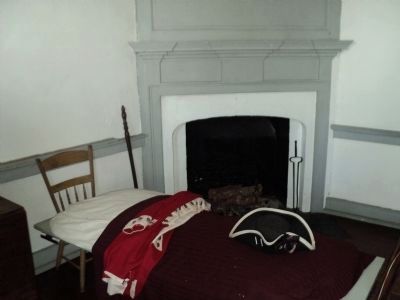
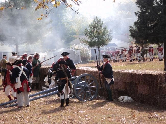
On the morning of October 22, 1777, Colonel Von Donop and his brigade marched on Fort Mercer. Young Jonas Cattell, an apprentice blacksmith, alerted Colonel Christopher Greene that a surprise attack was imminent. Around 4 P.M., the attack began. Quickly gaining the old northern section of the fort, the Hessians faced another 10 foot wall and abatis of sharpened tree trunks and branches. The disordered Hessians tried to move forward; but the Americans gained the advantage and held the fort. Hessian casualities amounted to over 500, including the mortally wounded Von Donop; while Americans counted 14 killed and 23 wounded out of 600. Many of the wounded, including Von Donop were taken into the Whitall house where they were tended by American doctors and Ann Whitall, who had remained in her home. Colonel Von Donop died in another house nearby and was interred with remains of his brigade on the battlefield.
The Battle of Red Bank resulted in heavy losses to the British and was a much needed morale builder to Washington’s army, giving new hope and rallying the spirits of the soldiers. This victory coupled with the British defeat at Saratoga, New York, resulted in the French decision to enter the war against Great Britain.
[Fort Mercer is Alerted Side]:
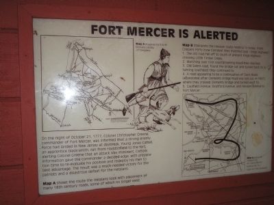
On the night of October 21, 1777, Colonel Christopher Greene, commander of Fort Mercer, was informed that a strong enemy force had landed in New Jersey at daybreak. Young Jonas Cattell, an apprentice black-smith, ran from Haddonfield to the fort, alerting Colonel Greene that an attack was imminent. Cattell’s information gave the commander a decided edge, with preparation time to re-evaluate his position and redeploy his men to best advantage. The result was a much-needed victory for the patriots and a disastrous defeat for the Hessians.
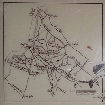
Map A shows the route the Hessians took with placement of many 18th century roads, some of which no longer exist.
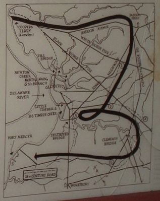
Map B interprets the Hessian route relating to today. From Coopers Ferry (now Camden) they marched over “Kings Highway”
1. The old road fell off to south of present Kings Highway crossing Little Timber Creek.
2. Marching over Irish road (Browning Road) they reached;
3. Old Salem road, found the bridge out and turned back to 2, turning southeast they continued to;
4. A road appearing to be a continuation of Davis Road (abandoned after Clements Bridge Road was laid out in 1807), where they crossed Clements Bridge and turned west to;
5. Caufield Avenue, Deptford Avenue, and Hessian Avenue to Fort Mercer.
Erected by Red Bank Battlefield Historical Park.
Topics. This historical marker is listed in these topic lists: Notable Events • Notable Places • War, US Revolutionary. A significant historical month for this entry is September 1777.
Location. 39° 52.261′ N, 75° 11.383′ W. Marker is in National Park, New Jersey, in Gloucester County. Marker can be reached from Hessian Road, on the right when traveling west. Marker is in Red Bank Battlefield. Touch for map. Marker is in this post office area: National Park NJ 08063, United States of America. Touch for directions.
Other nearby markers. At least 8 other markers are within walking distance of this marker. Fort Mercer (here, next to this marker); a different marker also named Fort Mercer (here, next to this marker); Brigadier General Hugh Mercer (a few steps from this marker); The Battle of Red Bank (within shouting distance of this marker); Flag of Fort Mercer (within shouting distance of this marker); Archaeology at Red Bank (within shouting distance of this marker); The Naval Engagement (within shouting distance of this marker); African American Soldiers (within shouting distance of this marker). Touch for a list and map of all markers in National Park.
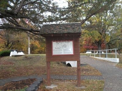
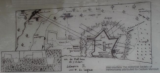
More about this marker. The "Fort Mercer at Red Bank" side of the marker contains a map of the fortifications at Fort Mercer. The "Fort Mercer is Alerted Marker" contains two maps showing the Hessian approach to Fort Mercer prior to the October 21, 1777 assault.
Also see . . .
1. Battle of Red Bank. Wikipedia entry (Submitted on October 13, 2023, by Larry Gertner of New York, New York.)
2. Red Bank Battlefield Park and the Whitall House. Visit South Jersey website entry (Submitted on October 13, 2023, by Larry Gertner of New York, New York.)
Credits. This page was last revised on October 13, 2023. It was originally submitted on November 9, 2008, by Bill Coughlin of Woodland Park, New Jersey. This page has been viewed 2,999 times since then and 24 times this year. Photos: 1, 2, 3, 4, 5, 6, 7, 8. submitted on November 9, 2008, by Bill Coughlin of Woodland Park, New Jersey. 9, 10. submitted on October 28, 2013, by Bill Coughlin of Woodland Park, New Jersey.
