Middleburg in Loudoun County, Virginia — The American South (Mid-Atlantic)
Mt. Defiance, the Turnpike, and Middleburg
Battle of Middleburg/Mt. Defiance
Inscription.
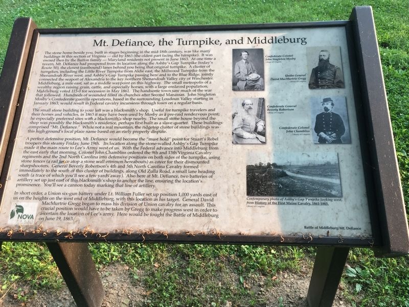
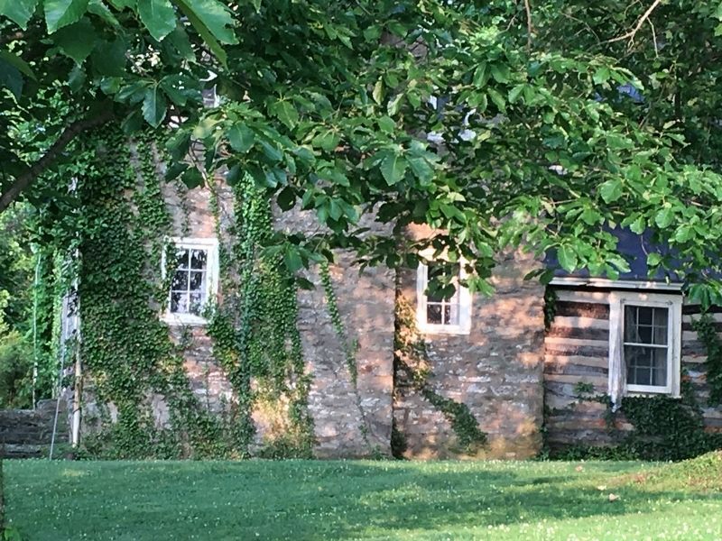
The stone home beside you, built in stages beginning in the mid-18th century, was like many buildings in this section of Virginia—old by 1863 (the oldest part facing the turnpike). It was owned then by the Barton family—Maryland residents not present in June 1863. At one time a tavern, Mt. Defiance had prospered from its location along the Ashby’s Gap Turnpike (today’s Route 50), the closest (eastbound) lanes behind you being that original turnpike. A cluster of turnpikes, including the Little River Turnpike from Aldie east, the Millwood Turnpike from the Shenandoah River west, and Ashby’s Gap Turnpike passing here and to the Blue Ridge, jointly connected the seaport of Alexandria to the key northern Shenandoah Valley city of Winchester. Middleburg, a mile east, sat as a middle waypoint on this highway. The small metropolis of a wealthy region raising grain, cattle, and especially horses, with a large enslaved population, Middleburg voted 115-0 for secession in May 1861. The handsome town saw much of the war that followed. Hundreds of wounded filled its churches after Second Manassas. John Singleton Mosby’s Confederate guerilla operations, based in the surrounding Loudoun Valley starting in January 1863, would result in Federal cavalry incursions through town on a regular basis.
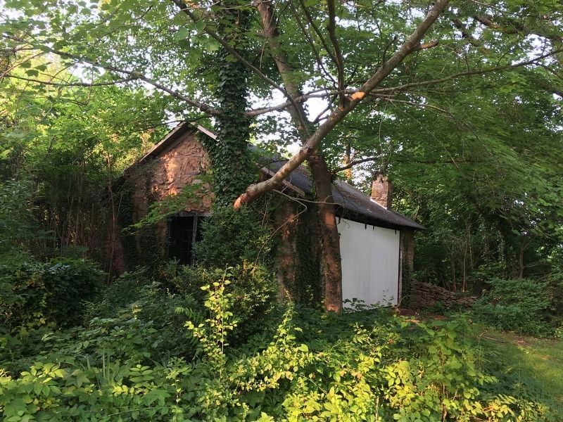
The small stone building to your left was a blacksmith’s shop. Useful for turnpike travelers and their horses and vehicles, in 1863 it may have been used by Mosby as a pre-raid rendezvous point; he especially preferred sites with a blacksmith’s shop nearby. The small stone house beyond the shop was possibly the blacksmith’s residence, perhaps first built as a slave quarter. These buildings comprised “Mt. Defiance.” While not a real mountain, the ridgetop cluster of stone buildings was this high ground’s local place name based on an early property dispute.
A perfect defensive position, Mt. Defiance would become the “must hold” point for Stuart’s Rebel troopers this steamy Friday, June 19th. Its location along the stone-walled Ashby’s Gap Turnpike made it the main route to Lee’s Army west of us. With the Federal advance into Middleburg from the east early that morning, Colonel John Chambliss ordered the 9th and 13th Virginia Cavalry regiments and the 2nd North Carolina into defensive positions on both sides of the turnpike, using stone fences (a rail fence atop a stone wall common hereabouts) as cover for their dismounted sharpshooters. General Beverly Robertson’s 4th and 5th North Carolina Cavalry formed immediately to the south of this cluster of buildings, along Old Zulla Road, a small lane heading south (a trace of which you’ll see a few yards away). Also here at Mt. Defiance, two batteries of artillery set up just east of this blacksmith’s shop to anchor the line, ensuring the location’s prominence. You’ll see a cannon today marking that line of artillery.
In short order, a Union six-gun battery under Lt. William Fuller set up position 1,000 yards east of us on the heights on the west end of Middleburg, with this location as his target. General David MacMurtrie Gregg began to mass his division of Union cavalry for an assault. This crucial position would have to be taken by Gregg to make progress west in order to ascertain the location of Lee’s army. Here would be fought the Battle of Middleburg on June 19, 1863.
Erected 2019 by NOVA Parks. (Marker Number 2.)
Topics and series. This historical marker is listed in this topic list: War, US Civil. In addition, it is included in the NOVA Parks series list. A significant historical date for this entry is June 19, 1863.
Location. 38° 58.073′ N, 77° 45.742′ W. Marker is in Middleburg, Virginia, in Loudoun County. Marker is on John Mosby Highway (U.S. 50) west of Zulla Road (Virginia Route 709), on the left when traveling west. Battle of Middleburg/Mt. Defiance Historic Site. Touch for map. Marker is at or near this postal address: 35945 John Mosby Highway, Middleburg VA 20117, United States of America. Touch for directions.
Other nearby markers. At least 8 other markers are within walking distance of this marker. Mount Defiance (within shouting distance of this marker); Phase Two of the Battle: Fighting Along the Turnpike (within shouting distance of this marker); Horse Artillery at Mt. Defiance (within shouting distance of this marker); a different marker also named Mount Defiance (within shouting distance of this marker); The Prussian Warrior Heros Von Borcke Goes Down (within shouting distance of this marker); The Battle Begins: Fighting East and Southeast of Mt. Defiance (about 300 feet away, measured in a direct line); The Battle Concludes: Buford's Flanking Movement & Stuart's Withdrawal (about 400 feet away); Battle of Middleburg (approx. ¼ mile away). Touch for a list and map of all markers in Middleburg.
More about this marker.
(captions)
Confederate Colonel John Singleton Mosby Library of Congress
Union General David MacMurtrie Gregg Library of Congress
Confederate General Beverly Robertson Library of Congress
Confederate Colonel John Chambliss Library of Congress
Contemporary photo of Ashby's Gap Turnpike looking west, from History of the First Maine Cavalry, 1861-1865. Library of Congress
Also see . . . Battle of Middleburg: Mt. Defiance Historic Park. NOVA Parks (Submitted on June 3, 2019.)
Credits. This page was last revised on June 14, 2020. It was originally submitted on June 2, 2019, by T. Elizabeth Renich of Winchester, Virginia. This page has been viewed 370 times since then and 37 times this year. Photos: 1, 2, 3. submitted on June 2, 2019, by T. Elizabeth Renich of Winchester, Virginia. • Bernard Fisher was the editor who published this page.


